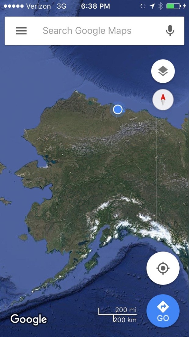
Andy loves maps. So when we got our Milepost to plan our trip up to Alaska and it had a big Alaska map included, he was super excited. He unfolded it and we started pointing at places we would visit, and finding new places we didn’t know existed, like Chicken, Alaska. I noticed the Deadhorse dot way at the top of the state and said, “So are we going to the top of Alaska too, then?” Immediately I could see Andy’s wheels turning. We did a little quick research. And thus began our two-month-long back-and-forth decision/indecision about making the drive up the Dalton High to Deadhorse, Alaska.

The reason the decision wasn’t obvious is that the Dalton Highway has a bit of a reputation. It’s been featured on BBC’s World’s Most Dangerous Roads, America’s Toughest Jobs, and was the focus of four seasons of Ice Road Truckers. It’s a beast.
Here’s the rundown:
- It’s a 414-mile road between Livengood and Deadhorse.
- Nearly the whole route is dirt and gravel and in rough condition, with grades up to 12%.
- It is one of the most isolated roads in the US, with only three towns along the route: Coldfoot (pop. 10), Wiseman (pop. 14), and Deadhorse (permanent pop. 25-50 but there are several thousand workers living there at any given time).
- As the longest stretch of unserviced road on the North American continent, the Dalton is totally remote and has no cell service along the entire route until Deadhorse.
- There is one gas station in Coldfoot and one in Deadhorse.
- It gets cold up there. In 1971 it was the location of the coldest temperature ever recorded in North America at -82 degrees.
- Atigun Pass through the Brooks Range is at elevation 4,739 feet and is considered quite treacherous, especially in unfavorable conditions.
- It was built as a service road during the construction of the Alaska pipeline and is still used primarily by supply trucks—about 160 daily in the summer and 250 daily in winter and they’re all driving at top speed and have the right of way.
- Travel tips on various sites include bringing two spare tires, plenty of extra fuel, survival gear, and your own surgical supplies.
- The road ends at Deadhorse, which is not a town in the traditional sense but an industrial camp in the Prudhoe Bay oil fields. So there’s not much to do once you get there.
According to a NY Times article, “In addition to these numerous privations, there is also no good reason for a nonprofessional driver to drive the Dalton Highway.” When we asked around, most Alaskans and fellow travelers we talked to about making the drive told us emphatically that it was a bad idea and just don’t do it.
So there was that.
You’d think that would be enough to make the decision quick and easy. Buuuuuut. . . we were also feeling compelled by the other characteristics of that most remote wilderness. For example:
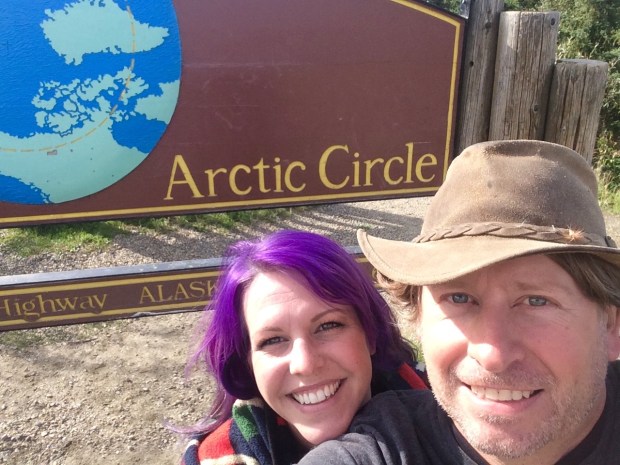
- Just south of Coldfoot you pass into the Arctic Circle!
- We’d get to see arctic tundra and (hopefully) arctic wildlife.
- The Arctic Ocean is just beyond Deadhorse, and though the area is blocked by security, there is a tour company that will take you right to the ocean, after you pass a security check and pay them $70 a person.
- Gates of the Arctic National Park sits on the west side of the highway, and though you can’t access the park by car, you can hike in on foot from a few parking areas.
- The terminus at Deadhorse is the farthest north you can drive in North America. And we have plans to drive to Chile one day, so it would be pretty freakin’ cool to have driven the continents from top to bottom.
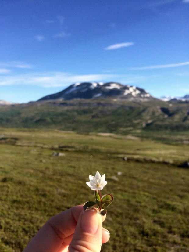
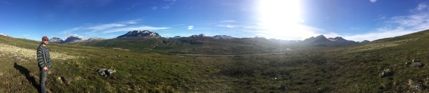
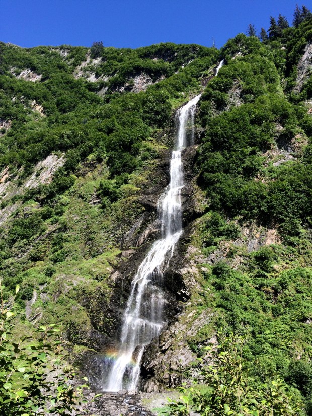
- Apparently it’s really, really beautiful up there.
- It’s almost completely wild.
- Adventure calls!
I think by now you have a pretty good idea of where we landed on this one, especially if you read the title of this post. (We decided to go.) A few final pushes in that direction came from our friend Sam, who is a native Alaskan and knows all the information contained in both above lists and said that he wouldn’t recommend it to just anyone, but he knows the Turtle is capable and so are we, and that we should definitely do it. That’s all Andy needed to hear, so he was locked in. I was at 98% until my friend Lexie sent me a video by a pair of overlanders who had made the trip just a week earlier in their truck camper, and the scenery was more beautiful than I’d even imagined, and also they saw a baby grizzly bear. So I was locked in.
We got to Fairbanks, got all our supplies in order and bought a CB radio so we could communicate with the truckers as an added safety measure. We got up early the next morning and began our northward journey to the top of Alaska.
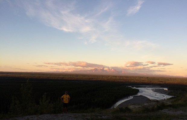
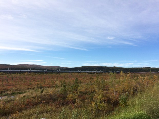
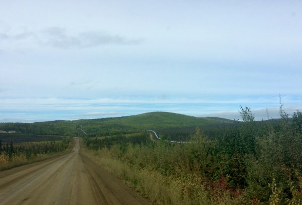
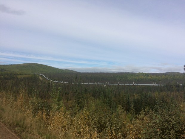
The first thing we noticed was the Alaska Pipeline, which was to be our one constant over the next few days, as it parallels the Dalton all the way to Deadhorse.
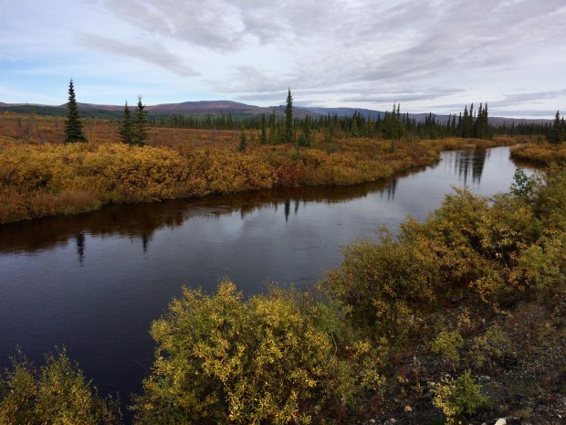
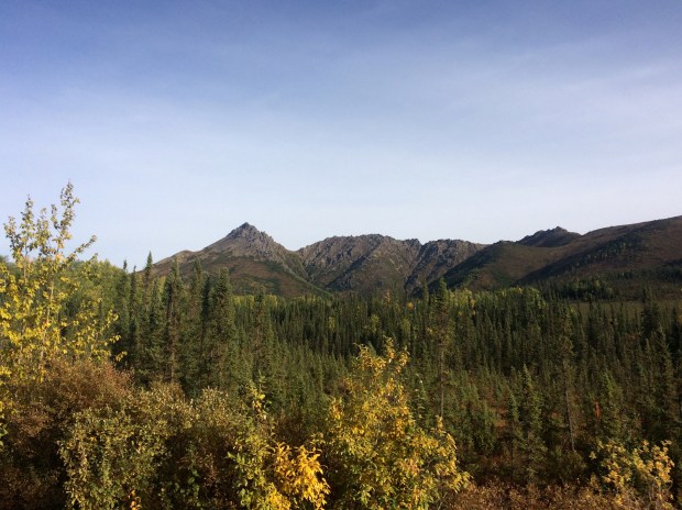
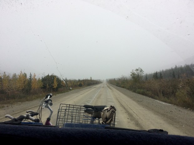
Also notable was how much more it felt like fall! It was much colder and the colors were gorgeous.

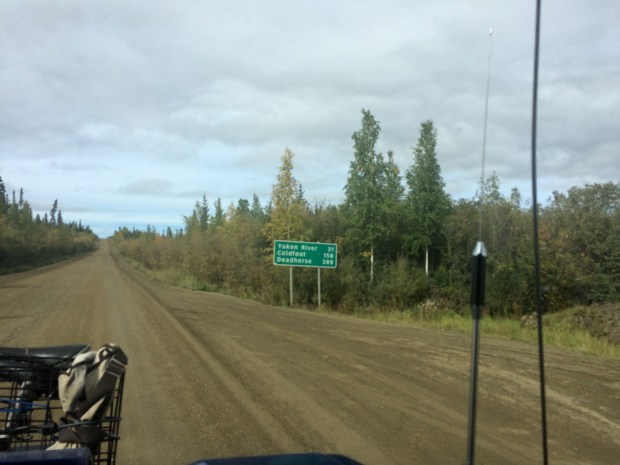
The pavement soon ended and we began the brain-rattling portion of the journey across the pitted, wash-boarded and pot-holed dirt road that would continue all the way to Deadhorse. It was a really beautiful drive, and we still felt pretty fresh when we saw the Arctic Circle sign and pulled over to take a few pictures.

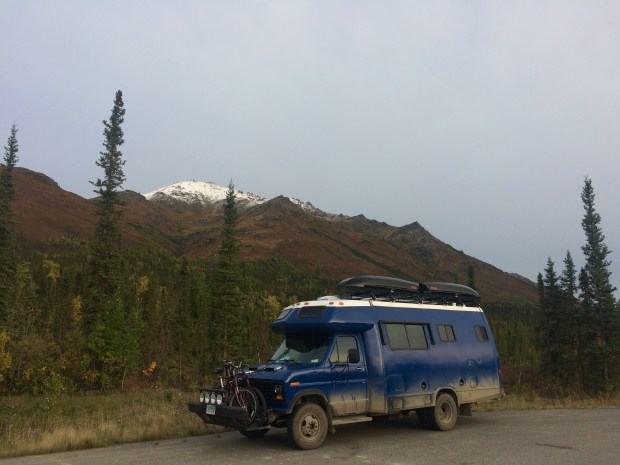
The Turtle still looked blue at this point, too! We continued on to Coldfoot, watching the lovely scenery as well as the gas gauge.

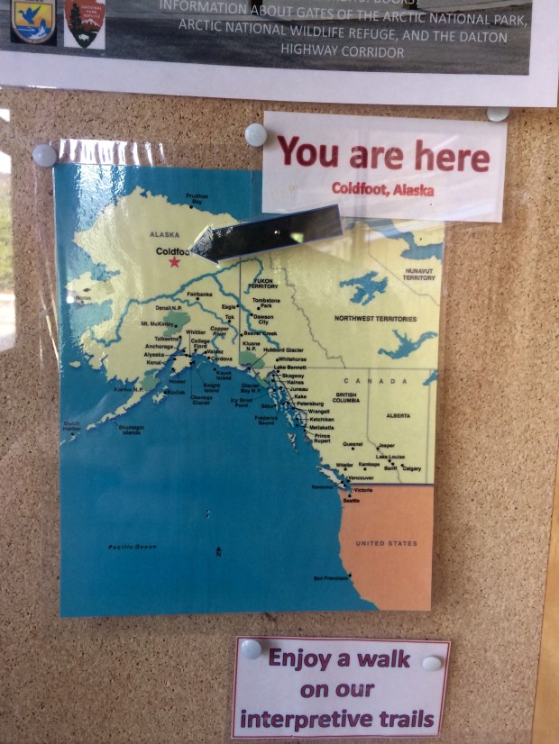
We weren’t sure what to expect when we finally reached Coldfoot after 8 long hours, and were pleasantly surprised to discover the Arctic Interagency Visitor Center tucked away on the west side of the highway. The facility is a cozy spot to learn about the Northern Lights and the flora and fauna of the area, and they have maps available and flyers with information about Coldfoot, Wiseman, and Deadhorse since there’s no cell service all along the highway.
They also print out the weather forecast for the towns and the Atigun Pass, which on our visit showed snowflakes in the next day’s box. We’d already made it halfway there, so there was no turning back. We filled up with gas across the road and had a surprisingly top-notch dinner buffet at the restaurant/bar/gift shop/one building in the town that felt kind of like a church basement but really served up a mean meal. Then we drove just a bit north of town to a nice little turnout for the night.


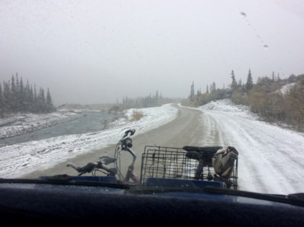
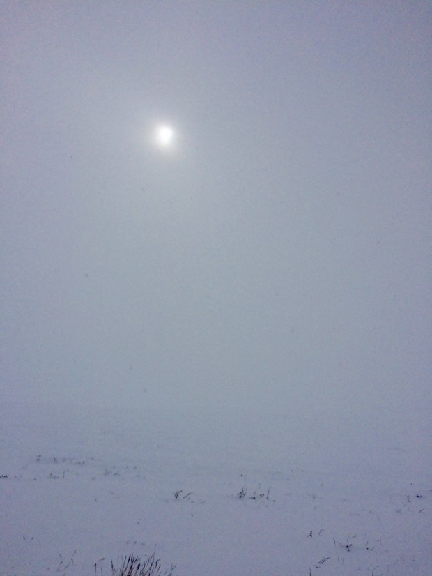
As predicted, the next day was super cold and foggy and the snow loomed on the horizon.
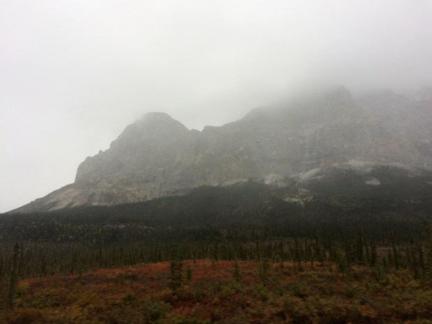
We could barely see the scenery behind all that fog!

There were huge mountains on all sides but after a while we couldn’t see them even a little. It was just a blank white backdrop in every direction.
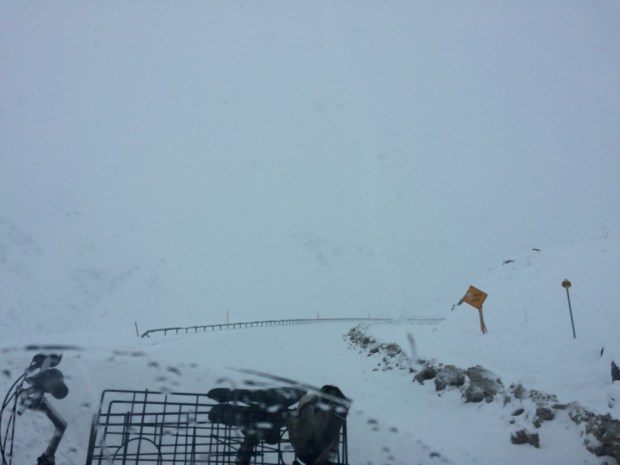
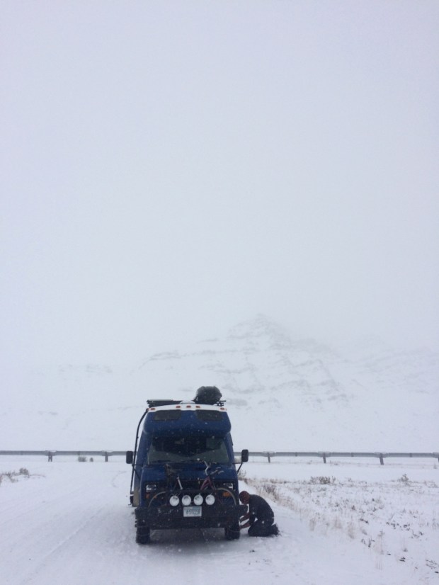
As we gained elevation approaching the Atigun Pass, the snow set in so suddenly that we were climbing the pass before we realized it and it was too late to chain up. If there were any turnouts we couldn’t see them at all, and there was barely enough room for two cars to pass one another, much less to pull off enough to not get hit by other passing vehicles.
We climbed and climbed, following the guard rails since that’s all we could see, and hoping against hope that the speedy ice road truckers wouldn’t blast by us.

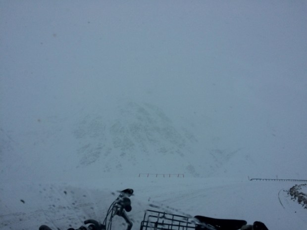
At least we could read the road signs. . . what does that one say? Avalance Area? Oh good.
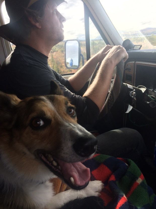
Andy handled that Turtle brilliantly, and I alternated between nervous picture taking and looking at the sky so I wouldn’t have to look over the dropoff into the white abyss. We finally made it through, and amazingly encountered no trucks. But even after the pass, the roads were so slippery that we pulled over on the road that leads to Galbraith Campground to chain up as a precaution.
On the return drive, we noted this spot was where we’d pulled over and were shocked to discover that there had been mountains surrounding us the whole time, but we had no idea.
Scout loved this stop. He’s a real snow hound, and he bounded through the snow and grazed on it and tried to get me to run with him, but it was too slippery. We did get an arctic frisbee session in though.


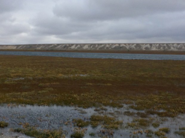
Soon the snow lessened, so we asked a driver on the CB if there was any more snow between us and Deadhorse. He said it was nothing but mud, so we removed the chains and bumped lurched down the road the rest of the way through the arctic tundra. It felt like being on another planet. It’s completely flat as far as the eye can see!
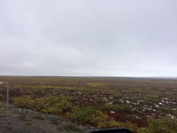
From the literature we took from the Visitor Center, I learned that because the ground is all permafrost beneath the top layer, there is a lot of standing water in the tundra because it has nowhere to go. Seeing little puddles and lakes everywhere wasn’t at all what I expected, but it was really interesting and beautiful.
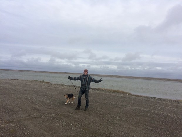
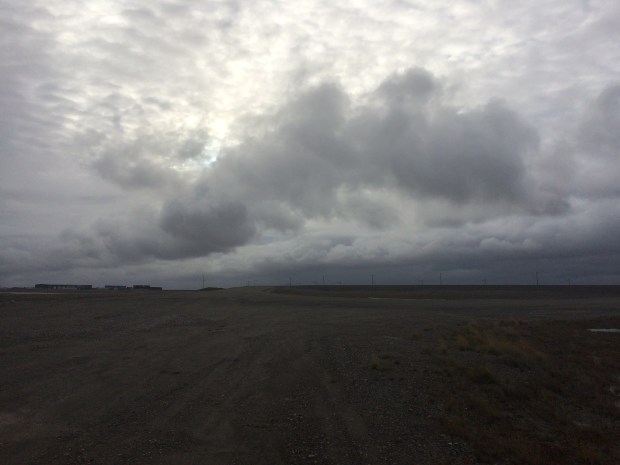
After 10 exhausting, jarring hours, we made it to Deadhorse!
We really felt like we were on top of the world. I put on 10 layers and Andy put on his one extra layer so we could examine the Turtle and let the animals out. Gracie hopped out, felt the cold, and jumped right back in. Scout was unfazed and just wanted to play frisbee again.
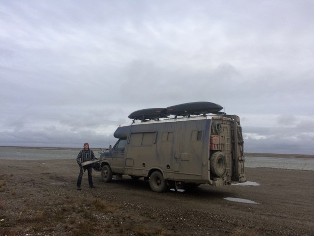
We were thrilled and amazed that the only part that had come off the Turtle had been removed intentionally—as we drove with the chains on, they were slapping into the corner of the running board on Andy’s side, so he just took it off. Otherwise, we’d made it in one piece!
We were worn out by the drive, so we hopped back in to cozy up for the evening and admire the view out our living room windows.

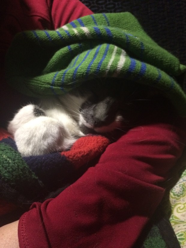
We’re all good at getting cozy, but Gracie is the professional. She zonked out so hard that when I jokingly put my hat on her head, she just slept right through it. We all could relate, and the whole gang slept like logs that night, excited to explore the northiest north the next day!