camping

Jasper National Park and Banff, AB

Happy Halloween everyone!

If you’ve been in touch with us over the last month, you’ll know that despite what the blog might lead you to believe, we’re not in Canada anymore! We got back to the states about a month ago, and are currently visiting my family in Bozeman, Montana after a really fun few weeks in Great Falls visiting Andy’s family.

But so many people had told us how much we were going to love Jasper National Park and Banff, Alberta, and we really, really did. So I’ll catch up with a quick photo-heavy post to share the beauty! It was cold and overcast as we drove through, but that couldn’t stop the views.

IMG_3282

IMG_3287 1

IMG_3292

IMG_3307

IMG_3318

Neither of us knew that the town of Jasper was right in the middle of the park, which was a fun surprise.

We stopped for pizza. . .

IMG_3322

We stopped to watch this handsome fellow for a while. . .

IMG_3327

IMG_3330

IMG_3338

And admired these sweet little deer until they hopped back into the forest.

IMG_3361

IMG_3379

The sun set before we made it through the park, so we stayed the night at the only spot that was still open for the winter on the south side of the park. The Columbia Icefields National Park Centre keeps the lower parking lot open for overnight campers, which was around $15 a night. A little spendy for a parking lot, but we really didn’t want to miss the views!

When we woke up the next morning, we discovered that we’d been parked right across the street from two glaciers!

IMG_3413 1

IMG_3419

IMG_3416

The rest of the drive was so beautiful that the $15 camping fee seemed like a really good investment.

IMG_3426

IMG_3471

IMG_3488 1

IMG_3489

IMG_3495 1

IMG_3510

IMG_3521

IMG_3527

After exiting Jasper National Park, we were immediately in Banff National Park. Another gorgeous drive! One of my favorite things about this stretch of the highway was the wildlife bridges. There are fences all along the road to prevent animals from wandering out into traffic, so in order to allow safe crossing they built these tunnels covered by dirt and grass so the animals can access the whole park safely.

IMG_3554

IMG_3569

IMG_3571

IMG_3579 1

Soon we’d passed through Banff as well, and by mid-afternoon we were back in Montana.

IMG_3647 1

When we got to Andy’s dad’s house, we were exhausted from three months of nonstop action. We slept like logs, relaxed, and visited with Andy’s dad and mom over some IPA’s and home-cooked meals, ate Howard’s pizza more than once, and slept some more . It was exactly what we’d been waiting for.

We also took some time to reorganize and assess the state of the Turtle. Andy looked in one of the compartments and found that it was filled with hunks of the Dalton Highway! Hilarious.

IMG_3697 1

We got the famous vacuum sealer out and sealed things up for winter storage. . .

IMG_3704 1

Andy fixed up our front brakes. . .

IMG_3707

And then we slept some more!

IMG_3718

Wildlife Safari on the Alaska Highway

Remember that time I said we loved spotting wildlife? Well we really loved the drive down through British Columbia into Alberta.

IMG_2417

As we pulled away from Liard Hot Springs, we made it about 100 feet before spotting this darling lineup of wood bison.

IMG_2663

We read in one of our travel pamphlets that while wood bison are a subspecies of the American bison, they differ slightly from the plains bison that are more common in the States. The most obvious difference is in size: these guys are much larger than the bison we’d seen before, and when we looked it up we learned that they are the largest land mammal in North America. Large males can weigh over 2,000 lbs!

I found this handy visual online which compares the two:

d5d10d09e408bd1aef79673424c0e4b0.jpg

As I read this information aloud to Andy as we drove, he tapped my arm and pointed up ahead.

IMG_2687

There, on both sides of the road, were about 60 or more wood bison! They ranged in size from hulking males to darling little fuzzy babies.

IMG_2686

IMG_2685

IMG_2693

We pulled over to watch them graze and nap in the tall grass, while others crossed the road right in front of us to meet their group on the other side.

IMG_2707

IMG_2713

IMG_2722

IMG_2723

It was very, very exciting—for us, not the wood bison. They seemed pretty nonplussed by the whole encounter.

After a while we decided to move along, and the landscape along the Alaska Highway was just as incredible to watch as the wildlife.

IMG_2747

IMG_2764

It wasn’t long before we came across another neat animal: a female rock sheep. She was the only one we saw during that portion of the drive, despite the signs all along the road telling us to watch out for rock sheep.

IMG_2812

After we passed rock sheep country, we stopped to take a picture of the beautiful rainbow of fall colors on the hill, and this time I was the wildlife being observed from someone inside the Turtle.

IMG_2914

The drive took us up into the mountains and then back down again as we approached Fort St. John, B.C.

IMG_2927

Once we’d left the mountains we thought the wildlife spotting was over, but just outside of town we came across this handsome couple:

IMG_2943

We hadn’t seen as many caribou as Andy had hoped, so this close-up view was just perfect.

IMG_2966

There’s a great rocky beach just south of Fort St. John that lots of locals go to launch boats and spend the day, and we saw other boondockers there for the night as well. That night we watched the Northern Lights while Scout and Gracie sniffed around on their leashes, and in the morning we played outside for a while before getting back in the Turtle and driving some more.

IMG_2992

Typically we prefer to move really slowly and drive a maximum of two hours a day when we’re not camped out. We’re not in any hurry, it’s cheaper and uses less gas, and we get to see so much more of the world and have more impromptu adventures that way. But since we were trying to stay ahead of the weather, we’d been driving much more frequently than usual, and it was starting to catch up with us. Being in a van all day is not why we’re living in a van!

So when we finally reached Whitecourt, naps were in order. Gracie is the best nap buddy a person could ask for.

IMG_3014

Waking people up to interact and play is much more in Scout’s wheelhouse.

IMG_3028

We pushed on, and within about 20 minutes of each other we watched a black bear cross the road in front of us, and then a lynx. I speculated that British Columbia wanted to make sure we left satisfied and was quickly sending animals out for us to have one last treat before we crossed over into Alberta.

IMG_3036

Alberta felt very metropolitan compared to the rural areas we’d gotten used to, but it was exciting to have cell service and reasonable gas prices again. We decided to take a trip to the West Edmonton Mall to get our wave pool and waterslides on at the World Waterpark. It was a great way to spend a blustery day, and as full-time travelers we always appreciate a fun activity that ends in free showers.

IMG_3118

IMG_3120

IMG_3133

IMG_3146

IMG_3148

The next day we returned to check out Galaxyland in the mall and went on the “largest indoor triple-loop roller coaster,” the Mindbender, which is very aptly named. Holy moly.

IMG_3167

After a few days in town, we escaped back to nature. We had plans to meet up on the road with some friends we met at Diablo Canyon in New Mexico last year, Eric and his PBD (plain black dog), Willow.

IMG_3245 1

We stayed for the weekend at a dispersed campsite outside of Hinton, AB. It was a great spot to catch up on the past year’s travels, have a few beers, enjoy a nice fire in the pit Andy built, and watch some animal playtime.

IMG_3197 1

Now that we were moving away from the land of many predators, we let Gracie have a little supervised off-leash time, and she chose to use her freedom to revisit her favorite sun porch and oversee everyone else’s activities.

IMG_3216

IMG_3227

While we’re on the subject of wildlife, there are three pets in this picture. Can you spot them all?

IMG_3240

Eric is a 5-star animal lover and was a patient and accommodating friend to Scout, throwing toys for him almost every time Scout asked. That meant he was busy from morning to night. Willow loves a cozy chair and a sunbeam, so she didn’t mind watching her human play with another dog.

In case you were wondering, this is what the aftermath of two days of being totally spoiled looks like:

IMG_3255

The next day, he was back to his old self and ready to go again!

IMG_3263 1

Of all the wildlife we’ve gotten to see along the way, these two are the strangest and sweetest.

Hmm . .  . make that “these three.” Wild beasts, all. I think I’ll keep them.

IMG_3265


Yukon Gold

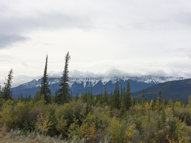
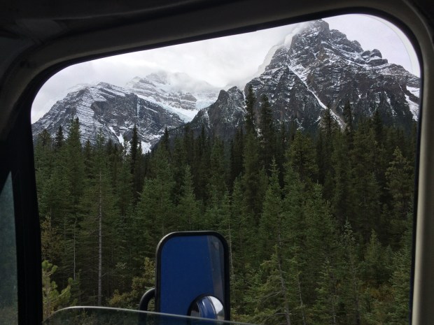
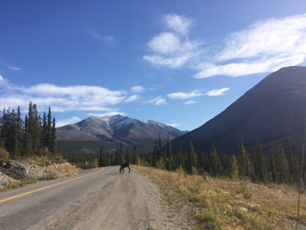
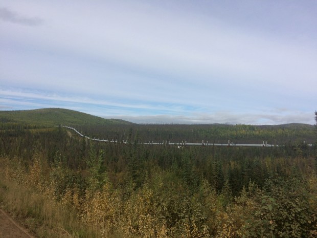
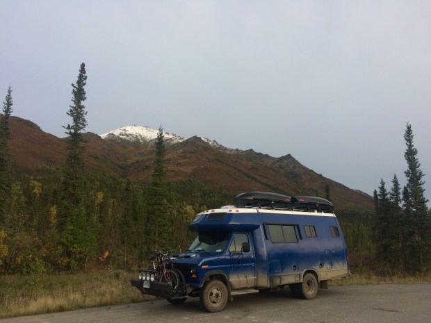
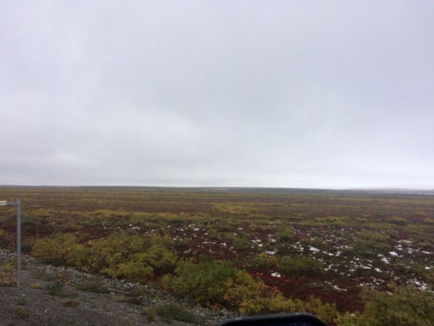
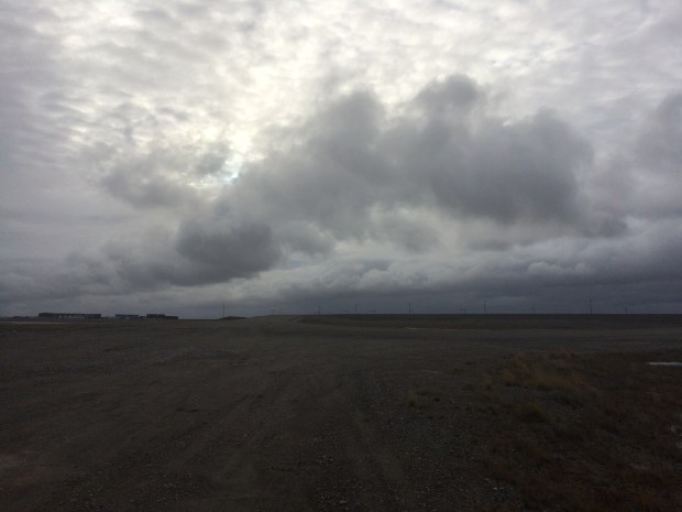
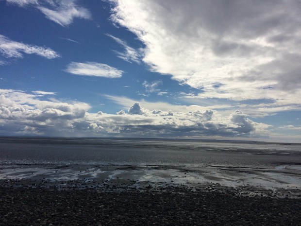
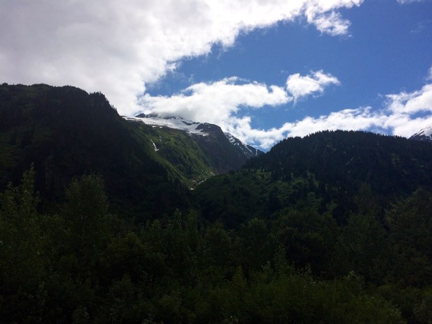
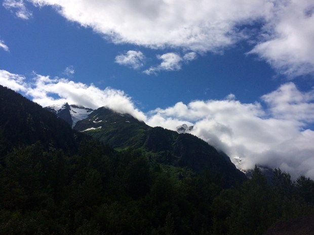
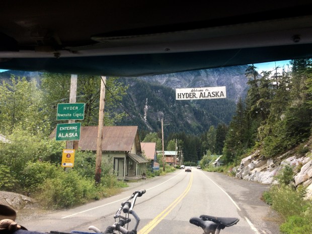
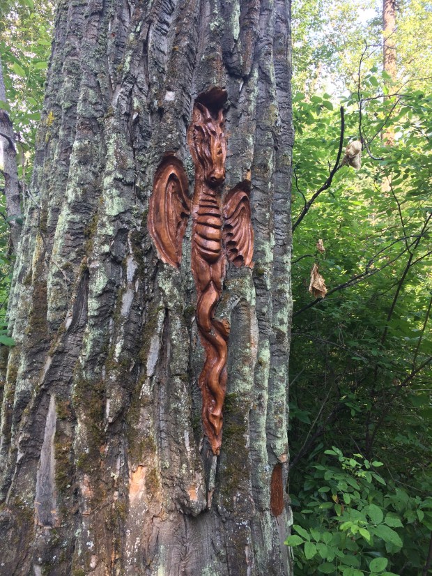
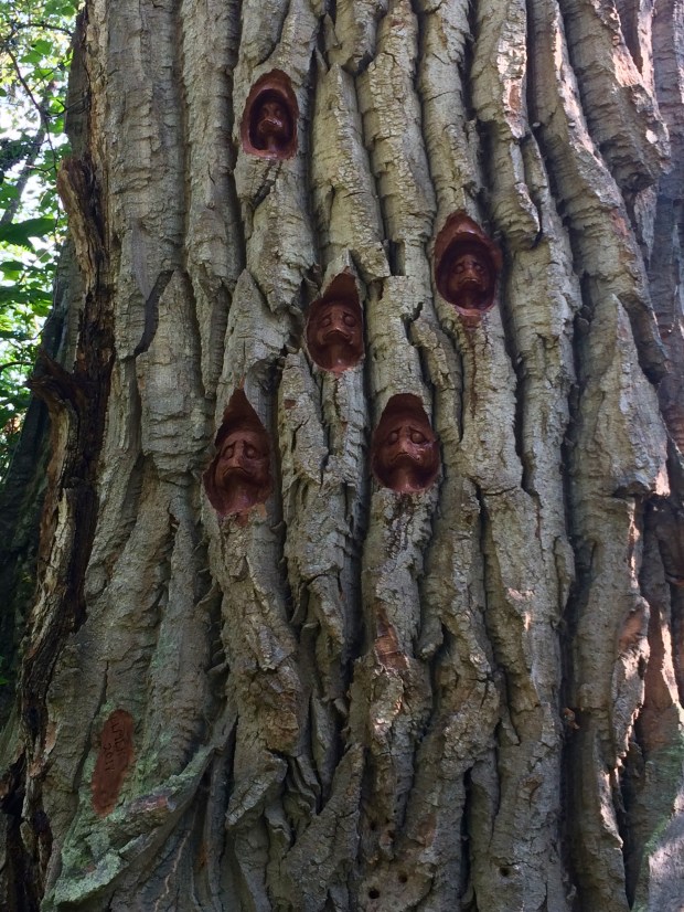
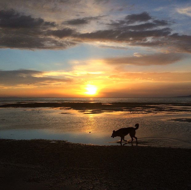
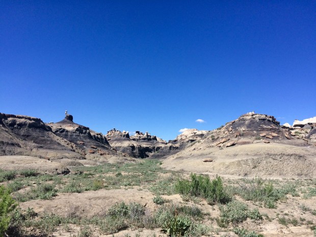
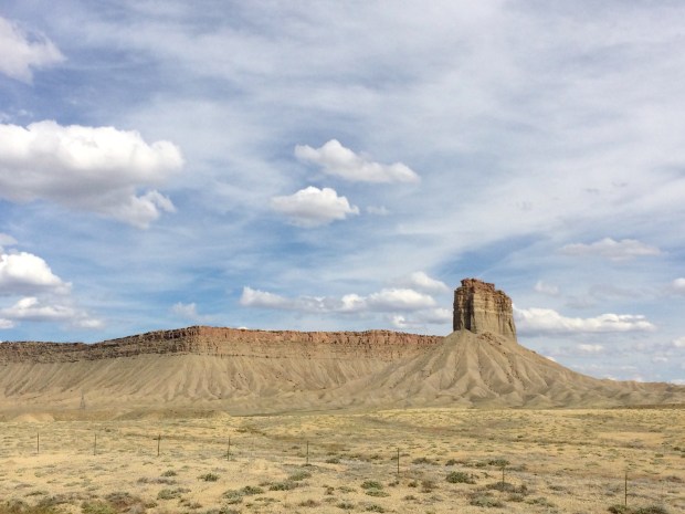
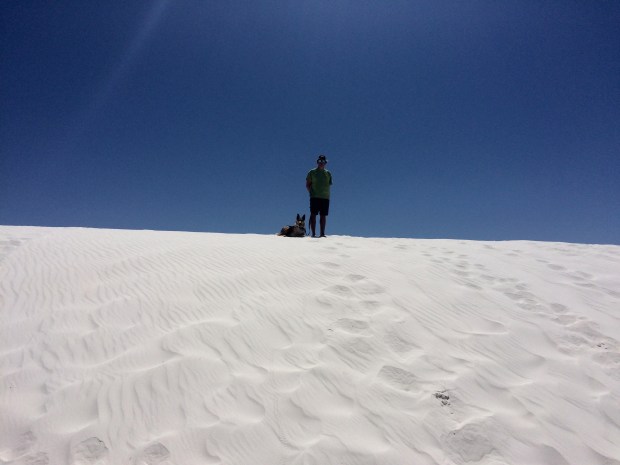
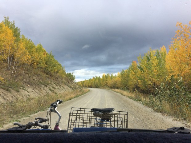
The first thing I said as we drove back into Yukon was, “Wow, the skies are just as big as when we left!” Yes, it’s the same sky as everywhere else, but somehow in Yukon I was constantly aware of the magnitude above me more than other places. It’s beautiful.

IMG_1775

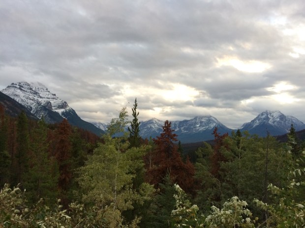
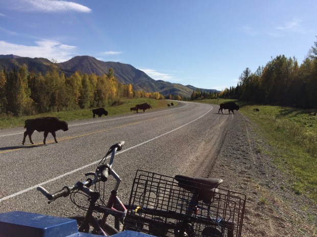
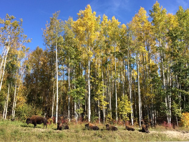
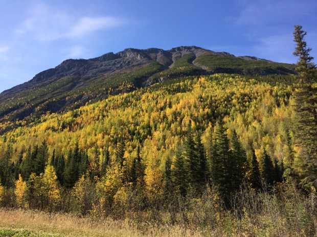
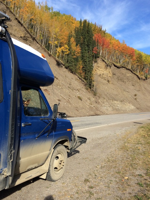
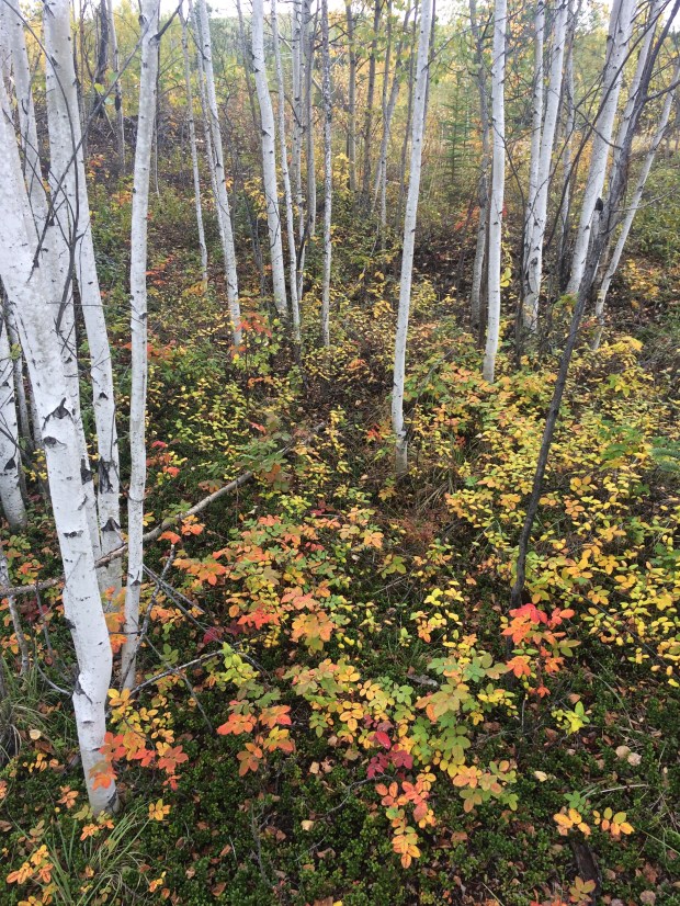
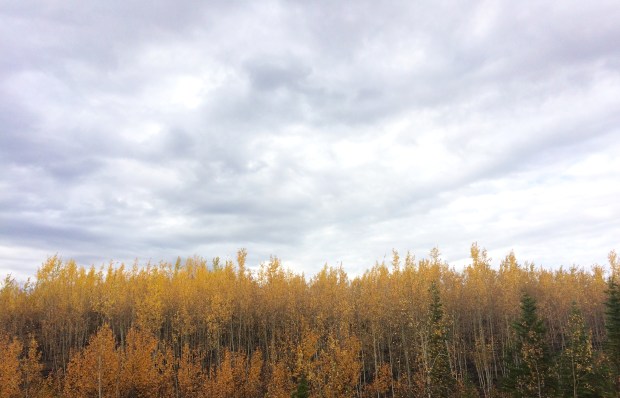
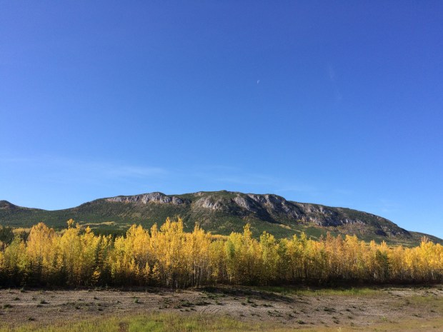
It was an exciting time to be my camera, because I had that thing working full time during our drive through Canada. The fall colors were really beginning to explode, and I filled up the camera to capacity every day. I’m sure if Andy asked you to quote me on the trip it would be a three-way tie for, “That YELLOW!” “That RED!” and “That ORANGE!” And that’s only if gasps don’t count.

IMG_1851

IMG_2134

IMG_1746

IMG_1782.jpg

IMG_2177

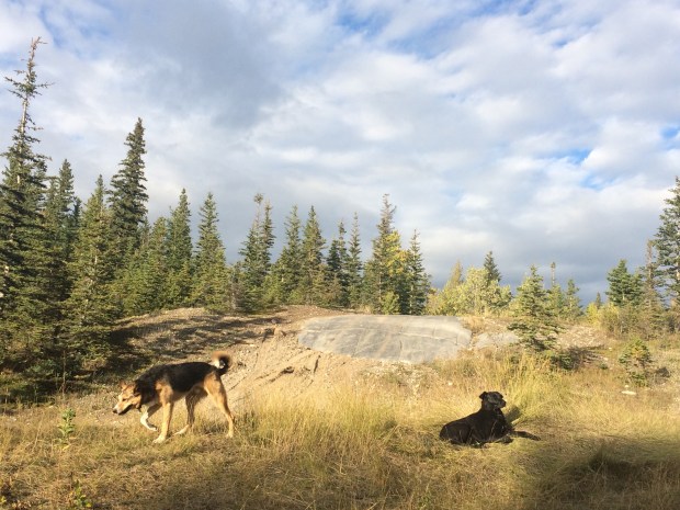
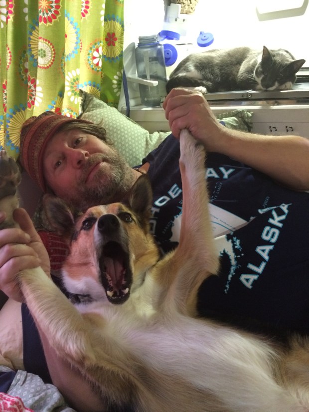
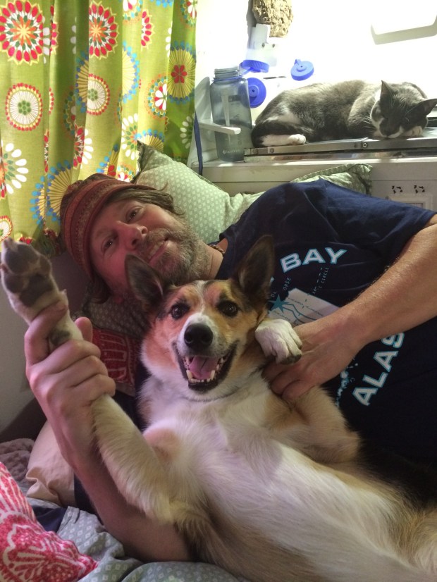
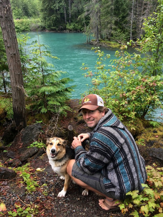
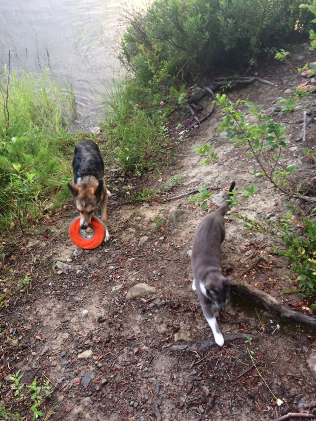
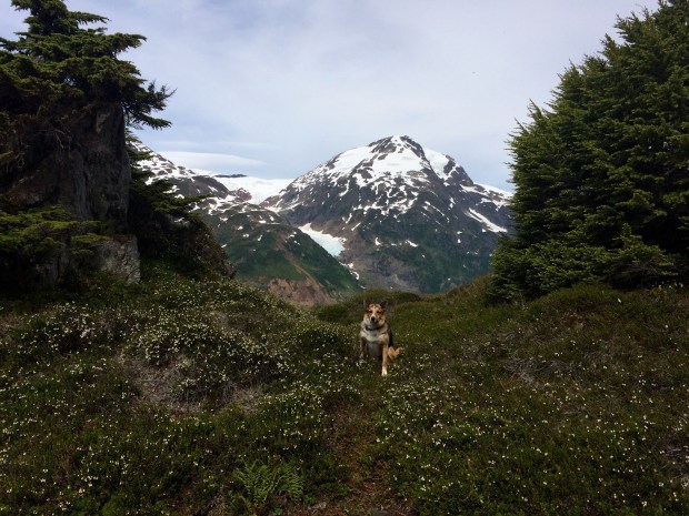
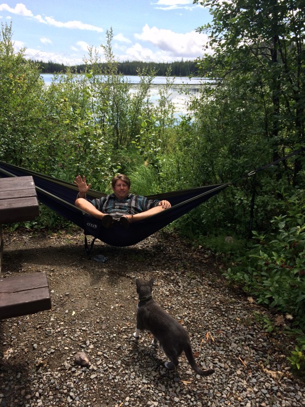
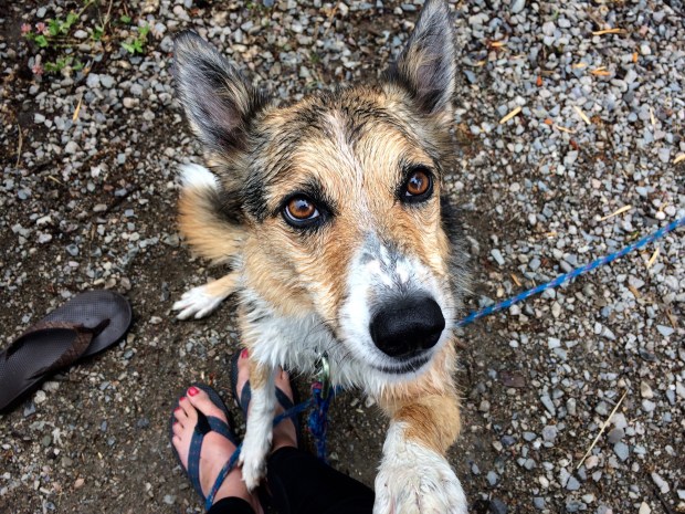
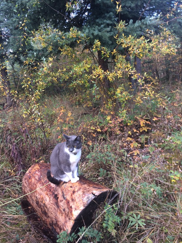
After spending a few weeks high up in wintery weather, the temperate fall was a welcome change. Scout and Gracie also got to spend more time outdoors, so everyone was enjoying Yukon to the fullest.

IMG_1759

IMG_1791

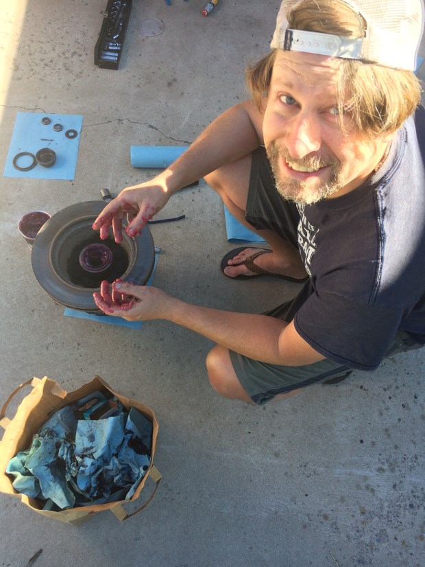
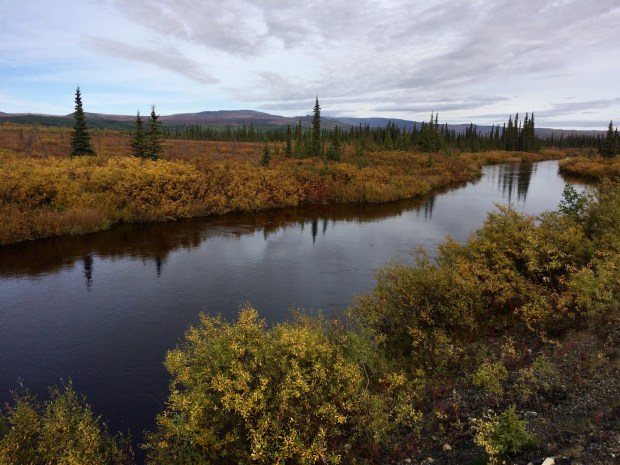
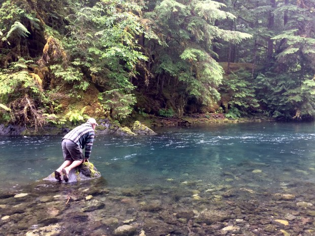
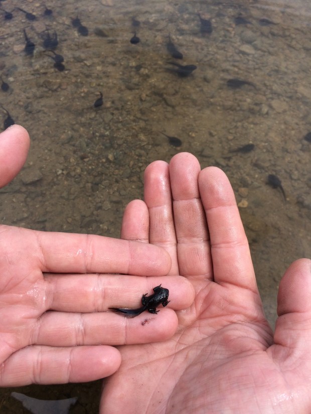
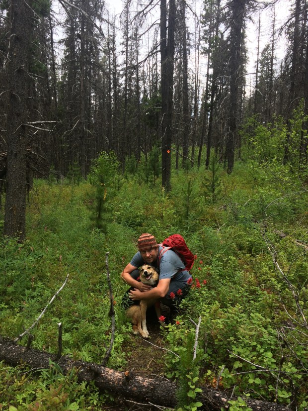
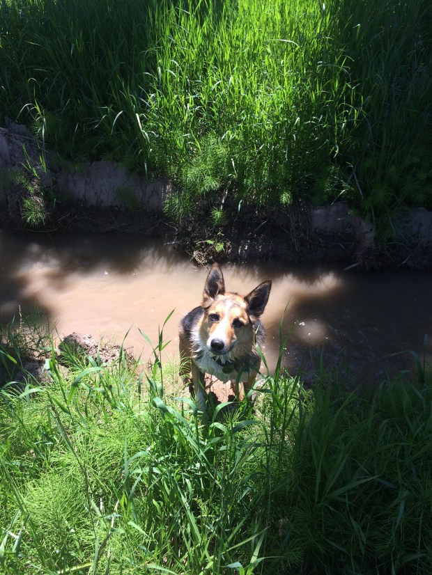
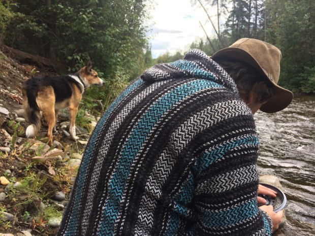
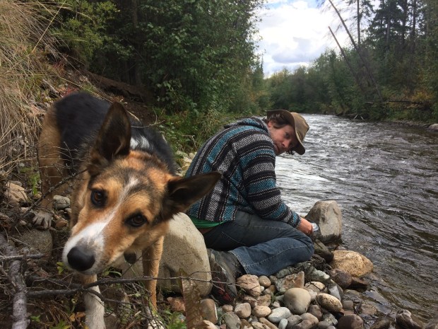
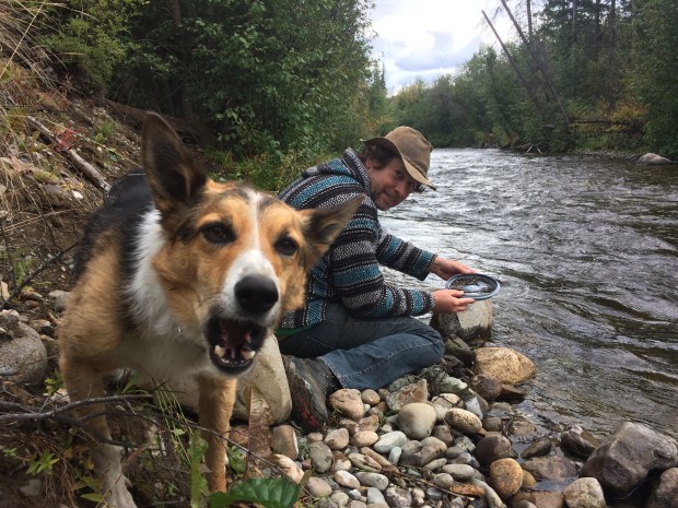
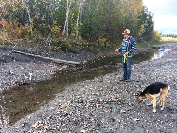
On our original trip through Yukon, Andy had mentioned wanting to pan for gold, and as we drove farther through the province, we realized we still hadn’t tried our hand at fortune-hunting yet. We found a nice spot to pull out by the river, took our pot lids, food scoops and a very excited doggy down to the water, and got to work.

IMG_1784

IMG_1796

It was a lot of fun and pretty exciting, even though we didn’t see any sparkly signs that we were in a good spot for panning. We wished we’d started sooner in the trip, because I could have panned for hours and hours in any river around.

IMG_1809

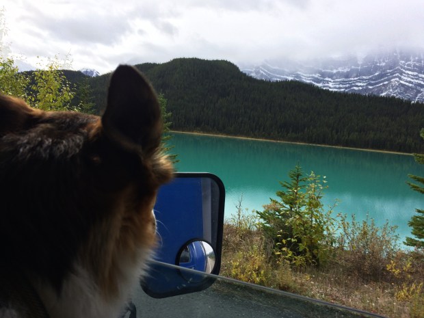
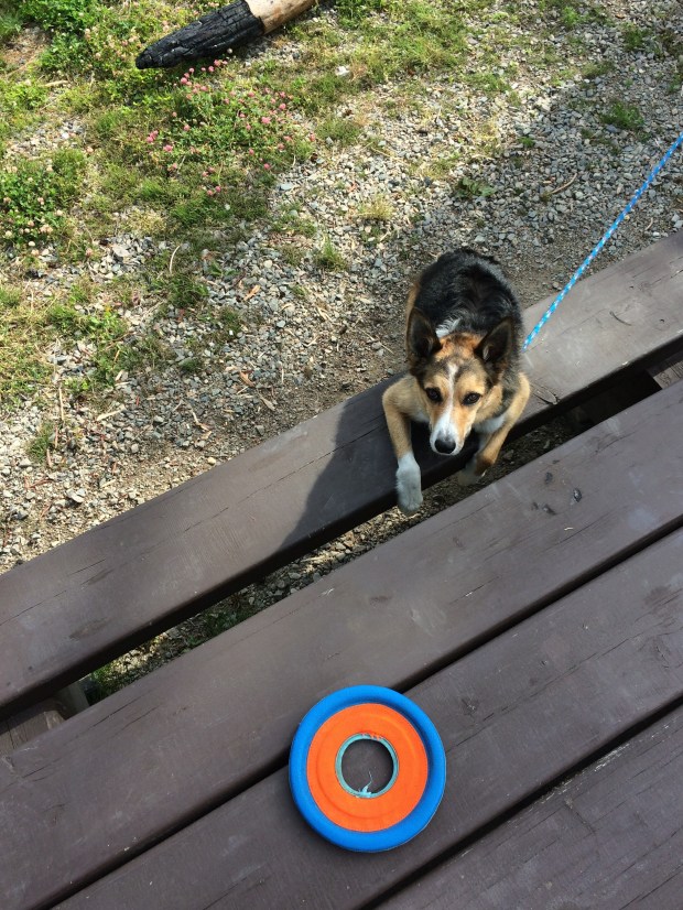
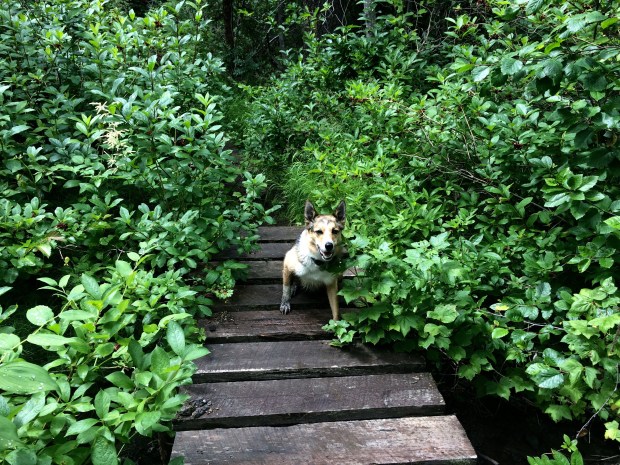
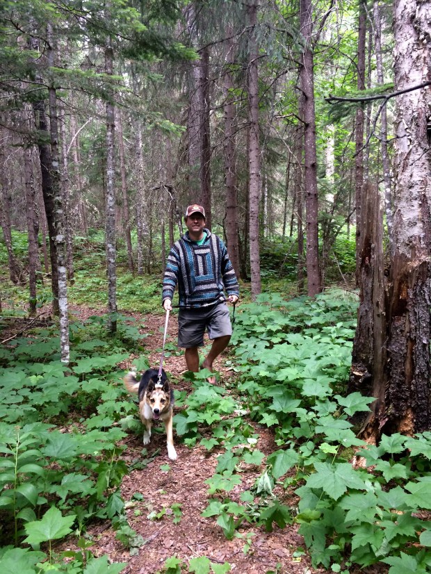
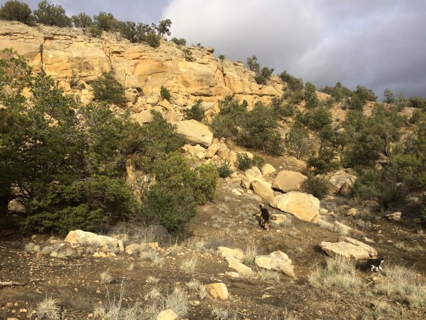
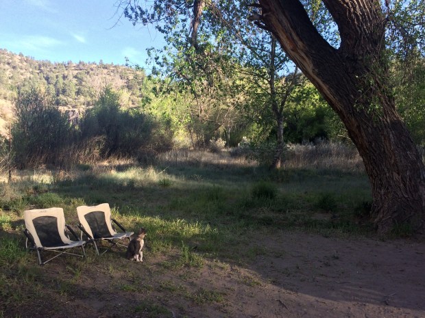
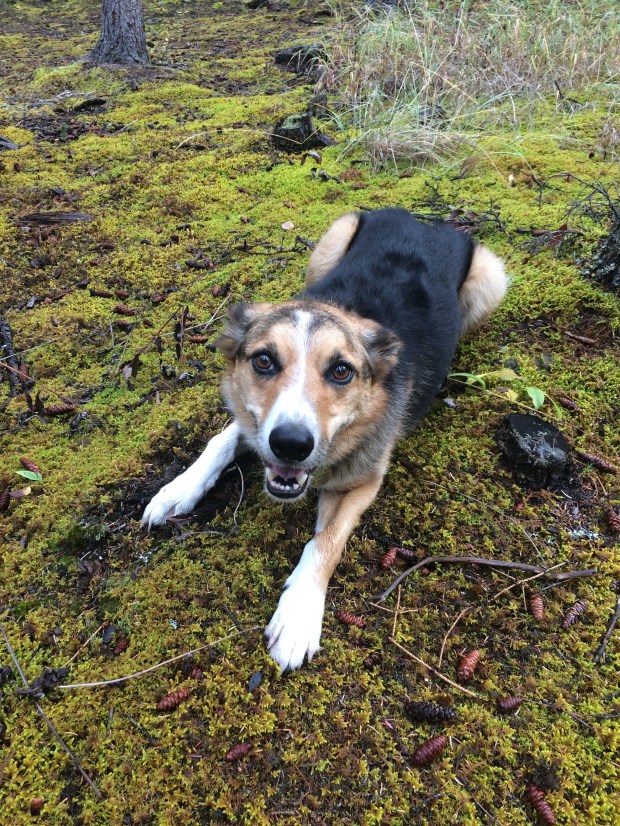
Scout had other plans for our time outdoors and tried all his best methods to convince us to throw all the sticks he found by the river.

IMG_1824

IMG_1834 (1)

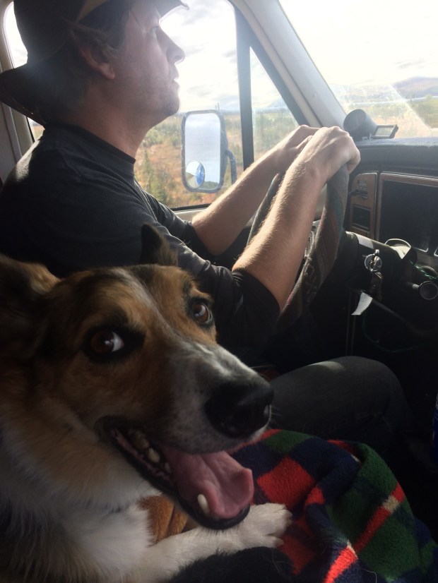
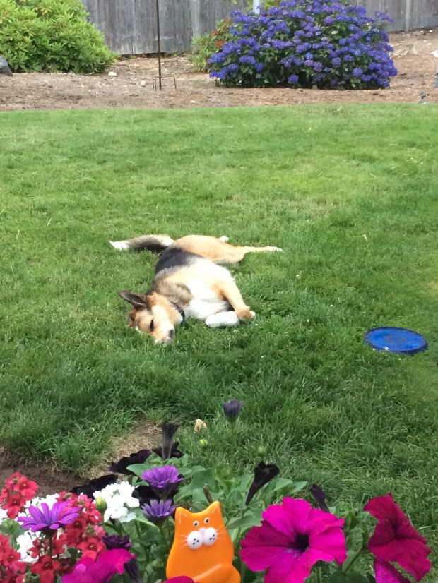
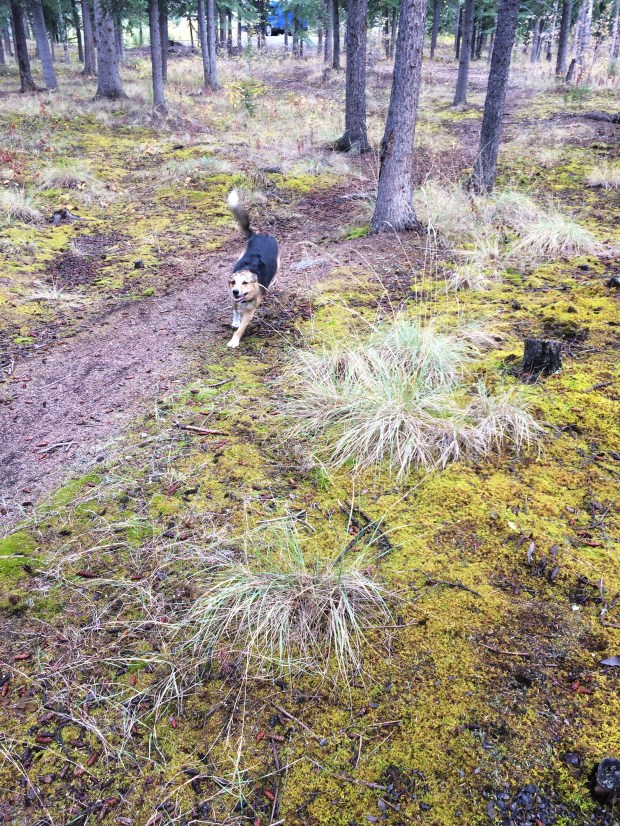
So on the walk back to the Turtle, we threw sticks, played hide and seek behind the trees, and then on the last leg Scout just bounded up and down the path with general Border Collie joy.

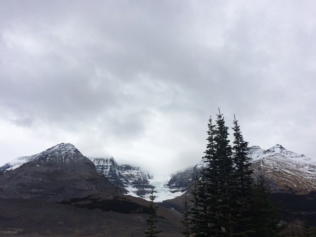
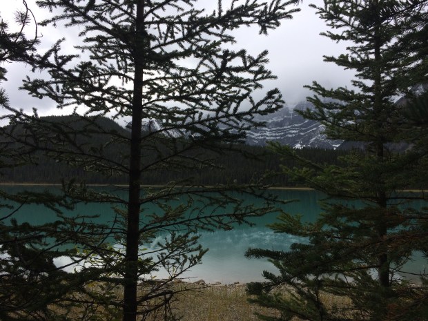
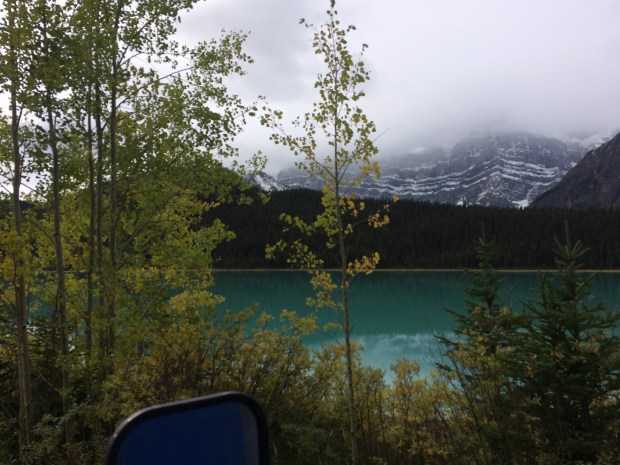
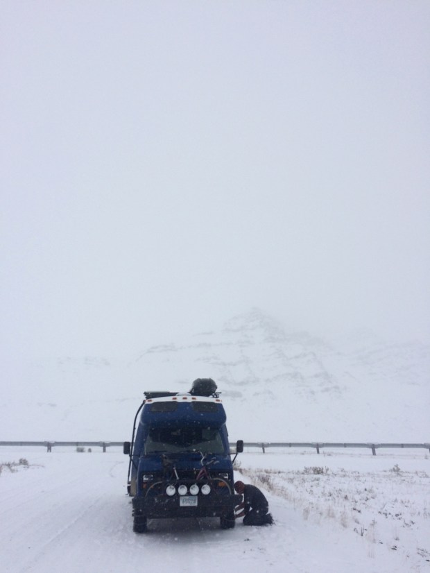
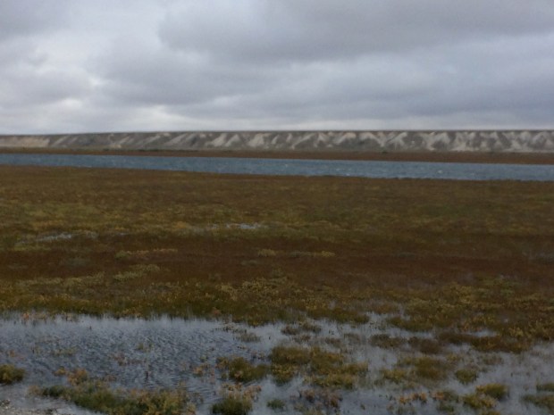
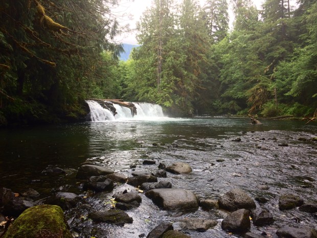
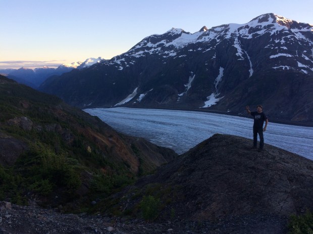
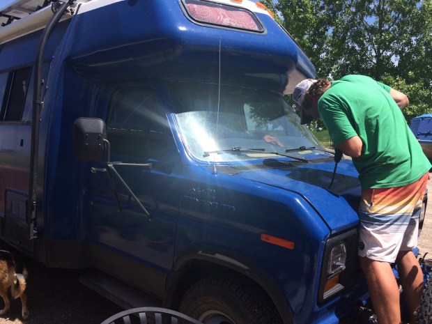
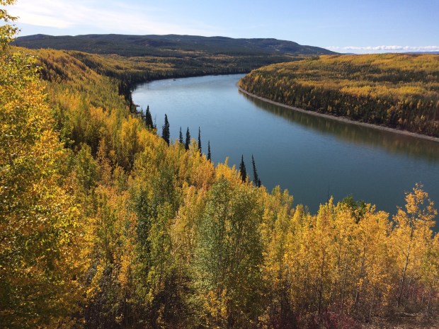
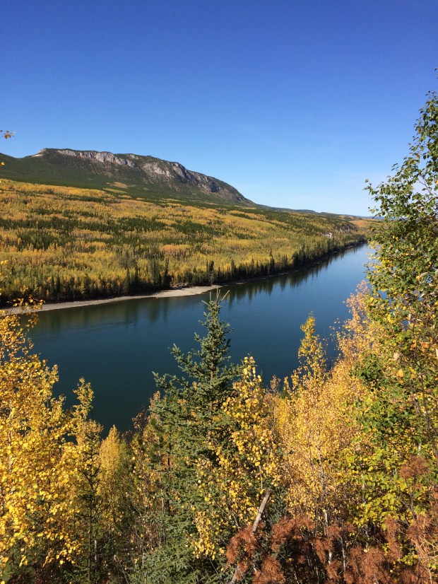
Farther down the road Andy wanted to check something under the hood, so we pulled over for a riverside picnic. Though the Yukon is so wide it looks like a lake!

IMG_1867

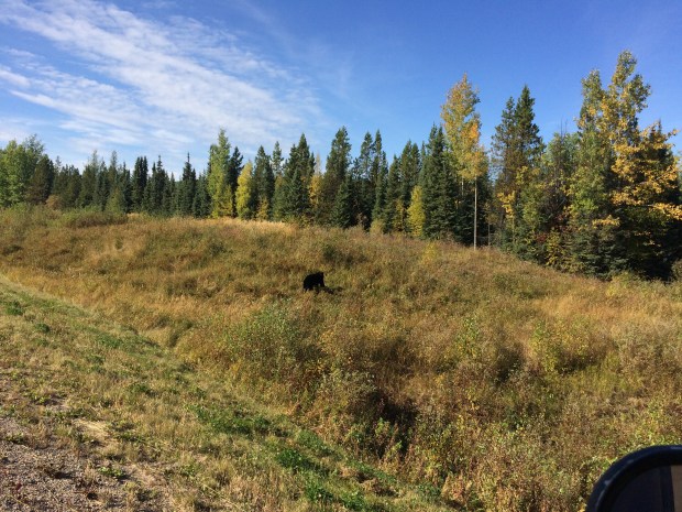
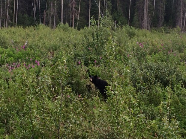
We panned for gold again after lunch, but no luck. We did see a fresh bear paw print in the mud near us, so we decided to make it a quicker stop and get back on the road.

IMG_1873

IMG_1891

IMG_1912

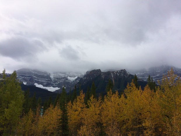
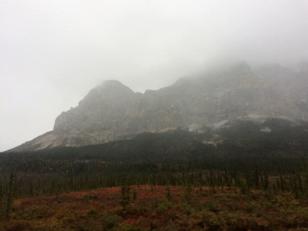
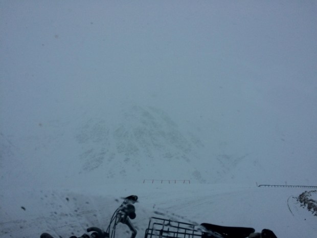
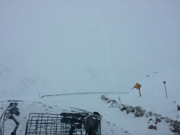
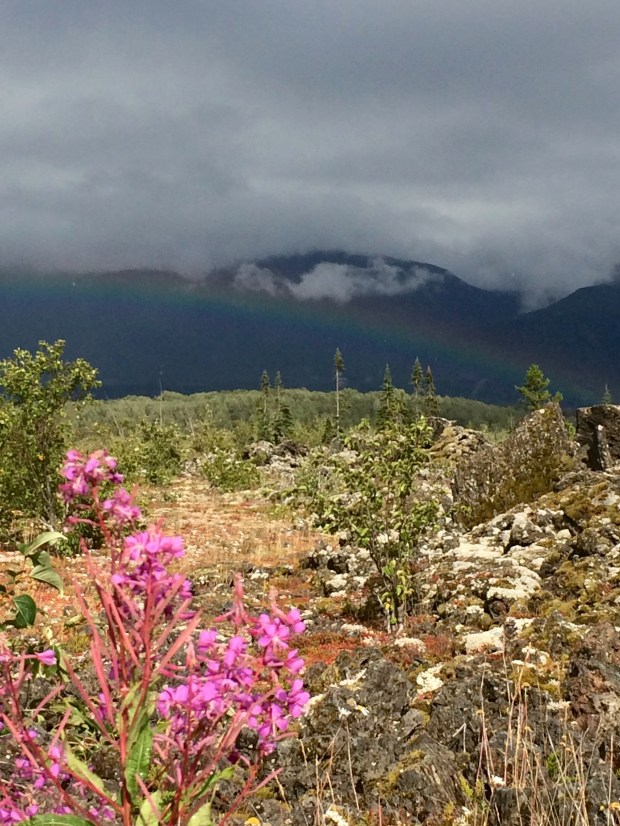
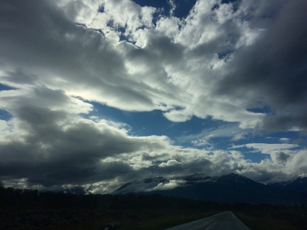
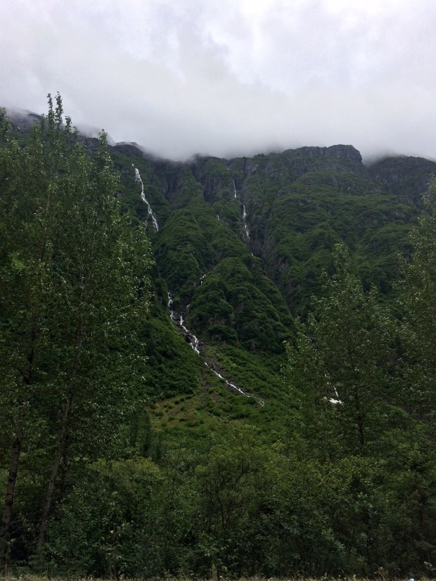
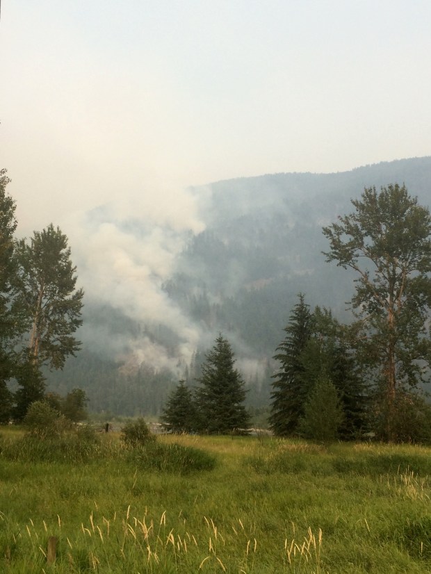
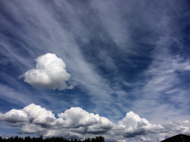
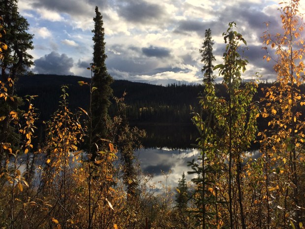
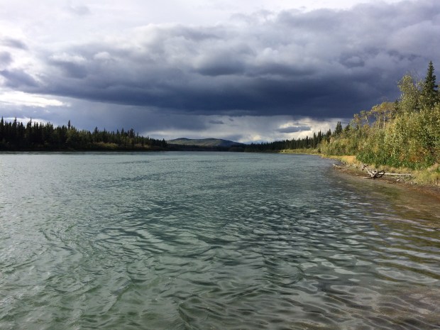
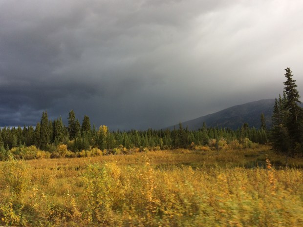
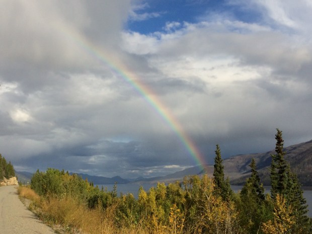
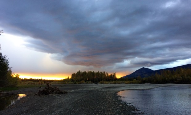
We could see some storms ahead, which made the light moody and surreal.

IMG_1982

When the most spectacular rainbow poured out of the sky, we followed it for a full 15 minutes before it evaporated back into the air.

IMG_1959

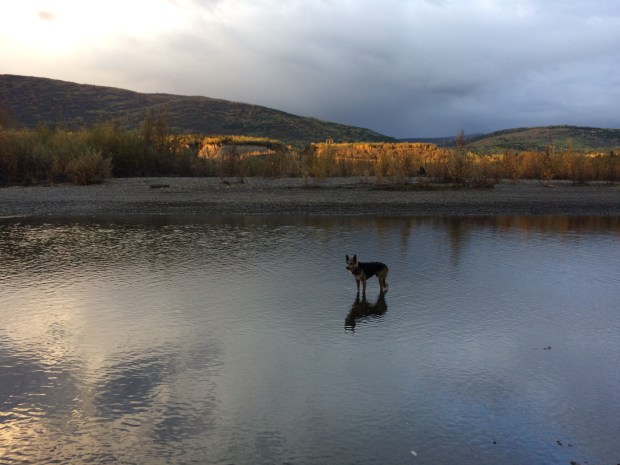
The storm moved all around in the distance, and when we stopped outside Taro for the evening, we could actually see the sheets of rain traveling east along the riverbank.

IMG_2012

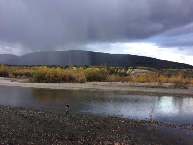
It never hit us directly, so we basked in the after-storm light and played outside until the sun went down.

IMG_2037

IMG_2026

Everyone had a successful day, I think.

IMG_2054

We had to try one last gold panning session before we left, so we played outside for a bit before packing up.

IMG_2085 (1)

IMG_2099

IMG_2062

As I put the panning implements in the Turtle, I laughed at how instantly messy it gets in there, between the toys we keep out to use later, the mud we inevitably and consistently track in, the rocks I can’t stop collecting and have no room for, the boots laying on the floor that we removed to change into “gold-panning shoes”, the travel pamphlets shoved into the front console, among the other regular chaos specific to Turtle life.

I decided to take a picture for posterity, since in 20 years we’ll want to remember the reality of our lives and not just the pretty pictures immediately post-clean-up. Right as I took out my camera, Scout came running to the door to see what I was up to, and the smile on his face and mud on his paws inadvertently made the photo complete: the reason we live this lifestyle, messy as it may be. At the end of the day, we all have that goofy smile on our faces.

IMG_2257

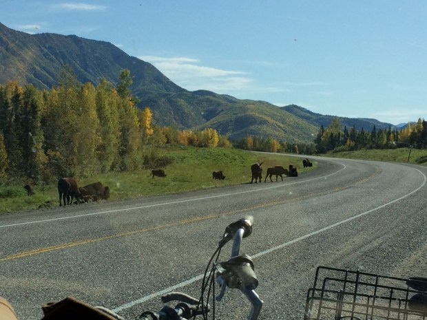
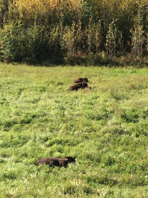
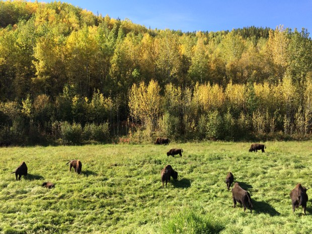
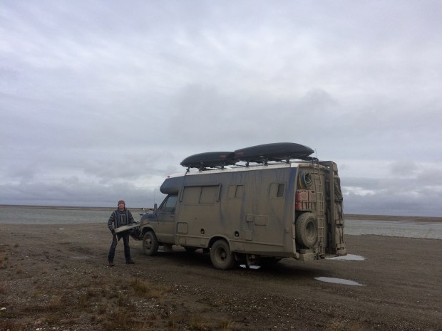
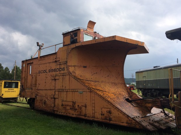
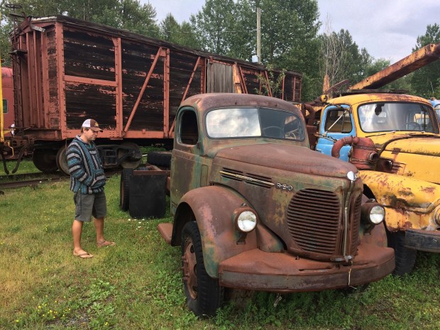
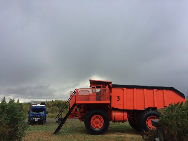
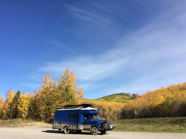
There weren’t many gas stations around, so we stopped in Taro for a fill-up and an ogle at this awesome orange beast.

IMG_2112

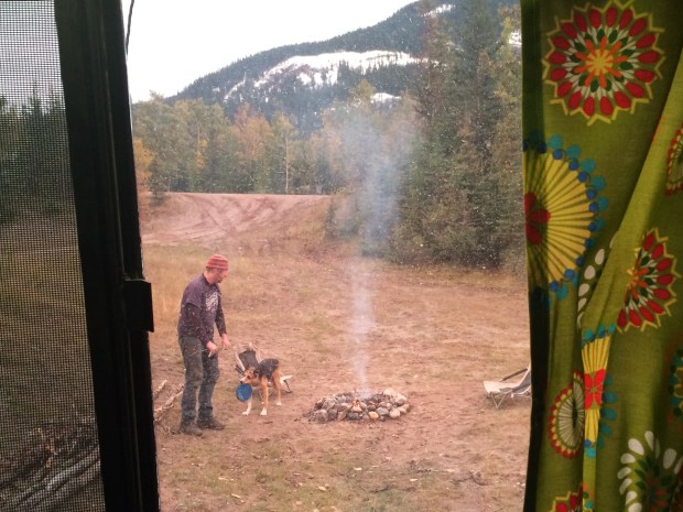
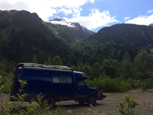
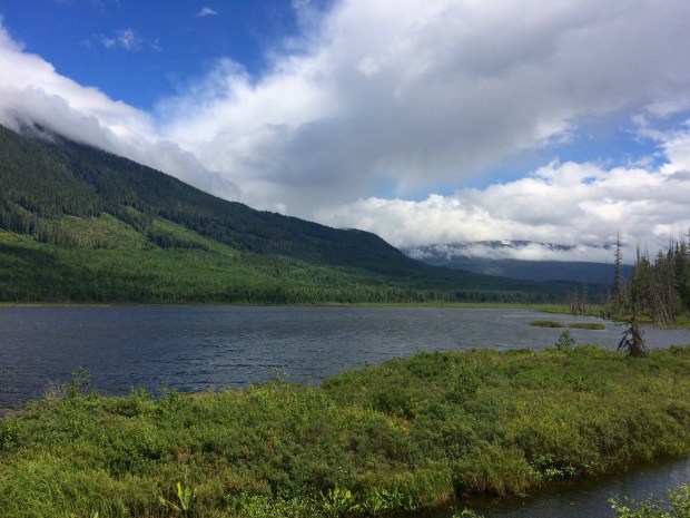
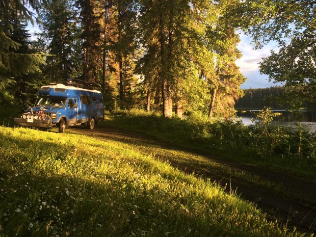
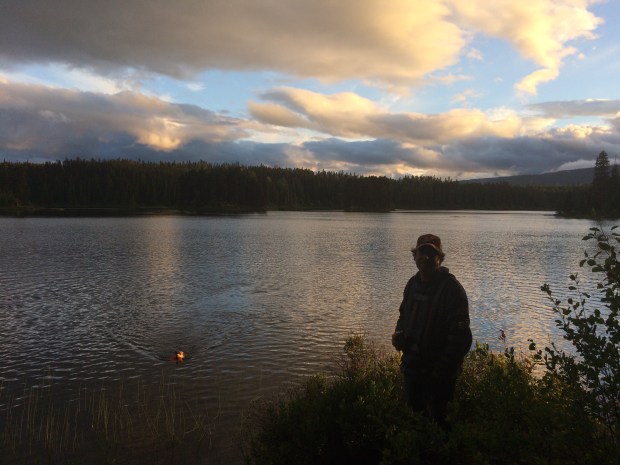
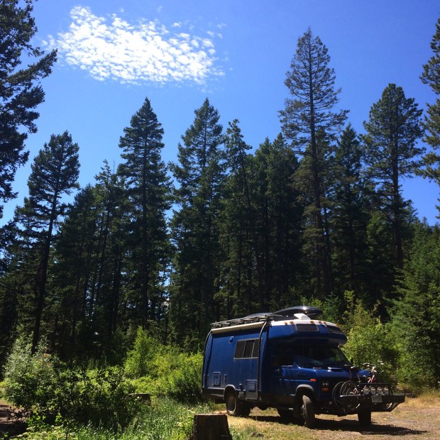
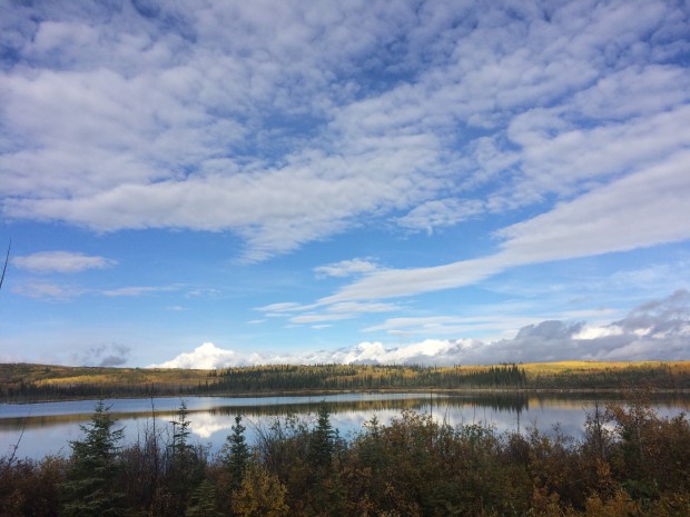
Then back onto beautiful Highway 4 toward Watson Lake, which we’d be passing through one more time on our way into British Columbia and Alberta. But first we had to stop at what was to become our Favorite Campsite Ever, a free pullout on postcard-worthy Finlayson Lake.

IMG_2259

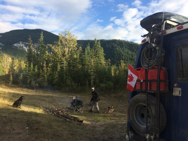
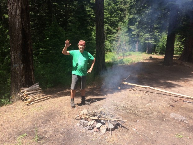
Due to the burn ban, we hadn’t been able to have a fire for months, and it seemed like fate that the ban had been lifted right as we came upon this site, complete with cut firewood scattered around for the taking.

IMG_2261

We were sitting just a little elevated from the water, overlooking the lake. There was no one around except the two people flying sea planes nearby. It was crisp, cool and clear, and we were on cloud nine that we got to live there for a whole day.

IMG_2266

IMG_2279

IMG_2287

IMG_2294

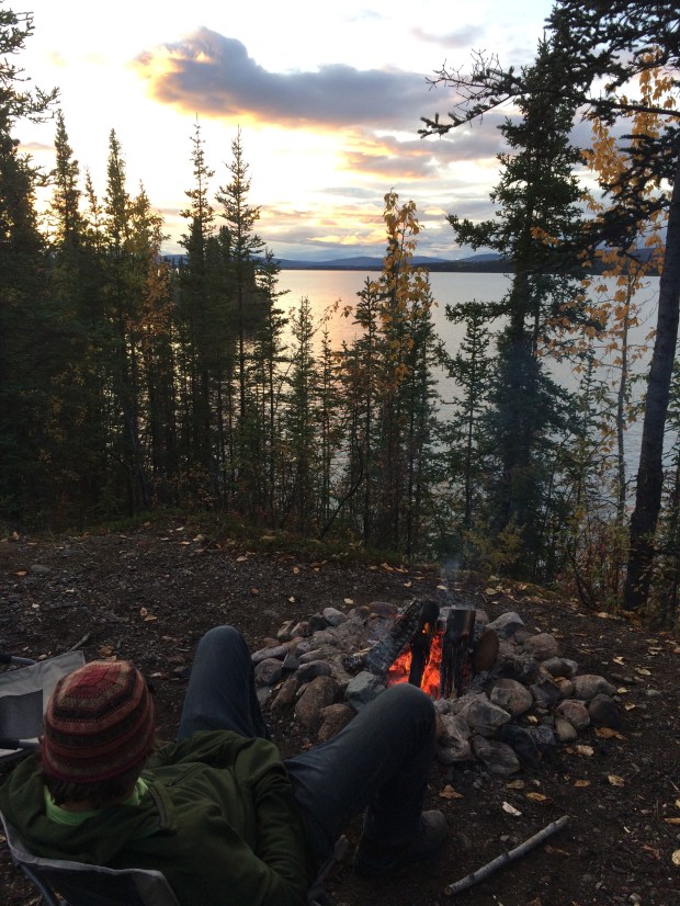
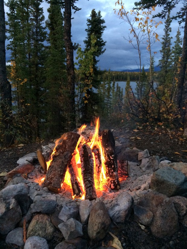
It was such a perfect spot that I took a quick video of the fire so that in future years we can relive the moment.

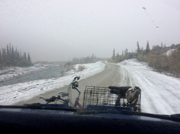
If we didn’t have the winter weather nipping at our heels, we would have stayed for days. But that chill wasn’t far behind, so we moved on toward Watson Lake.

IMG_2312

IMG_2648

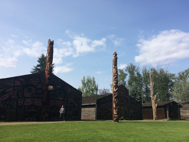
We thought it would be fun to go visit our signs at the Signpost Village, especially because it’s not too often these days that we’re somewhere familiar. There they were!

IMG_2345

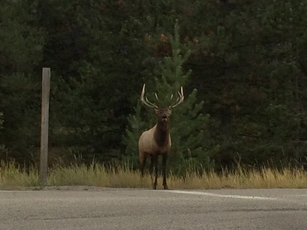
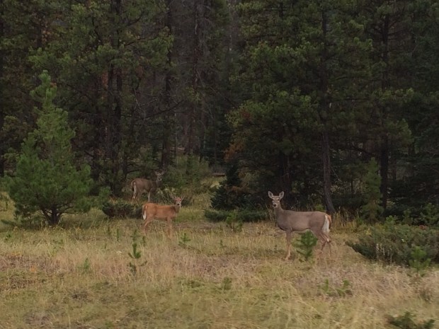
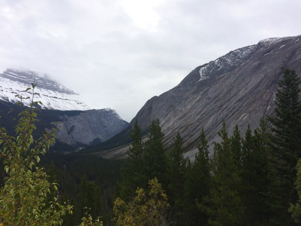
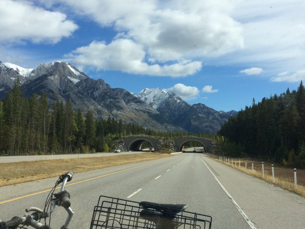
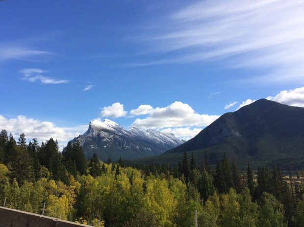
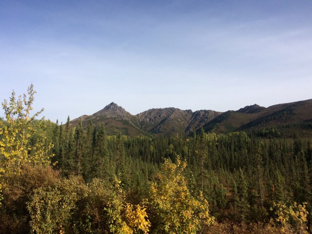
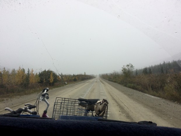
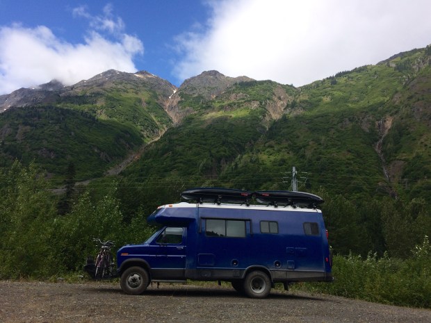
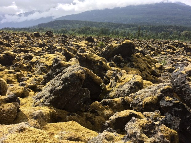
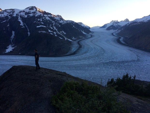
Then on we drove into the endless green and gold mountains and valleys of British Columbia.

IMG_2428

IMG_2431

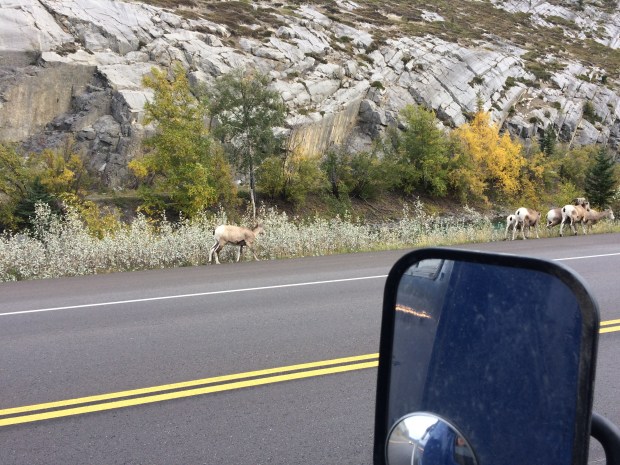
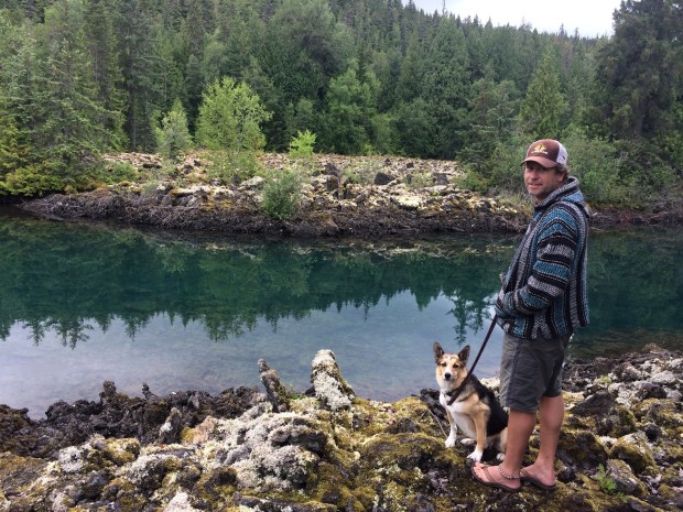
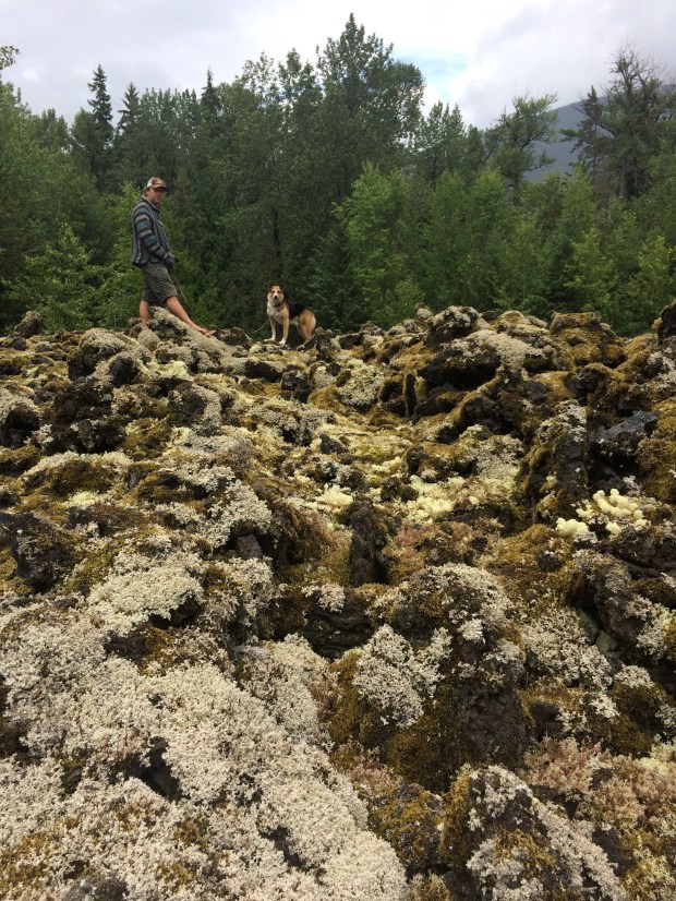
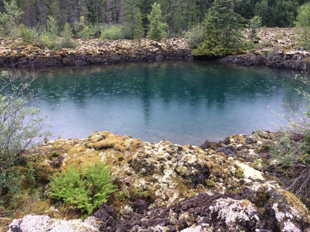
We had a garbage bag to toss, so we pulled over at a viewpoint to use the waste bins, and accidentally stumbled across this vista.

IMG_2441

IMG_2443

And this was the view from the other side of the parking lot! Beautiful British Columbia, indeed.

IMG_2474

IMG_2492

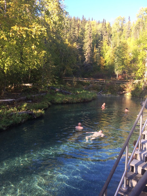
And then to add even more icing to the British Columbia cake, we stopped at Liard Hot Springs and accidentally had the time of our lives. We’d read about it over and over while researching the area, but didn’t think much more of it than “Sure, we could stop at a hot springs; that sounds nice.”

It was wonderful. It’s a provincial park and not privately-run, so for starters it’s really affordable. The day use fee is just $5 per person, but the hot springs fee is waived if you’re camping, which is $26 a night. That’s actually a little on the spendy side for boondockers, but it’s also really nice to have water and garbages at your disposal now and then, in addition to the free hot springs. So we paid for our site, got settled and then went straight to the hot springs.

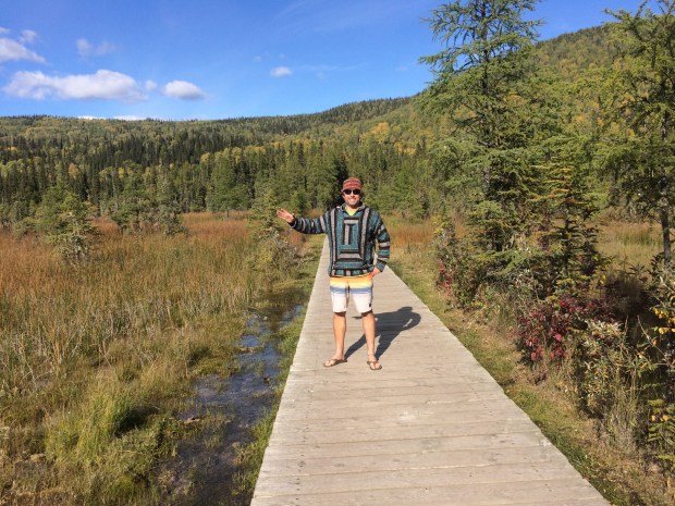
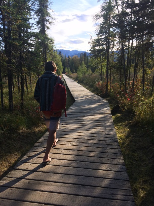
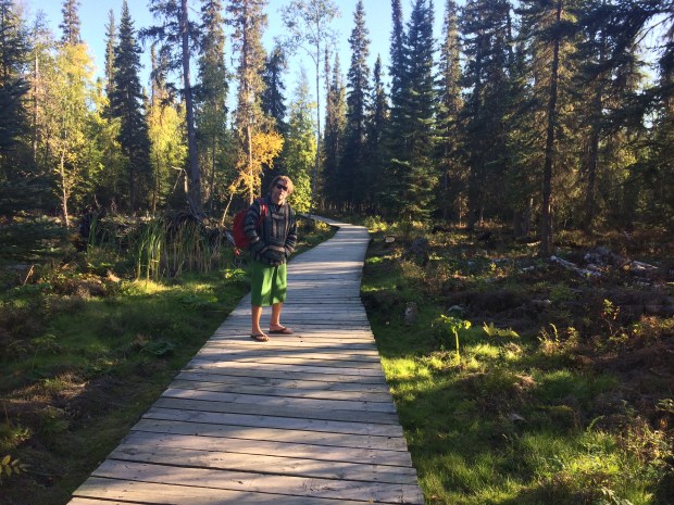
It’s a beautiful walk down the boardwalk to the springs, over the warm marsh that is very popular with the wildlife, especially during winter.

IMG_2527

For a developed hot springs site, this one is surprisingly untouched in all the best ways.

IMG_2532

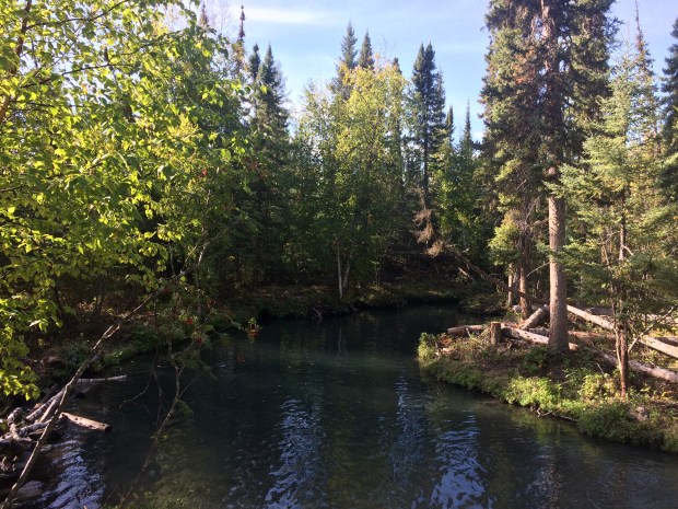
There are bathrooms, changing rooms, and a deck, but other than those few comforts it’s just a lovely pond that’s a piping hot 110-120 degrees at the source and then cools the farther away it travels from there. So the upper pool stays super toasty, and the lower pool is a perfectly warm and slightly deeper swimming pool.

IMG_2540

We loved it so much we spent a few hours there on our first trip before going back for dinner and some travel planning.

IMG_2544

The Anti-Project always has other plans, but luckily she has a short attention span and was soon on the prowl for buggies while we got a little work done.

IMG_2568

IMG_2576

As we planned we decided we weren’t ready to leave the hot springs already, so we decided to stay another day, then went back for our night soak. Liard doesn’t have closing hours since it’s a natural springs, so we got to soak until late when we were ready for bed.

The next day was another sunny fall day, perfect for multiple trips to the hot springs.

IMG_2592

IMG_2613

That night as we splashed around the warm lower pool and visited with some other travelers, the Northern Lights came out in enormous green flickering bands that twisted and arched from one side of the sky to the other over our heads. We laid on our backs and floated in the steaming water, watching the lights and laughing out loud at how perfect it all was.

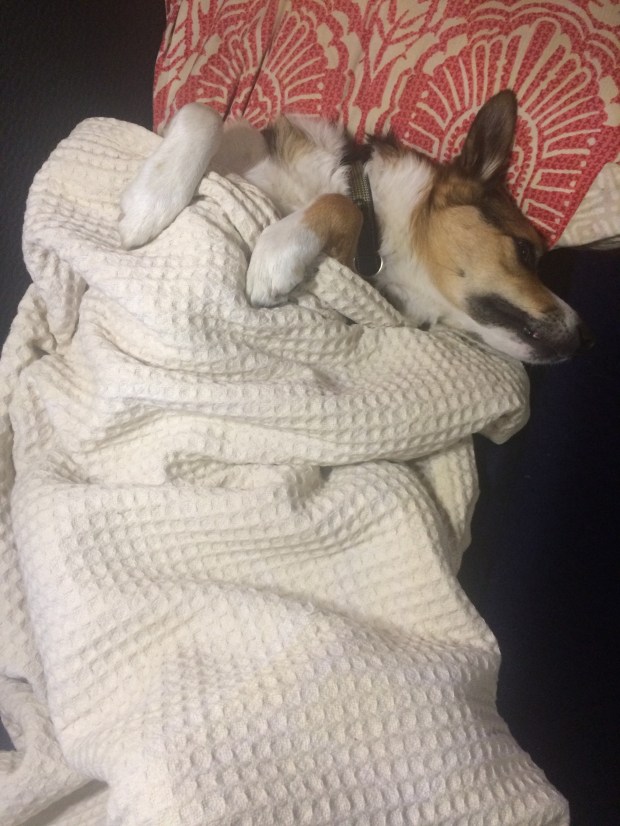
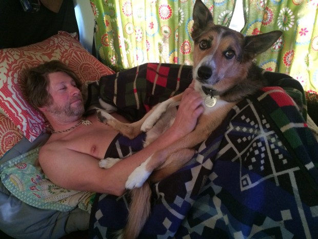
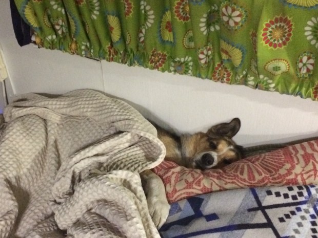
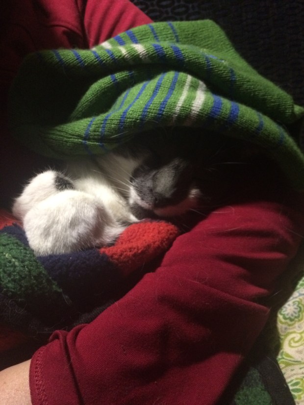
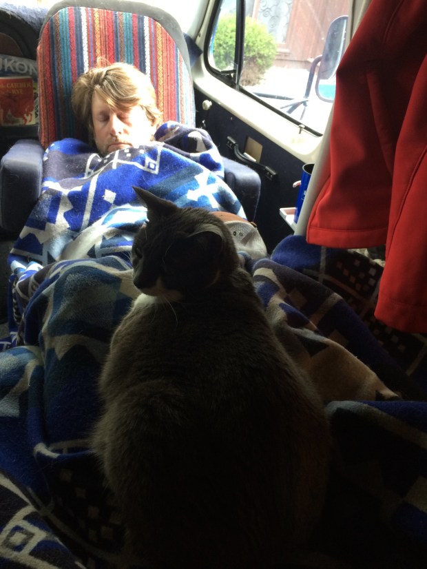
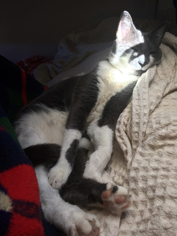
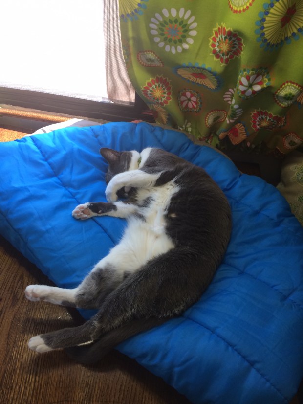
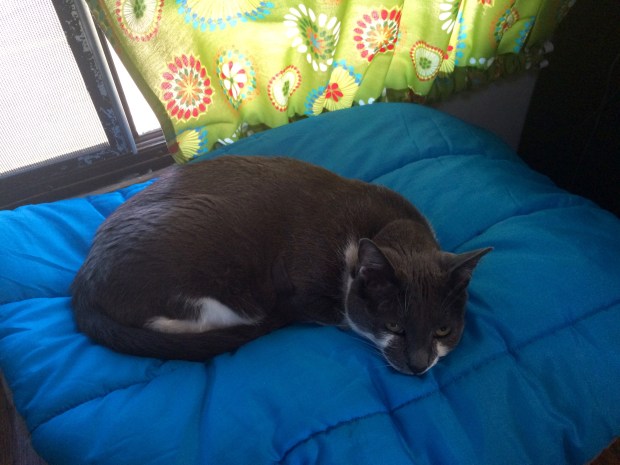
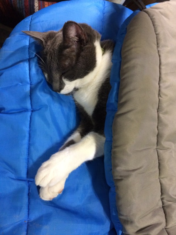
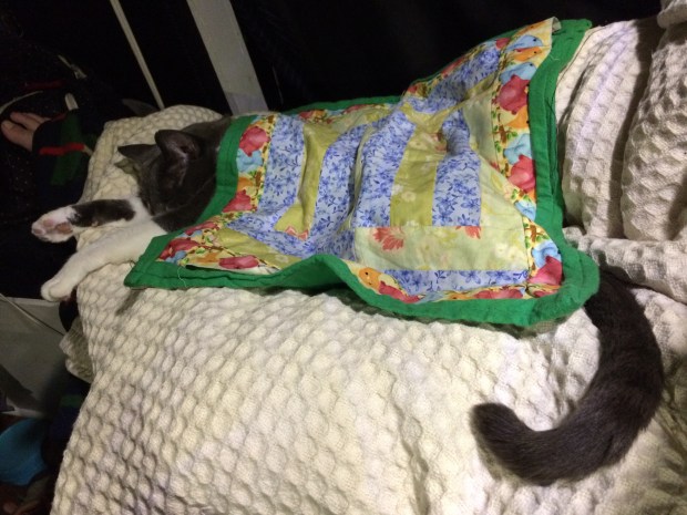
When we got back to the Turtle, it was late and we were all warm, cozy and ready to snuggle up. While we got ready for bed, Gracie crashed out under her own personal quilt that my niece Ava made for her before we could even make it up to the loft!

IMG_2635

With plans to return as soon as possible—especially in the snowy winter months—we got everyone ready to move on.

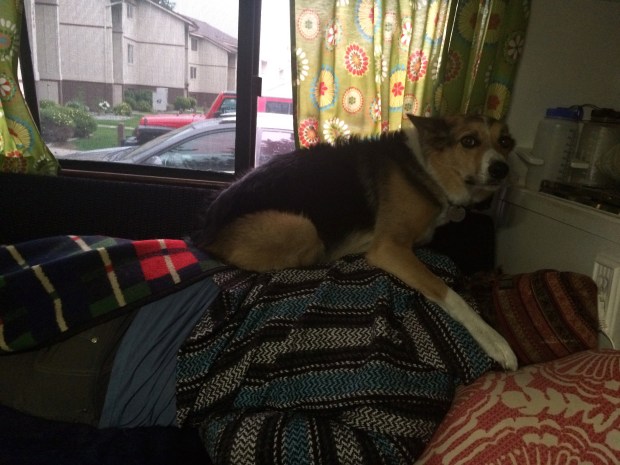
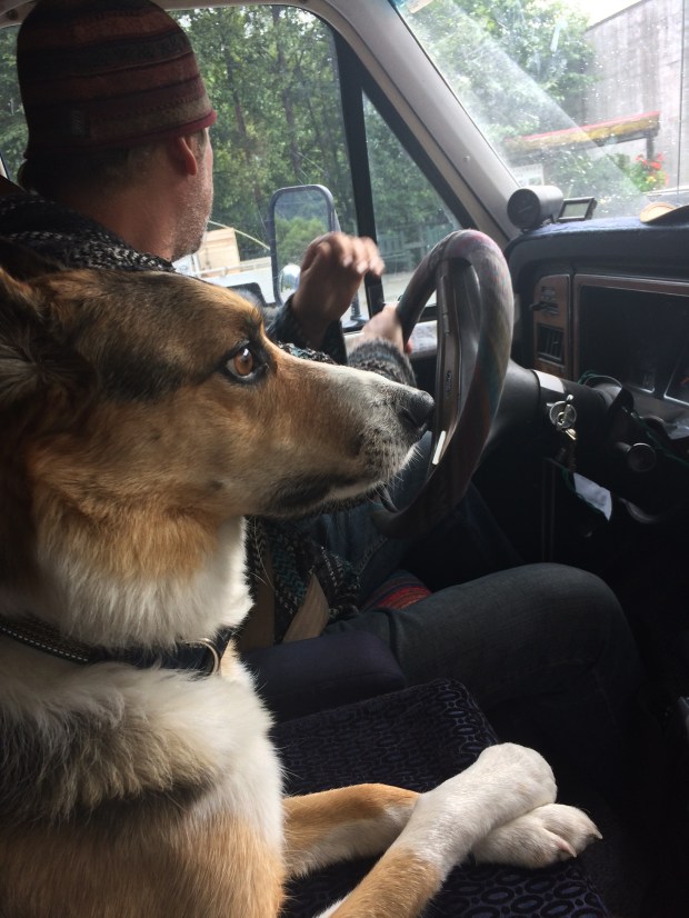
Gracie’s preferred and self-appointed travel spot is in a clothes bin in the closet, which is kept open for her as we drive. Usually when it’s time to go she hears the engine start and hops into her spot, but if she doesn’t sometimes we have a conversation about it to give her a chance to get in before we start moving. And it’s adorable.

And with the huge skies of the Yukon in our rear view mirror, we set our sights on the road ahead.

On Top of the World: North on The Dalton Highway to Deadhorse, AK

Andy loves maps. So when we got our Milepost to plan our trip up to Alaska and it had a big Alaska map included, he was super excited. He unfolded it and we started pointing at places we would visit, and finding new places we didn’t know existed, like Chicken, Alaska. I noticed the Deadhorse dot way at the top of the state and said, “So are we going to the top of Alaska too, then?” Immediately I could see Andy’s wheels turning. We did a little quick research. And thus began our two-month-long back-and-forth decision/indecision about making the drive up the Dalton High to Deadhorse, Alaska.

Screen Shot 2017-09-17 at 8.55.58 PM.png

The reason the decision wasn’t obvious is that the Dalton Highway has a bit of a reputation. It’s been featured on BBC’s World’s Most Dangerous Roads, America’s Toughest Jobs, and was the focus of four seasons of Ice Road Truckers. It’s a beast.

Here’s the rundown:

  • It’s a 414-mile road between Livengood and Deadhorse.
  • Nearly the whole route is dirt and gravel and in rough condition, with grades up to 12%.
  • It is one of the most isolated roads in the US, with only three towns along the route: Coldfoot (pop. 10), Wiseman (pop. 14), and Deadhorse (permanent pop. 25-50 but there are several thousand workers living there at any given time).
  • As the longest stretch of unserviced road on the North American continent, the Dalton is totally remote and has no cell service along the entire route until Deadhorse.
  • There is one gas station in Coldfoot and one in Deadhorse.
  • It gets cold up there. In 1971 it was the location of the coldest temperature ever recorded in North America at -82 degrees.
  • Atigun Pass through the Brooks Range is at elevation 4,739 feet and is considered quite treacherous, especially in unfavorable conditions.
  • It was built as a service road during the construction of the Alaska pipeline and is still used primarily by supply trucks—about 160 daily in the summer and 250 daily in winter and they’re all driving at top speed and have the right of way.
  • Travel tips on various sites include bringing two spare tires, plenty of extra fuel, survival gear, and your own surgical supplies.
  • The road ends at Deadhorse, which is not a town in the traditional sense but an industrial camp in the Prudhoe Bay oil fields. So there’s not much to do once you get there.
    DaltonHighway.jpg

According to a NY Times article, “In addition to these numerous privations, there is also no good reason for a nonprofessional driver to drive the Dalton Highway.” When we asked around, most Alaskans and fellow travelers we talked to about making the drive told us emphatically that it was a bad idea and just don’t do it.

So there was that.

You’d think that would be enough to make the decision quick and easy. Buuuuuut. . . we were also feeling compelled by the other characteristics of that most remote wilderness. For example:

  • Just south of Coldfoot you pass into the Arctic Circle!
  • We’d get to see arctic tundra and (hopefully) arctic wildlife.
  • The Arctic Ocean is just beyond Deadhorse, and though the area is blocked by security, there is a tour company that will take you right to the ocean, after you pass a security check and pay them $70 a person.
  • Gates of the Arctic National Park sits on the west side of the highway, and though you can’t access the park by car, you can hike in on foot from a few parking areas.
  • The terminus at Deadhorse is the farthest north you can drive in North America. And we have plans to drive to Chile one day, so it would be pretty freakin’ cool to have driven the continents from top to bottom.
  • Apparently it’s really, really beautiful up there.
  • It’s almost completely wild.
  • Adventure calls!

I think by now you have a pretty good idea of where we landed on this one, especially if you read the title of this post. (We decided to go.) A few final pushes in that direction came from our friend Sam, who is a native Alaskan and knows all the information contained in both above lists and said that he wouldn’t recommend it to just anyone, but he knows the Turtle is capable and so are we, and that we should definitely do it. That’s all Andy needed to hear, so he was locked in. I was at 98% until my friend Lexie sent me a video by a pair of overlanders who had made the trip just a week earlier in their truck camper, and the scenery was more beautiful than I’d even imagined, and also they saw a baby grizzly bear. So I was locked in.

We got to Fairbanks, got all our supplies in order and bought a CB radio so we could communicate with the truckers as an added safety measure. We got up early the next morning and began our northward journey to the top of Alaska.

IMG_0029

The first thing we noticed was the Alaska Pipeline, which was to be our one constant over the next few days, as it parallels the Dalton all the way to Deadhorse.

IMG_0038

IMG_9993 (1).jpg

Also notable was how much more it felt like fall! It was much colder and the colors were gorgeous.

IMG_0033

IMG_0041

IMG_9988

IMG_9995

The pavement soon ended and we began the brain-rattling portion of the journey across the pitted, wash-boarded and pot-holed dirt road that would continue all the way to Deadhorse. It was a really beautiful drive, and we still felt pretty fresh when we saw the Arctic Circle sign and pulled over to take a few pictures.

IMG_0061

IMG_0079

The Turtle still looked blue at this point, too! We continued on to Coldfoot, watching the lovely scenery as well as the gas gauge.

IMG_0088

IMG_0095

We weren’t sure what to expect when we finally reached Coldfoot after 8 long hours, and were pleasantly surprised to discover the Arctic Interagency Visitor Center tucked away on the west side of the highway. The facility is a cozy spot to learn about the Northern Lights and the flora and fauna of the area, and they have maps available and flyers with information about Coldfoot, Wiseman, and Deadhorse since there’s no cell service all along the highway.

IMG_0105

They also print out the weather forecast for the towns and the Atigun Pass, which on our visit showed snowflakes in the next day’s box. We’d already made it halfway there, so there was no turning back. We filled up with gas across the road and had a surprisingly top-notch dinner buffet at the restaurant/bar/gift shop/one building in the town that felt kind of like a church basement but really served up a mean meal. Then we drove just a bit north of town to a nice little turnout for the night.

IMG_0110

IMG_0114

IMG_0134

As predicted, the next day was super cold and foggy and the snow loomed on the horizon.

IMG_0148

We could barely see the scenery behind all that fog!

IMG_0154

There were huge mountains on all sides but after a while we couldn’t see them even a little. It was just a blank white backdrop in every direction.

IMG_0155

As we gained elevation approaching the Atigun Pass, the snow set in so suddenly that we were climbing the pass before we realized it and it was too late to chain up. If there were any turnouts we couldn’t see them at all, and there was barely enough room for two cars to pass one another, much less to pull off enough to not get hit by other passing vehicles.

IMG_0156

We climbed and climbed, following the guard rails since that’s all we could see, and hoping against hope that the speedy ice road truckers wouldn’t blast by us.

IMG_0175

IMG_0177

At least we could read the road signs. . . what does that one say? Avalance Area? Oh good.

IMG_0178

Andy handled that Turtle brilliantly, and I alternated between nervous picture taking and looking at the sky so I wouldn’t have to look over the dropoff into the white abyss. We finally made it through, and amazingly encountered no trucks. But even after the pass, the roads were so slippery that we pulled over on the road that leads to Galbraith Campground to chain up as a precaution.

On the return drive, we noted this spot was where we’d pulled over and were shocked to discover that there had been mountains surrounding us the whole time, but we had no idea.

IMG_0205

Scout loved this stop. He’s a real snow hound, and he bounded through the snow and grazed on it and tried to get me to run with him, but it was too slippery. We did get an arctic frisbee session in though.

IMG_0212

IMG_0195.jpg

IMG_0215

Soon the snow lessened, so we asked a driver on the CB if there was any more snow between us and Deadhorse. He said it was nothing but mud, so we removed the chains and bumped lurched down the road the rest of the way through the arctic tundra. It felt like being on another planet. It’s completely flat as far as the eye can see!

IMG_0248

From the literature we took from the Visitor Center, I learned that because the ground is all permafrost beneath the top layer, there is a lot of standing water in the tundra because it has nowhere to go. Seeing little puddles and lakes everywhere wasn’t at all what I expected, but it was really interesting and beautiful.

IMG_0262

After 10 exhausting, jarring hours, we made it to Deadhorse!

IMG_0263

We really felt like we were on top of the world. I put on 10 layers and Andy put on his one extra layer so we could examine the Turtle and let the animals out. Gracie hopped out, felt the cold, and jumped right back in. Scout was unfazed and just wanted to play frisbee again.

IMG_0278

We were thrilled and amazed that the only part that had come off the Turtle had been removed intentionally—as we drove with the chains on, they were slapping into the corner of the running board on Andy’s side, so he just took it off. Otherwise, we’d made it in one piece!

IMG_0271

IMG_0273

We were worn out by the drive, so we hopped back in to cozy up for the evening and admire the view out our living room windows.

IMG_0266

We’re all good at getting cozy, but Gracie is the professional. She zonked out so hard that when I jokingly put my hat on her head, she just slept right through it. We all could relate, and the whole gang slept like logs that night, excited to explore the northiest north the next day!

IMG_0313

The Road to Alaska – Part 6: Anchorage, AK with Friends

If I’ve said it once, I’ve said it a thousand times (I may have actually said it a thousand times): one of the best things about Turtle Life is the flexibility and freedom to visit our friends and family. And during our time in Anchorage, we were lucky enough to be able to spend quality time with both friends and family!

First we spent a week with Andy’s longtime buddy Sam and his wife Sara. Sam is a professor and has the summer off, so we took full advantage of his schedule by having a full week of fun.

IMG_8922

Andy and I had caught some salmon in Valdez and kept two to bring along, which Andy prepared in his famous marinade and Sam grilled up for us.

*A tip if you like delicious things: Sam also BBQ’s up frozen seasoned hashbrowns as a side dish, which were so good I just got jealous of myself when I saw this picture of the hashbrowns I was about to eat when I took the photo.

IMG_8756

Sam took us on a field trip to the fish hatchery, where we saw loads of spawning salmon! Pictured are only two, so please just take my word for it that there were a bunch.

IMG_8781

Sam, Sara, and their son Oliver took us for a crisp and refreshing rainy-day walk up to Portage Glacier.

IMG_8844

IMG_8825

We hadn’t seen snow in a while, so we had to take advantage of the wintery playground and make ourselves a slide. I paved the way with the classic bum slide, and Andy immediately took it to the next level, as he is wont to do.

On the way home, all our dreams came true when we spotted a moose grazing right by the road in town!

IMG_8847

We were really beginning to believe the area moose were a rumor created by the Alaska Chamber of Commerce.

And luck was really on our side—or else the COC had gotten wind that we were on to them and planted that moose in two spots so we wouldn’t spread the conspiracy theory around—because a day later we saw another one!

IMG_8888

This one was on a walk through a beautiful park on the way to the beach. She had been grazing on the trail blocking hikers, and the locals who warned us about her presence smiled curiously when I threw up my hands and cheered about a moose on the trail. Somehow they could tell right away that we weren’t from around there.

We stood up the hill from her to admire her moose-y cuteness, then walked on to the ocean since it’s weird to stare at a moose all day. And what a day for the beach!

IMG_8900

IMG_8905

IMG_8913

Another highlight of the trip was the delivery we had waiting for us at Sam and Sara’s place! After catching so many fish in Haines and Valdez, we decided we should spring for a vacuum sealer so we can pack more of our fresh fish and berry picking surpluses into the freezer and keep them for even longer. I was super happy about our newest purchase, and Andy was even a little more so. (Sam and Sara, I’m aware that I’m grossly underselling Andy’s excitement about this purchase, but if I did his joy any justice everyone would think I was exaggerating.)

Well of course we had to test the thing out. An hour and 50 vacuum bags later, Andy had made it as far as testing out vacuum sealing tortilla chips just to see what would happen, and suddenly it was bedtime.

IMG_8859

When we got back to the Turtle for the night, we found that someone had caused a little trouble back at home. The culprit still remains at large as we try to gather more conclusive evidence.

On Monday Sara was back at work, so Sam took Andy and me on a beautifully sunny and very fun walking tour of Anchorage.

IMG_8925

IMG_8930

IMG_8958

IMG_8944

I’ll have you know that we had way more than a week’s worth of fun that week. Sam and Andy are two peas in a pod, and it’s awesome to see your sweetheart having fun like the old days with his buddy.

Although we tried our best to convince Sam to blow off another week’s commitments to goof off with us some more, he somehow decided to take the responsible road. Go figure!

Before we moved onto the next leg of the Anchorage Adventure, we needed a little battery-recharge, at which point it became apparent which of our friends are helpful when it comes to naps . . .

IMG_8877

And which aren’t so much.

IMG_8785

Oh, and in case you’re still wondering what happened to the vacuum-sealed tortilla chips . . . they were all ground to corn crumbles, except for one, which stayed completely intact!

Weird and worth the suspense, right?


The Road to Alaska – Part 3: New Aiyansh, Stewart, & Hyder

Holy cow, you guys.

We knew before we began the drive through Canada to Alaska that it was going to be beautiful, but somehow we weren’t even prepared for how majestic this part of the world is!

IMG_7152


IMG_6885

Every new place we go, we just look at each other, wide-eyed, and laugh out loud in amazement that we’re getting to see all this.

One of my favorite spots yet was the next stop on our map after leaving Stewart. New Aiyansh, BC and the other neighboring villages of Nisga’a are so beautiful that I can’t possibly do it any justice with words. And believe me when I say that I’ve been trying! Even when we were there, both of us were more quiet than usual.

A volcano eruption in the 18th century left the area covered in lava rock, which now is blanketed in dozens of different varieties of moss, ferns and little succulents. And the pools of water scattered around the lava fields are a perfectly clear aquamarine color that felt like something out of a fairy tale.

IMG_6903

IMG_6920

IMG_6910

The Drowned Forest was a favorite stop for me.

IMG_6927


IMG_6956

A neighboring village has a bouncy suspension bridge spanning the Nass River, so we crossed it and I quickly admired the view as I hurried to the other side. Andy, of course, loved it!

IMG_6965

IMG_6996

Vetter Falls was a rainforest wonderland, and we walked out as far as we could to see if we could spot the “phantom fish”—steelhead that get trapped at the falls and develop snake-like bodies with large heads—but they lived up to their name.

IMG_7029

Andy tried very, very hard though. So you have to give him credit.

IMG_7035

IMG_7042

We stayed the night at a lake near Cranberry Junction, which had a name but will now just be known as “mosquito lake” in our memory. It was a gorgeous spot for a feeding frenzy though!

IMG_7087

IMG_7107

IMG_7116

IMG_7120

Although staying indoors to escape mosquitos has its advantages.

IMG_6873

The next day, we drove to Stewart, BC, which took us five times as long as it would have had we not stopped every half mile to marvel at the mountains, glaciers, and waterfalls.

IMG_7142

IMG_7145

IMG_7196.jpg

IMG_7211

Right next door to Stewart is a little town called Hyder. . . Alaska! They’re minutes away from one another, and have a very similar vibe; they’re just separated by a border agent on the BC side.

IMG_7215

A local tradition is to get “hyderized” at the Glacier Inn, so we did. A bracing shot of Everclear later, we had our official cards!

The next day, one of the locals we’d met found us and invited us out for a day of fishing on their boat! We had a phenomenal time, especially considering the weather was clear and sunny so we could venture out on the speed boat to explore, fish and pick wild blueberries.

IMG_7281

IMG_7243

IMG_7259

IMG_7270

IMG_7279

There were other perks as well:

IMG_7347

It was such a treat and we’re so grateful we got to join! Thanks again, Kim and David!

After we left the dock that evening, we drove up to the Salmon Glacier, the fifth largest glacier in Canada. Because the sun doesn’t set until 11 p.m. around here this time of year, we had plenty of time to drive up and stop for photos along the way.

IMG_7364

IMG_7371

IMG_7382

IMG_7387

IMG_7391

IMG_7396

IMG_7399

We found a great lookout to stop for the night, and watched the sun set behind the mountains.

IMG_7424

The view from our front yard when we woke up the next day was pretty incredible!

IMG_7451

We even had friendly neighbors!

IMG_7435

Scout and I took a little walk while Andy made coffee.

IMG_7446

I love our morning coffee views these days.

We drove back down the mountain to Stewart, where we got our fishing licenses and headed out to the dock to see if we could catch a few crabs. We had great luck catching crabs, but for a little while it seemed like the only crabs in the water were females! We met a local who was also crabbing from the dock and enjoyed hanging out with him while we all released the ladies back into the ocean. By the time he had to go he’d caught a number of prawns, which he gifted to us. We were totally thrilled. I’ve never had fresh prawns before, so it was generous and very much appreciated! Thanks again, Tim! 🙂

Well, I have more tales to tell and I’m not nearly caught up all the way yet, but I just looked at the time and it’s almost grizzly bear feeding time here in Haines, and we want to see more bears!

Yes, I said more! Spoiler alert:

IMG_7580

The Road to Alaska – Part 2: British Columbia, Eh?

Greetings from Beautiful British Columbia!

IMG_6107

It’s been an exciting first few weeks in Canada as we make our way north to Alaska. We’ve covered some ground and have been really enjoying watching the landscape change and become less and less familiar. The road signs are more frequently featuring moose, and though we haven’t yet spotted one yet, we did see a sleek little silver fox slinking around a park as we pulled in for the evening in Prince George! So that will tide me over for quite some time.

Our first adventure over the border began in Vancouver, BC. I briefly mentioned our stay in Vancouver in my last post, but now that I have all the photos uploaded I thought I’d fill you in further on the fun we had while we were there. Especially since, despite the fact that both of us have lived in Seattle, neither had ever been to nearby Vancouver so we were really looking forward to seeing the city.

IMG_5964

One of my favorite resources as we visit new cities has been the online Atlas Obscura site, which suggests interesting attractions that aren’t found on most other “Things To Do In _______” sites. This time I told Andy that I was going to take him on a surprise tour of Vancouver and lead him to all the spots I thought sounded fun without telling him what they would be. He’s a good sport and agreed!

Our first stop was the VanDusen Botanical Gardens, which was one of the loveliest botanical gardens I’ve ever visited. The grounds are enormous, and the circuitous layout lends itself to a full day of wandering through paths and gardens reminiscent of Alice’s Wonderland.

IMG_5885 (1).jpg

Check out this delphinium garden:

IMG_5917

IMG_5919.jpg

Ok so if I’m being honest, the gardens were lovely, but the real reason for going here was something that’s been on my to-do list for as long as I can remember:

IMG_5953

A hedge maze!

It’s one of only six Elizabethan hedge mazes in North America, and it was so much fun and more challenging than we gave it credit for going in.

Afterwards we went to the Granville Island Market, which my uncles in Seattle had highly recommended to us. It took us some time to find a spot to park, and it came in handy that Andy is a wizard. Look at this park job!

IMG_5960

We wandered around the market and were totally in love. It was a bustling throng of people and the wonderful smells of hot espresso, cooking meats, fresh flowers and herby soaps. After picking up some darling wood map pins, we had lunch at a tiny Chinese restaurant downtown and then hit the road for the next stop on the secret tour . . .

IMG_5983

The Steam Clock in Gastown. It’s a working steam clock built in 1977, which you can look inside and see the gears and levers moving. We were even there to hear the hourly musical whistles blow. In honor of the clock, we popped into nearby Steamworks Brewing Company for a beer.

Next we walked a number of blocks to the Marine Building, a remarkable Art Deco building that was conceived to look like it had risen from the sea, and it truly does. I mean it looks like something from a movie . . . oh wait, it is! To my fellow nerds out there, it’s also been featured in a number of movies, as the Baxter Building in Fantastic Four and for The Daily Planet in Smallville. Fun!

KIMG0583.jpg

KIMG0584.jpg

Afterwards we walked to see the Digital Orca sculpture, which we weren’t able to see up close due to an event that had the terrace roped off. (If you look closely, you can see empty glassware at the tail.)

KIMG0587.jpg

It was a full day in Vancouver, and we left very satisfied. But after over a month staying in cities, I’d been so looking forward to getting back outside, and was happy to arrive at our next campsite at Gillis Lake. We stayed two nights, and got plenty of reading and swimming done.

IMG_6067

IMG_6039

IMG_6059

IMG_6014

IMG_6053

IMG_6004

When we woke up the morning of third day, the entire forest was flooded with smoke, which we later found out was due to dozens of forest fires throughout BC. A handful of towns had been evacuated, and the road we’d planned to take was closed. So we rerouted and drove through Kamloops to Prince George, windows rolled up to minimize our smoke inhalation. It was so thick my eyes watered, and you couldn’t even see the mountains beyond the freeway through the grey. And in the areas that we could see a fair distance, we saw fires licking the mountainsides. It was unreal.

IMG_6091

IMG_6076

We spent a two days in Prince George, or “PG” as the locals call it. (Which is pretty cute for a city in Canada, where everything is sweet and friendly and very “rated PG”.) When we got to town, we went to one of the best Railway Museums we’ve been to so far, and that’s saying something! We go to a lot of railroad museums, apparently.

IMG_6181

IMG_6196

IMG_6205

IMG_6214

IMG_6230

We rode the little train around the grounds, and got to go inside most of the cars and engines. Andy had more fun than all the other museum-goers combined.

IMG_6234

IMG_6251

IMG_6256

We stayed until they closed, then walked right next door to Cottonwood Island Park. I’d read that a local artist sculpted little pieces right into the trees, and as you walk through you can treasure hunt for them.

IMG_6320

IMG_6267

IMG_6274

IMG_6280

IMG_6282

IMG_6296

It likely comes as a huge surprise to nobody that my favorite was the gnome houses.

IMG_6308

We stayed the night at the park’s lot and that’s where we saw the silver fox!

IMG_6346

It’s a poor picture, but it was the best I could do at twilight while squealing with joy.

Over the next few days, we found ourselves in more picture-perfect campsites, all of which are free! We stayed a few nights at Co-op Lake, where we noticed a strange bubbling at the shoreline. As we got nearer to investigate, we saw that it was a massive mob of tadpoles!

IMG_6457

We all had a wonderful time there, reading, hammock-ing, swimming, fetching frisbees in the lake, pouncing on bugs, paddling out to the middle of the lake in our floaties and watching the clouds roll by.

IMG_6452

IMG_6449

IMG_6401

IMG_6424

IMG_6421

IMG_6461

IMG_6418

IMG_6417

IMG_6379

We then moved to another great campsite at the Eagle Creek Opal Beds, where we went on a gorgeous hike, hunted for—and found!—raw opals, discovered and ate the huckleberries along the path, and then hiked up a hill at midnight where we saw the Northern Lights flickering on the horizon. It was a pretty magical spot.

IMG_6492

IMG_6501

IMG_6530

Scout even remembered how to pick huckleberries!


I could have stayed in any one of those campsites for weeks, but there is much to see in these parts, so we pressed on. We wanted to see Prince Rupert, a darling coastal town in northwestern BC, even though it was a few hours out of the way. On our way there, other things happened and they looked like this:

IMG_5971

IMG_6158

IMG_6149

IMG_5994

IMG_6326

IMG_6358

IMG_6467

IMG_6536

IMG_6583

IMG_6608

IMG_6616

IMG_6666

When we got to Prince Rupert it was a brilliant sunny day, which—we were informed by the locals—is not usually the case. We walked all around town, in and out of cute little shops, through the Museum of Northern British Columbia, and ended up on a bright patio overlooking the ocean.

IMG_6695

IMG_6688

We looked down and noticed crabs walking along the ocean floor, and the next day’s plan was born. After all, we’ve been carrying our crab traps around for over a year!

IMG_6705

The next day we got our licenses and some bait, and headed down to the docks, where we discovered the depth off the edge was around 80 feet! We spent the entire afternoon into the evening sitting on the dock, chatting with locals, fishing, and reading books. We caught three crabs, one was a keeper, and Andy caught a small flounder.

IMG_6709

IMG_6764

IMG_6805

So all in all the day was a success, and as we packed up we were treated to a perfectly picturesque coastal sunset.

IMG_6822

Today was our last day in Prince Rupert, and we visited the North Pacific Cannery Museum on our way out of town. We accidentally stayed three hours, and enjoyed every last minute.

IMG_6830

IMG_6833

IMG_6841

IMG_6843

We’re now back in Terrace, BC, heading north for some serious camping way-off-grid, so the next post will be on the other side of the wilderness when we have service again. And though the silver fox was a superior thrill, here’s hoping that next post will include some photos of a moose. 🙂


The Alaska Road Trip Begins!

Well hello there!

A lot has happened since the last time I updated the blog on our roving whereabouts, wild shenanigans and general goings-on, and if I could, I’d catch you up completely on what we’ve been up to since I last reported. But as I sit here writing this post, I realize how long that could take, as we’ve been moving at breakneck Turtle speed for the last few months! (Of course I’m not referring to miles-per-hour speed, as that remains as slow as ever. I’m talking about how much ground we’ve covered, which for us has been a lot in an uncharacteristically short amount of time.)

Instead, I’ve decided to pick up where we are at this moment, which is the beginning of such a fun adventure that I think you’ll agree this is the best place to begin. Because we just crossed the border into Canada, which (in our minds at least) is the official beginning of the Overland Trek to Alaska!

IMG_5838

The general plan is as follows:

The Timeframe: A month driving up to Alaska (July), a month exploring Alaska (August), and a month returning home (September). We’d stay longer, but we’d like to stay ahead of snowy road conditions and by October the roads can start to ice over.

The Route: We are going to loosely follow what some travel guides call the “Gold Rush Route” on the way up, and then follow the Alcan Highway which ends just north of Montana, so we can drop in to see family at the end of the journey.

Must See: Denali National Park, Wrangell-St. Elias National Park, The Cook Family in Anchorage, Harding Ice Fields, Kenai Peninsula, and a moose. (It doesn’t matter which one.) Other than that we’ll play it by ear, as is our general travel style. There’s a lot of Alaska up there and we want to see as much as we can without moving so quickly that we forget to relax and enjoy the quiet moments that we’ve come to love most during our travels. I’ve been surprised to find my sweetest memories are the little surprise spots we stumble across between official destinations, and we try to make sure we leave room for improvisation for that reason.

Aaaaand, honestly, that’s as far as we’ve gotten. It’s tricky to make new travel plans while you’re in the midst of traveling and enjoying your current location! So we’ve become accustomed to making detailed itineraries a day or two in advance and then making more general plans where the upcoming weeks and months are concerned. It’s just no use trying to nail things down when we could see an interesting road and end up somewhere completely different than we’d anticipated!

We just arrived in Canada yesterday, and already we’re just charmed to pieces. It’s very familiar of course, but different enough that we’re excited to see what unexpected twists we’ll encounter as we go.

Unanswered questions include:

  • How different are the regulations regarding boondocking? Can you stay overnight at any turnout or viewpoint along the highway like you can in the states we’ve visited in the US?
  • What are “good” prices for fuel and propane? Our brains are already so tangled by conversions, and then by the time we work out what the prices are in US Dollars we realize that we don’t even know if the price is good or bad for the region we’re in!
  • We were surprised by the questions they asked us at the border, but they let us in so who are we to complain? They had a lot of questions regarding our lack of jobs, even though we explained we were living off of savings, and wanted to know what jobs we had before we left them for life on the road. The agent asked to see bank account balances to ensure we had enough money to cover our trip, which makes sense. He didn’t ask about pets, even though we did have all the documentation for Scout and Gracie including immunization records, etc. The one we’re still puzzled about though is that he asked how many guns we own. Not how many we were carrying with us, but how many do we own anywhere in the world. Interesting, right? The answer is none, so I’m not sure what the outcome would have been had we said we had an arsenal somewhere in the states. But again, we’re not here to tell the man how to do his job, especially since we crossed over in very little time.

IMG_5834

Today we went to Vancouver, BC and had a great time at the Granville Island Market and VanDusen Botanical Gardens before hitting up a few points of interest including the steam clock, a “metaphysical supply store,” the Digital Orca, and the Marine Building. All awesome.

IMG_5882IMG_5917IMG_5927IMG_5953IMG_5964IMG_5971IMG_5983

We love Vancouver!

And now that we’re all up-to-date on the current adventure, here is a sampler platter of the aforementioned shenanigans we’ve been into the last month or two, for those who like pictures of cute animals, lovely scenery, fun friends, and other general niceness.

IMG_3824
IMG_4198IMG_3914IMG_5793IMG_5784IMG_3818IMG_4307IMG_0800IMG_3976IMG_4797 (1)IMG_4843IMG_5413IMG_5342IMG_0667IMG_4364IMG_0680tIMG_4191IMG_5068IMG_0762IMG_0809wIMG_3997IMG_4056IMG_5489IMG_5684IMG_5414IMG_5706IMG_5090IMG_5228IMG_4060IMG_4006IMG_0819dogIMG_5403IMG_4730IMG_4376IMG_4477IMG_3971

A Busy Few Weeks: The VLA, ABQ, Boise, The Bisti Badlands, Four Corners, & Mesa Verde NP

Our current location is generally a mystery to anyone trying to keep track of us—including us—mostly due to the fact that we’re so busy having fun that I forget how long it’s been since I last updated the blog or Instagram! I promise that by the end of the next post both you and I will be completely caught up.

As I type this, I’m sitting at an adorable cafe and sweets shop in a town that, I announced immediately before consulting anyone else in the Turtle, we will one day live, even if just for a season. This place is a dream. But we’ll get to that next time. We have so much to cover right now!

IMG_1910

We left our last story outside the Very Large Array near Socorro, NM, having a delicious evening treat of a pie sampler from Pie Town. We found a great pull-out to stay the night just a few minutes from the VLA. That night before bed, we watched Contact with a view of the VLA right outside our window! It was awesome. In the movie, the VLA plays a prominent role in Jodie Foster’s research and makes a really dramatic background. And it’s just as impressive in person.

IMG_1917

The VLA is an astronomical radio observatory made up of 27 antennas that are each 82′ in diameter. They’ve helped with the investigation of black holes, quasars, pulsars, planets, and loads more. It’s astonishing to see them up close.

IMG_1921

IMG_1949

(Not quite sure what I was up to in this photo, but it’s the only one I’ve got, so you’re stuck with my unexplainable dance number.)

IMG_1953

After getting our science on, we made our way back to Albuquerque where I had a flight to catch in a few days to Boise to visit my girlfriends Beth and Lexie.

But first, Andy and I had a mission: to get poolside as soon as possible. I’m not sure how we got the idea in our heads, but suddenly we couldn’t live without a swim. So we headed to the only RV park in Albuquerque that had their pool open before Memorial Day—American RV Park.

IMG_1985

IMG_1998

IMG_2003

We came for the pool and stayed for the lovely park, yummy continental breakfast, clean showers and laundromat, and beyond-friendly staff. We really did stay another day. It’s a great park that I can’t recommend highly enough! We realized that it had been over a year since we had stayed in an RV park, which was fun because we’ve really gotten the hang of boondocking and have saved lots of money by not going to parks unless we need to take advantage of their amenities. Turtle power!

We stayed two nights, and the next day I left this guy:

IMG_1975

To hang out with these guys:

IMG_2040

It was a bunch of fun. We painted the town red, and even got dressed up to go watch the Kentucky Derby.

IMG_2088

IMG_2138

After a whirlwind few days, I was back in Albuquerque and the four of us were back on the road. Andy and I went to a fantastic mining museum in Grants called the New Mexico Mining Museum, which has a replica uranium mine underground. The man at the front desk had worked in mining for about 35 years, and had worked his way up from the bottom to be the head of his mine and even got an award for safety, with the longest time without a death in the mine or serious injuries. He had lots of information, was adorable, and gave me a goldstone to remember the mine by.

IMG_2151

IMG_2158

IMG_2164

Outside of Grants, we stayed at the Joe Skeen campground near El Malpais.

IMG_2173

IMG_2200

I was happy to be reunited with this guy:

IMG_2271

And this guy:

IMG_1981

And this guy:

IMG_2420

We drove to the Bisti Badlands wilderness, where you can stay overnight in the parking area for free! It was especially appreciated that we got to stay after we climbed for hours over the crazy hills that changed in appearance every few minutes. It felt like a walking tour of 10 different planets.

IMG_2439

IMG_2448

IMG_2444

IMG_2461

IMG_2472

IMG_2478

IMG_2490

IMG_2548

IMG_2555

It was a hot day, and when we got back to the parking lot, we relaxed in our chairs and read books with Scout and Gracie. Gracie has become a real champ with her harness and leash these days. I think she’s figured out that sometimes it’s her only ticket outside, so she wears it without any problem, and even comes to my feet meowing when she hears me get it out.

IMG_2575

The next day we made it to Four Corners with beautiful skies above us.

IMG_2583

IMG_2585

IMG_2605

Then we drove on toward Mesa Verde National Park. The landscape on the way to the park was a destination unto itself. I swear this is not a painting.

IMG_2617

In the last year, we’ve been to two other cliff dwellings sites: Bandelier NM and Gila Cliff Dwellings NM. We really enjoyed both, but agreed once we made it to Mesa Verde that this is our favorite site so far.

IMG_2700 (1)

IMG_2870

In the park are 600 beautifully preserved cliff dwellings of the Ancestral Pueblo people, many of which you can tour or see clearly from various vistas. Depending on the site, the tours are just $5 or $10 each, which gets you 1-2 hours of information and a walk right through the dwellings. You can see petroglyphs and pictographs, the different styles of construction each group used, and the actual tools they used to grind corn and make food. And the views are so vast and unreal that we both said more than once that we’d pay just to hike the trails on the mesa! There are also self-guided tours you can take, so we did all of those too.

IMG_2838

IMG_2774

IMG_2799

IMG_2817IMG_2733

IMG_2819

IMG_2672

IMG_2666

IMG_2675IMG_2871

Our second day there, as we parked at Balcony House for our tour we noticed another van that could be the Turtle’s long-lost cousin, so we parked by it as we often do when we see a van we like. After traveling around for the last year and a half, we’ve found that we can usually tell by someone’s van if they are kindred spirits, and our track record is pretty good so far. This time was no exception! We ran into Gary and Kiki as we returned from our tour, and found out that they’re just starting out on their full-time vandwelling adventure (though they’ve already been on many, many adventures of other sorts). We’d all already purchased tickets for the same tour the following day, so we got to hang out even more during the Long House tour.

IMG_2881

IMG_2864

We super enjoyed getting to know you guys, and I’m certain that our paths will cross down the road. (When they do, we’ll let you know what Turtle theme song we came up with; hopefully one as cool as Birdy’s.) You guys were a pleasure to hang out with. Stay in touch! 🙂

After the tour, we did a quick 6-mile loop on top of the mesa to check out the other cliff dwelling overlooks.

IMG_2908

We would have loved to stay and visit (both the park and the new friends) longer, but the storm clouds were rolling in and the skies were getting darker. Our first rule of overlanding is “Never Drive at Night”, which is comparable to driving in terrible weather, so we hit the road to make it to Durango, CO to find a spot before the weather hit.

We hung out in Durango for the evening, a town that I already loved and knew Andy would too. The weather was unfortunate, with frigid winds and constant cloud cover, but we had a great time anyway. If you can involve pizza in the plans, Andy is a happy camper.

IMG_2994

If you can also include a free trip to the coolest railroad museum ever, Durango and Silverton Narrow Gauge Railroad Museum, he will be even happier.

IMG_2975IMG_2965IMG_2968IMG_2976IMG_2984

And if you really want to make his day, cap it all off with a little performance testing at the highest altitudes the Turtle has ever attempted. . .

IMG_3092.jpg

Which, unbeknownst to us, was the next leg of the trip. And one that would bring us to where I sit now, in my new very favorite town of all time! But that’s up next.


We Love NPS: Carlsbad Caverns, Guadalupe Mountains, White Sands & Gila Cliff Dwellings

It’s no secret that we love the National Parks System. In fact, part of our five-year plan (or as close as full-time wanderers get to a plan) involves taking occasional breaks from the road to work at National Parks and Monuments as we travel around. Not only will it be soooo fun to live at a park, but we can also make a little extra travel money while giving back to the Parks System that has basically been our landlord for a good portion of the last year and a half. We’ve boondocked on NPS land at National Parks, campgrounds, and dispersed camping areas. And not only to we get access to astonishingly beautiful and unique gems around the United States, we’ve also been provided at many sites with potable water, RV dump stations, showers, bathrooms, and garbage services. Oh, and a surprise favorite—ranger talks around campfires under the stars! At Wind Cave the fireflies were flying around us as we walked to the amphitheater to hear a ranger tell us all about the history of bison in South Dakota, and another ranger sang us a song on her ukulele that she wrote about Native American folklore. Pretty fancy, right?

Immediately after hitting the road, we got our NPS annual Interagency Pass and it’s no surprise that we’ve gotten our $80 worth and feel pretty happy about it! The last few weeks have been especially National Parks-y.

We began the streak at Carlsbad Caverns National Park, hiking down to the Big Room from the Natural Entrance.

IMG_0900

IMG_0910

IMG_0914

There were some beautiful intricate formations on the way down, but the real thrill was the 1.25 mile loop around the Big Room at the bottom. We’ve been in a bunch of caves, but never anything like this! The photos do it no justice, but the scale of these stalactites and stalagmites is staggering.

IMG_0935

IMG_0951

IMG_0955

IMG_0956

IMG_0963

IMG_0964

We were thankful for the railings along the path, which made it possible to just stare upward with our mouths hanging open, pinballing our way down the walkway. It’s Andy’s Favorite Cave To Date, and for me it’s Tied For First with all the other caves I’ve explored. (I just really like being in caves.)

We stayed the night somewhere outside the park, and then the following day—Easter Sunday!—we arrived at Guadalupe Mountains National Park for a holiday hike.

IMG_0985

IMG_0996

Of course we had to investigate the potable water situation, and they had a nice spigot near the RV camping area, so we made a note of it and hiked on into the hills. This park is home to El Capitan, which is a celebrity rock, and Guadalupe Peak, which is the highest mountain in Texas. We didn’t hike either of them; it was 90 degrees with full sunshine, so neither of us felt bad about choosing a less strenuous trail.

IMG_0999

IMG_1006

IMG_1039

IMG_1046

After the hike and a water fill, we proceeded to El Paso for a Costco run and then on to Alamogordo and saw. . . well, look.

IMG_1059

IMG_1066

That’s right; it’s the World’s Largest Pistachio! It’s a sculpture at the McGinn’s Pistachio Tree Ranch, which is a really fun stop if you’re in the area. There’s a lot to see and eat there. We sampled dozens of flavored pistachios and pistachio candy, bought some bags to take home, and got some pistachio ice cream to eat under a pistachio tree by the huge pistachio sculpture.

I’ve never written the word “pistachio” so many times in my life combined.

IMG_1069

IMG_1070

IMG_1073

Then another stop in Alamogordo at the Alameda Park Zoo, recommended to me by my buddy Daren who used to live in the area. And I’m so glad he did; we wouldn’t have thought to stop by this tiny zoo in a park in the middle of town, but it was one of the coolest zoos either of us has ever visited! It’s only $2.50 to get in, the grounds are lovely and nicely manicured, and the animals are happy and well-cared for in their clean and green enclosures.

IMG_1085

IMG_1097

IMG_1101

We left the zoo while we still had plenty of light so that we could make the big climb up to Cloudcroft, an adorable town 19 miles outside of and 4,000 feet higher than Alamogordo. And our little Turtle made it! We may have been going 2 mph, but we made it! We stopped at the scenic train trestle outside of Cloudcroft, and then found a cool dispersed campsite nearby to stay for the night.

IMG_1139

IMG_1186

We stayed two days, and drove back down.

. . .Don’t get me wrong, lots of fun things happened in Cloudcroft, but I promised you a National Parks post so I’m going to try to stay on topic here. 🙂

IMG_1204

A lot of National Parks that we go to feel like being on another planet, which is a shared characteristic of all the parks I’ve liked best. So you can probably guess my approval rating for White Sands National Monument! This place was bizarre in the very best way.

IMG_1212

IMG_1225

IMG_1238

It was magical. Hills and hills as far as the eye can see of gypsum sand.

It played tricks on our minds, as hills of white usually mean snow and winter, but it was 85 degrees and we were roasting! I made a sand angel anyway. Also strange was the sensation that we were walking on sand in that heat, but it wasn’t hot on our feet at all.

IMG_1250

IMG_1269IMG_1282

Before we began walking back to the Turtle, Andy joked that we should fill our bucket with water and make a white sand castle. We both got quiet and looked at each other, and then went to get the bucket.

IMG_1334IMG_1338

The next day we went to Hatch, NM to get ourselves the epic green chile cheeseburger at Sparky’s that some hot springs friends had told us about a few months ago.

IMG_1367

IMG_1370

It was legitimately one of the best burgers I’ve ever had. Thanks for the recommendation, guys! On our way out of Hatch, we got some green chiles from a roadside market, Andy hassled one of the locals, and then we hit the road for Spaceport America.

IMG_1380

Spaceport America is incredible to see, even though it’s not open to the public right now. We’d read that there was a visitor’s center, but it’s in nearby Truth or Consequences (actual town name) so we just got a long-distance view of “the world’s first purpose-built commercial spaceport” and some really neat info from the hospitable guard at the gate. The sci-fi nerd in me was already picturing the next time I drive out there, this time with my flight ticket in hand. To infinity and beyond!

IMG_1470

That night and the next we stayed at Elephant Butte Dam in Truth or Consequences. We swam, read by the water, got some sun, and threw Scout’s frisbee into the water a thousand times before continuing onto the next leg of our journey.

IMG_1493

Which was Gila Cliff Dwellings National Monument! Another new favorite, and another great NPS spot to visit at the top of a very windy road that tops out at about 8,300 ft. The Turtle was wheezing, but we made it up this one too! And the reward was worth it.

IMG_1681

IMG_1649

IMG_1660

IMG_1697

IMG_1702

IMG_1705

IMG_1716

IMG_1722

IMG_1731

IMG_1678

There are free campsites all around the monument, as well as an oasis just right outside—a privately-owned hot springs with three pools and camping available. If they hadn’t been booked up, we would have gladly stayed the night too!

IMG_1774

But we already had a site we’d found the night before that we loved, so we were happy to return to our little house by the river.

IMG_1614

IMG_1794

IMG_1598

It was a great place to relax and catch our breath before moving on to the next National Park! It was also a great place for catching other things too.

IMG_1816

After returning our new friend to his home by the river, we returned to the road—the Turtle’s natural habitat! And on to the next National Park—the Turtle’s second home.