north

Heading South: North Pole and Chicken, AK Are Real Places

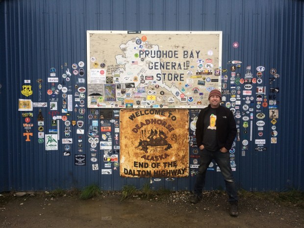
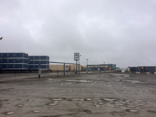
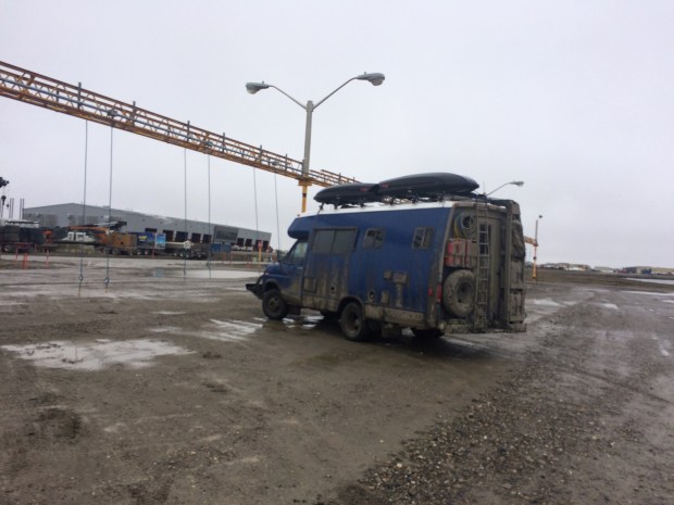
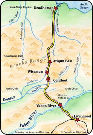
After our long journey up to Deadhorse and back, we needed a few days to recover.

IMG_1187

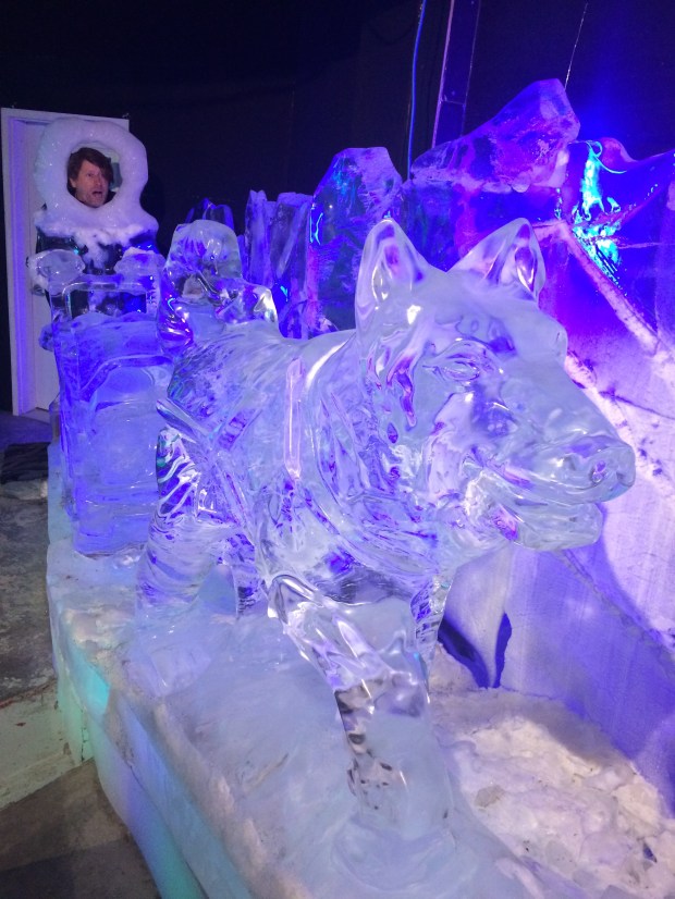
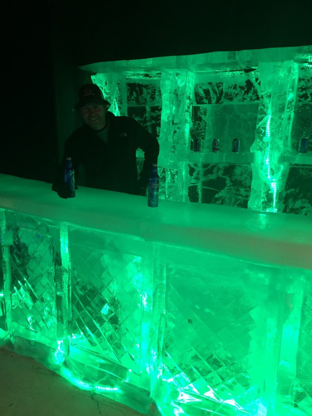
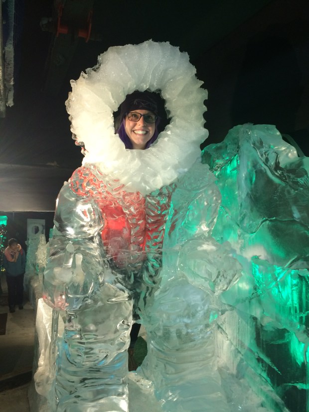
We decided to post up in Fairbanks for a day or two to do some laundry, resupply, see the Ice Museum, and just generally knock the dirt off of ourselves.

IMG_1197

IMG_1230

IMG_1213

IMG_1239

IMG_1250

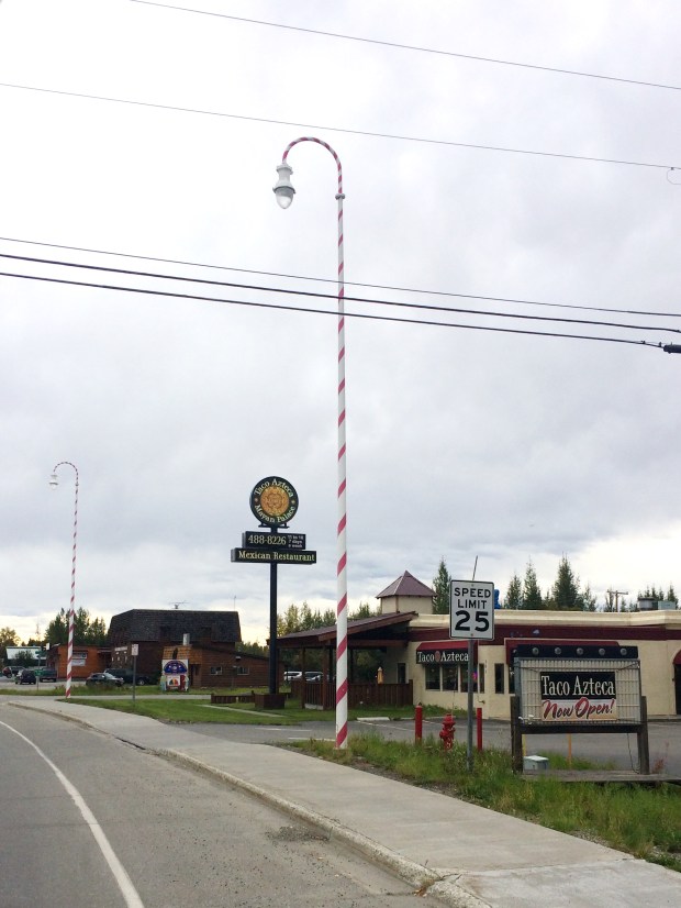
After a few days, we began the journey back down south which surprisingly brought us to the North Pole! Ok, not THE North Pole. But North Pole, Alaska which is as close as you can get to the real thing.

IMG_1289

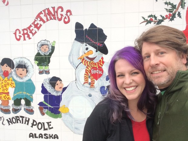
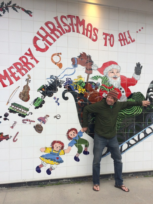
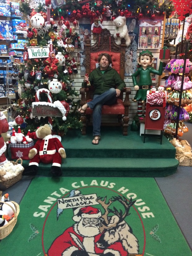
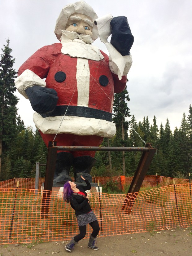
The whole town is Christmas themed year-round, from candy cane light poles to road names like “Mistletoe Drive” and “St. Nicholas Drive,” and there are resident reindeer who live next door to the Santa Claus house, where we spent some time getting in the spirit of Christmas a few months in advance.

IMG_1282

IMG_1366

IMG_1338

IMG_1272

IMG_1346

IMG_1351

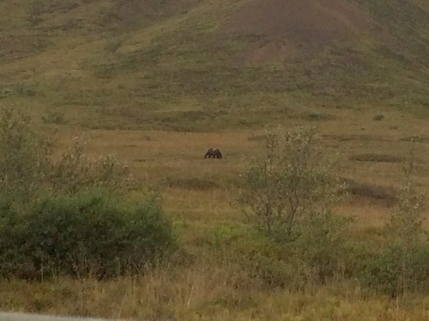
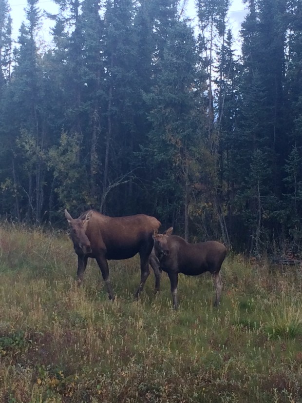
We’d had our hearts set on seeing a huge herd of caribou in the wild while we were up north, but we made do with Santa’s reindeer. (Which we learned on this trip are the same animal—reindeer are just domesticated caribou! The more you know.) But then on our way toward Tok, AK we came across a darling mama moose and her baby, and felt very lucky indeed. They hung around right alongside the road for over ten minutes before meandering back into the trees . . . but not before they posed for this glamour shot.

IMG_1432.jpg

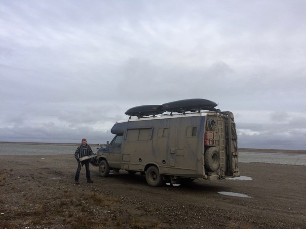
The sun was setting as we neared Tok, which we’d traveled through on our way up and had stayed overnight with the dirt bike rally racers at an unused airstrip outside of town. We went back to the spot, and had the whole place to ourselves! That night we saw the best Northern Lights of the trip so far, and the next morning we raced around the track at Top Turtle Speed. I’ll let you speculate on what speed that could be, and hopefully you’re generous.

IMG_1520

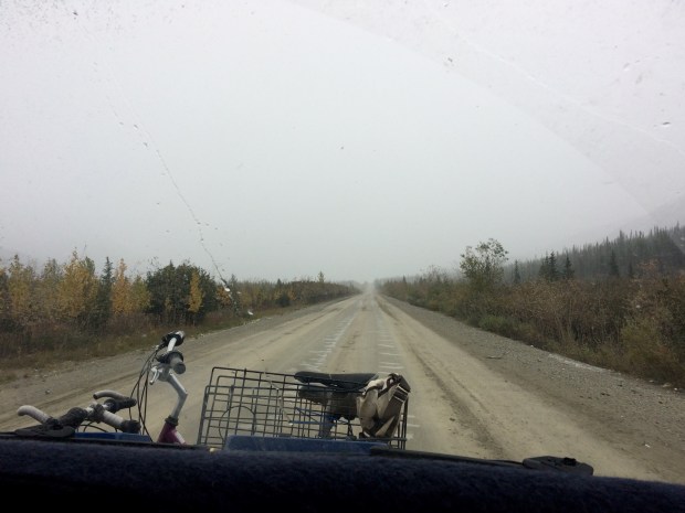
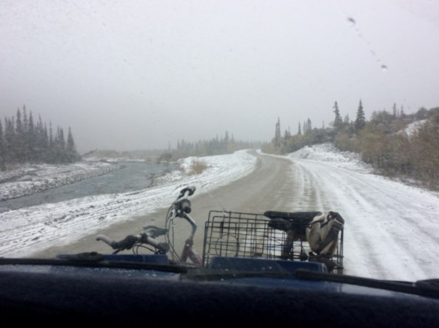
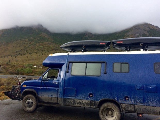
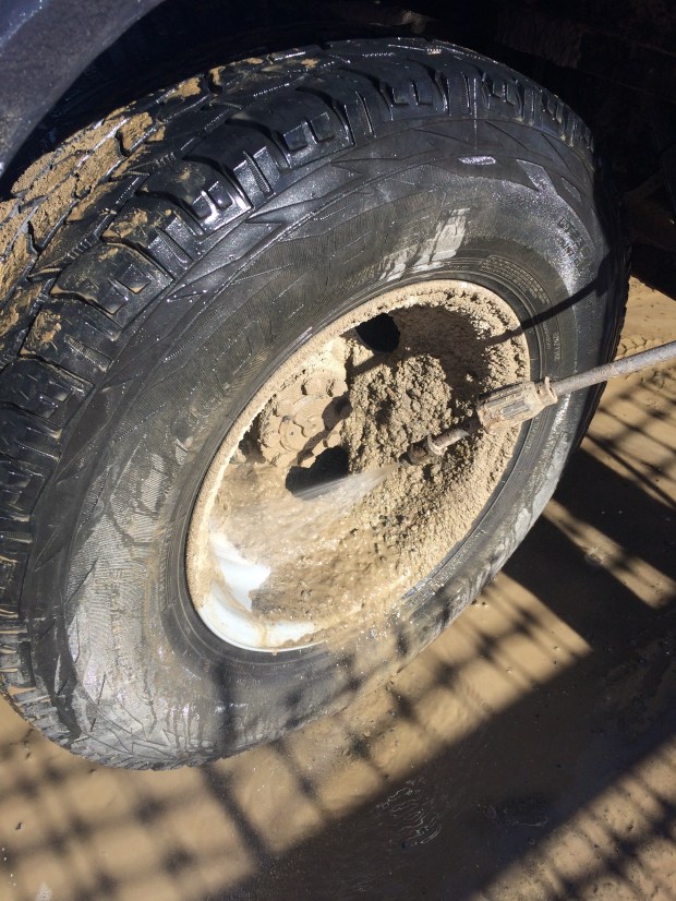
A much-needed Turtle bath afterwards helped us offload many of pounds of dirt, and we wondered if maybe we should have gone back to try the race track again to see if we could shave some time off our record. But we had more stops to go, and with the dirt highway ahead of us, we knew we were pressed for daylight.

IMG_1547

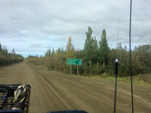
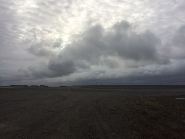
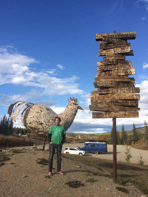
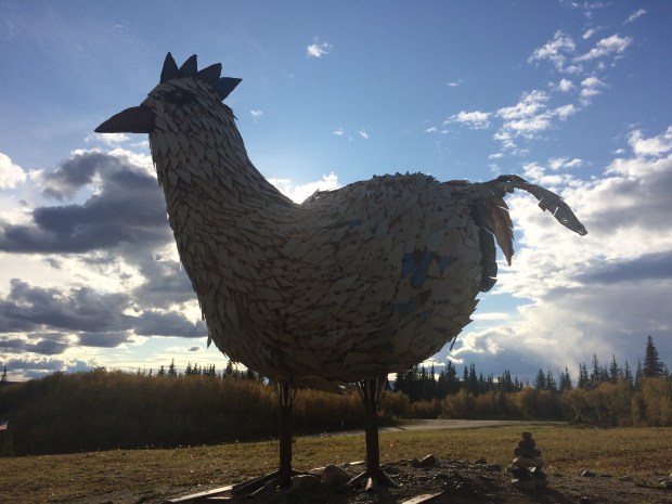
Beyond Tok lay Chicken, Alaska: a real place that I did not make up. We got to town shortly before the one store that was still open for the season was closing for the day, so we looked around, admired how wonderful the chicken soup smelled, took some enormous chicken photos, and drove on.

IMG_1562

IMG_1576

IMG_1580

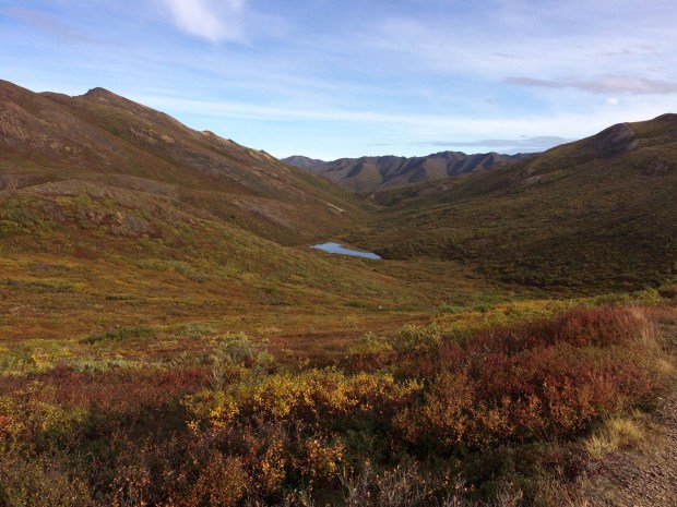
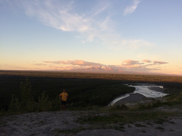
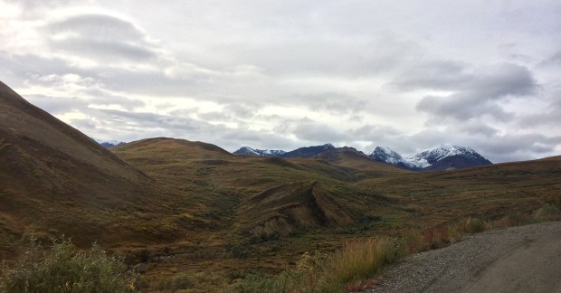
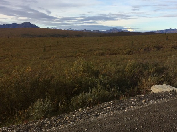
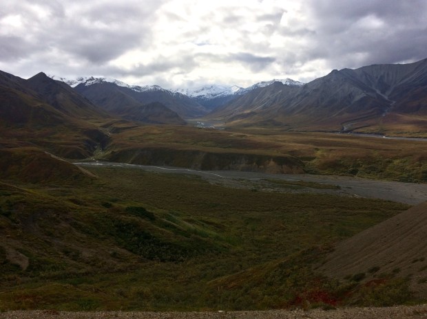
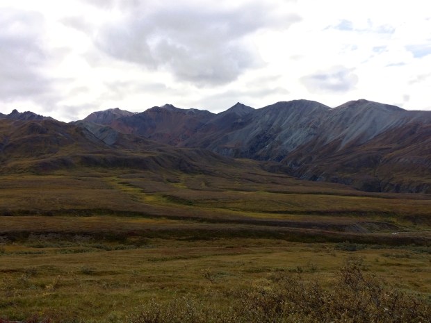
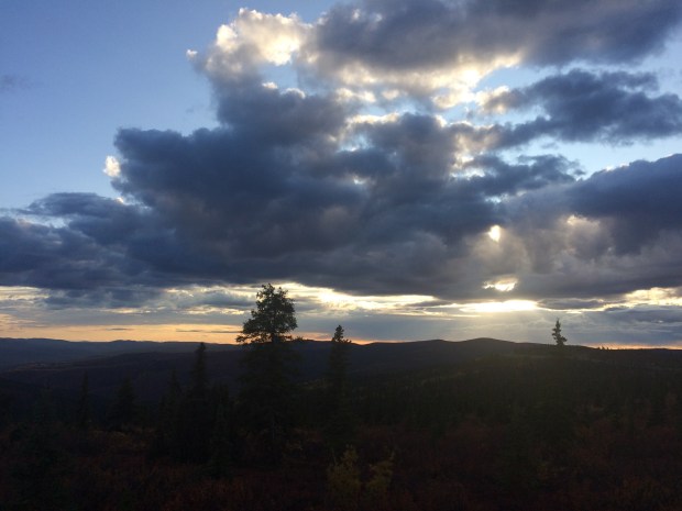
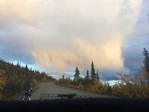
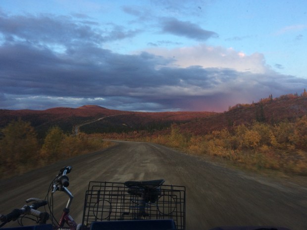
The next portion of the road is a beautiful drive called “The Top of the World Highway” which was where we finally had to say farewell to Alaska as we crossed back over into Yukon once again.

IMG_1593

IMG_1602

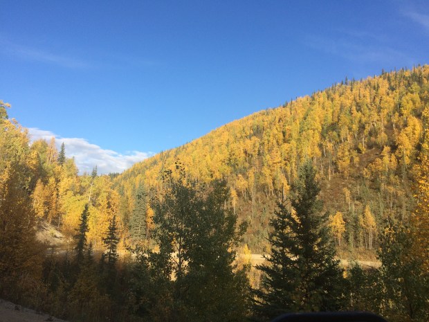
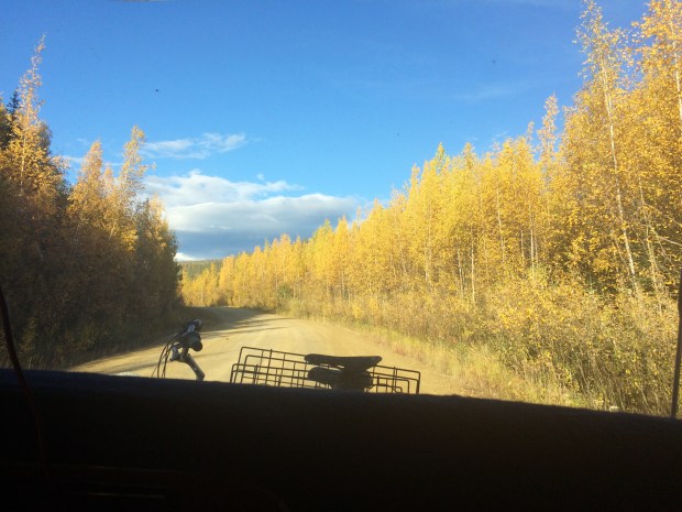
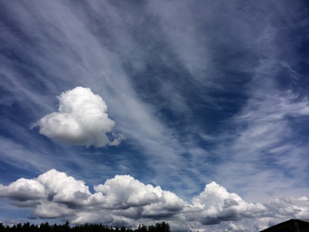
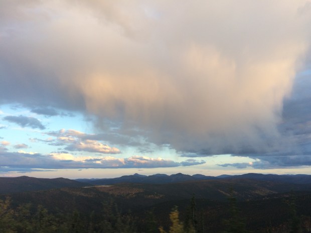
We had an amazing vantage point to watch the sun set over the valleys far below.

IMG_1642

IMG_1645

IMG_1671

IMG_1683

IMG_1684

IMG_1693

IMG_1709

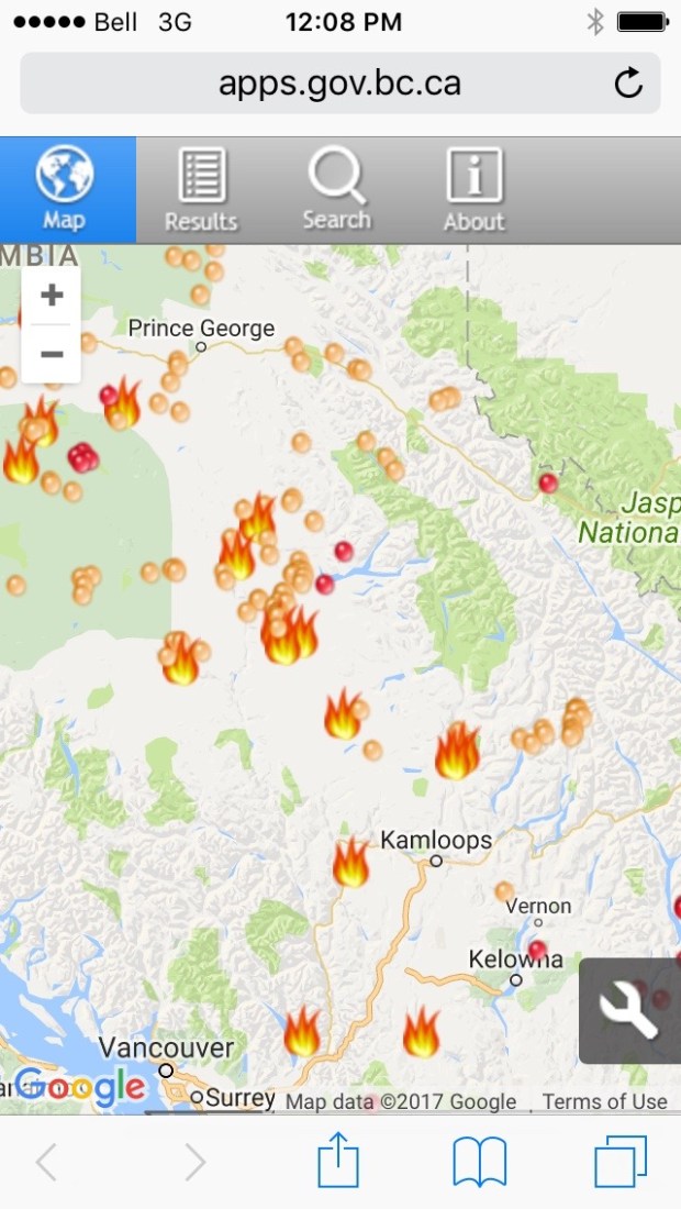
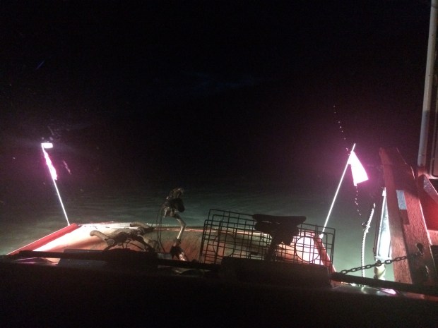
The sky was dark as we approached Dawson City, YT, and since we hadn’t had cell service for most of the last few days, I hadn’t noticed the map showed an unexpected break in the highway until we were right on top of it.

Screen Shot 2017-10-15 at 6.23.54 PM.png

The Yukon River divides the road right outside of Dawson City, so we got to take the Turtle on a small ferry that was luckily still operating on summer hours and ran every 15 minutes or so. Had we been two weeks later, I’m not sure what we would have done, but we took our accidental good timing and ran with it.

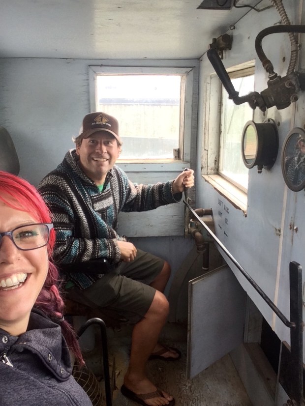
This actually might have been one of Andy’s favorite parts of the entire trip. He was so excited. He kept pointing ahead and telling me to look! even though I was of course looking already, but he just couldn’t help himself. It was pretty funny to be sitting in our Turtle and watching water flow by on all sides.

IMG_1712

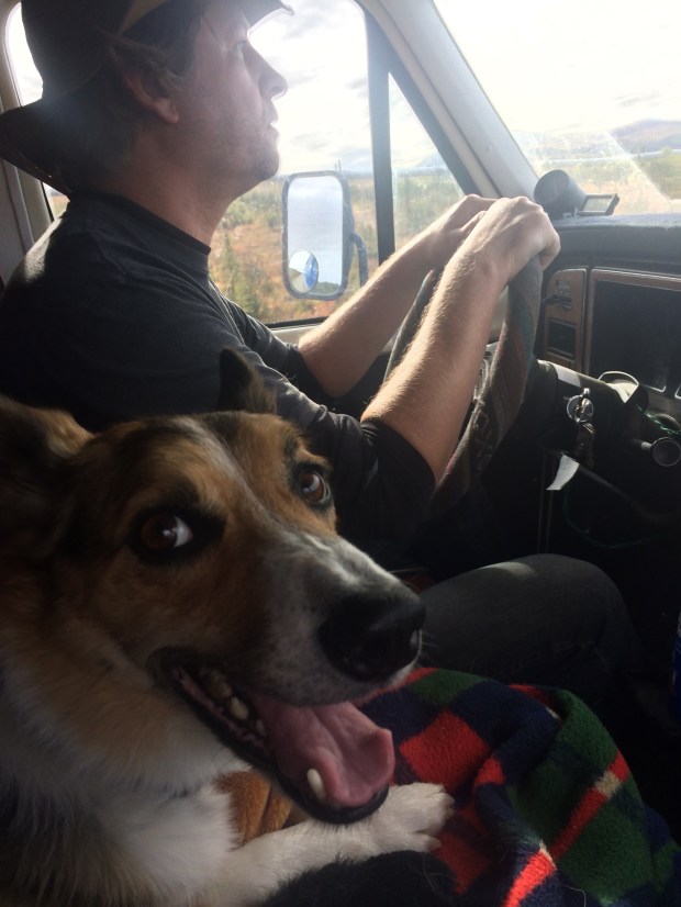
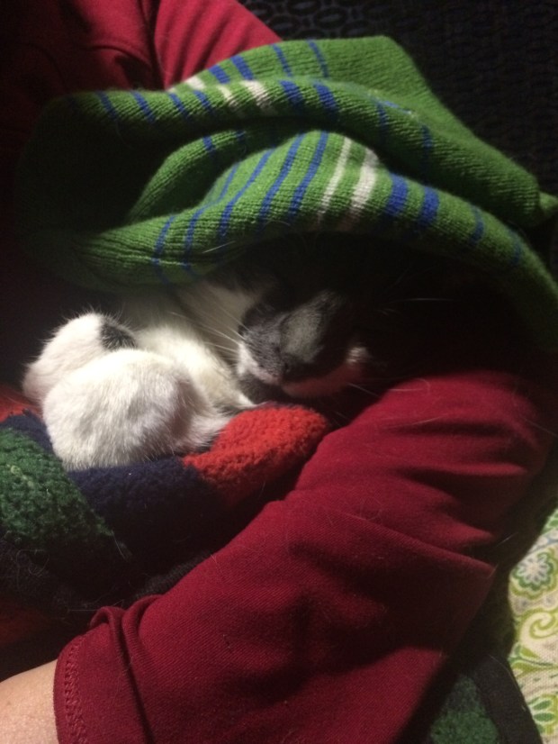
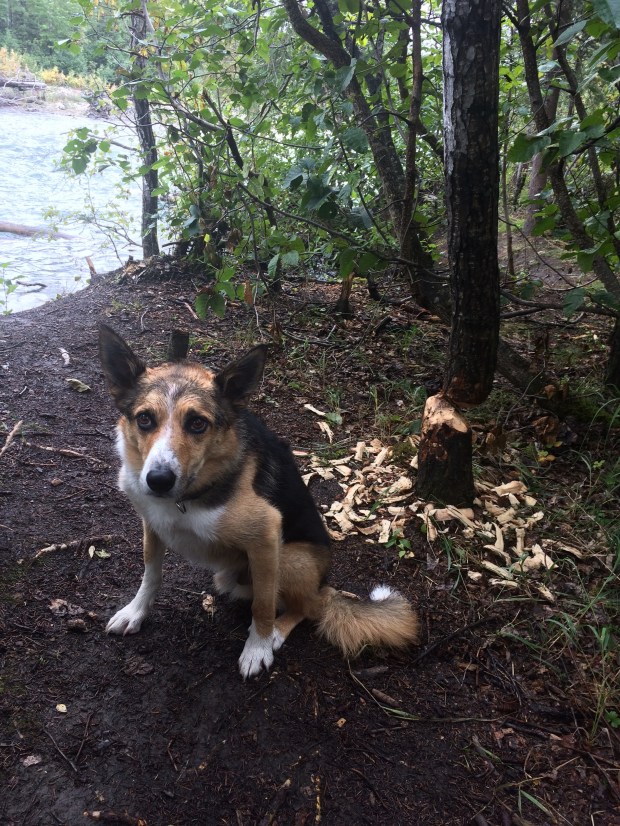
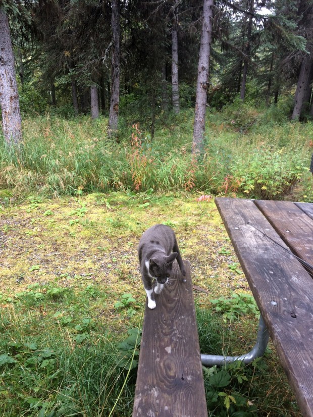
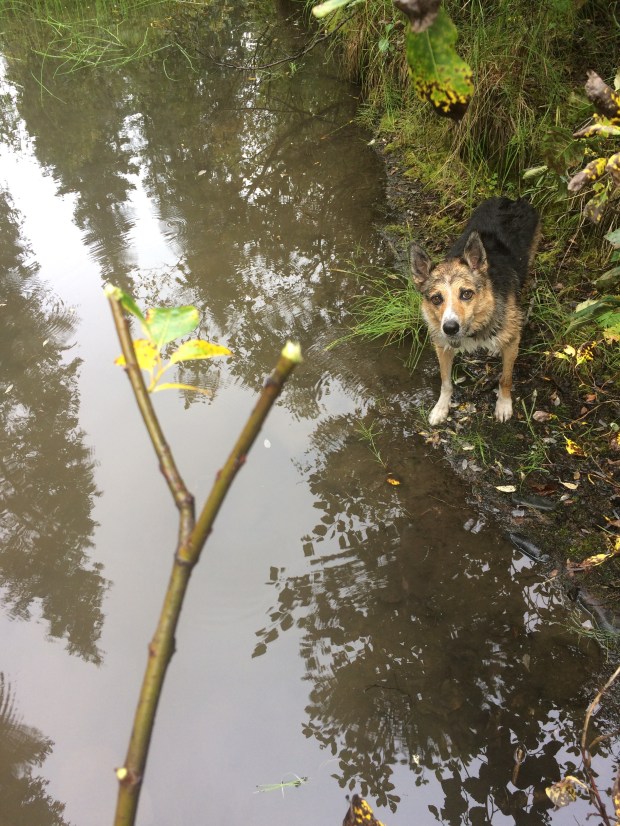
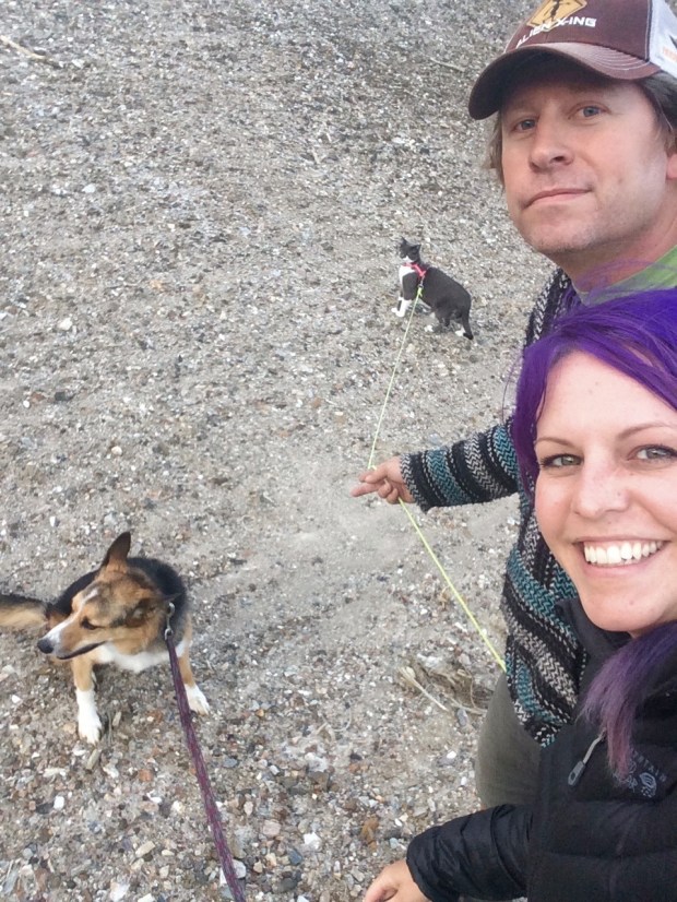
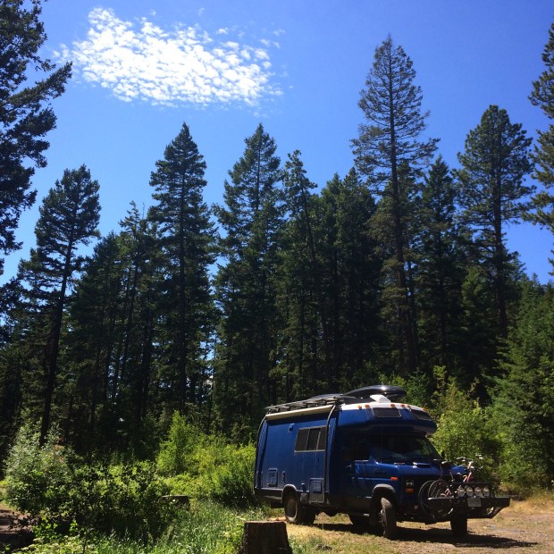
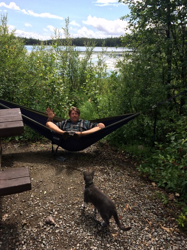
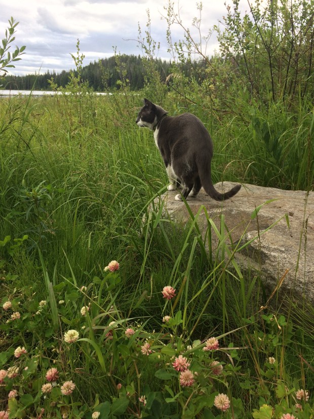
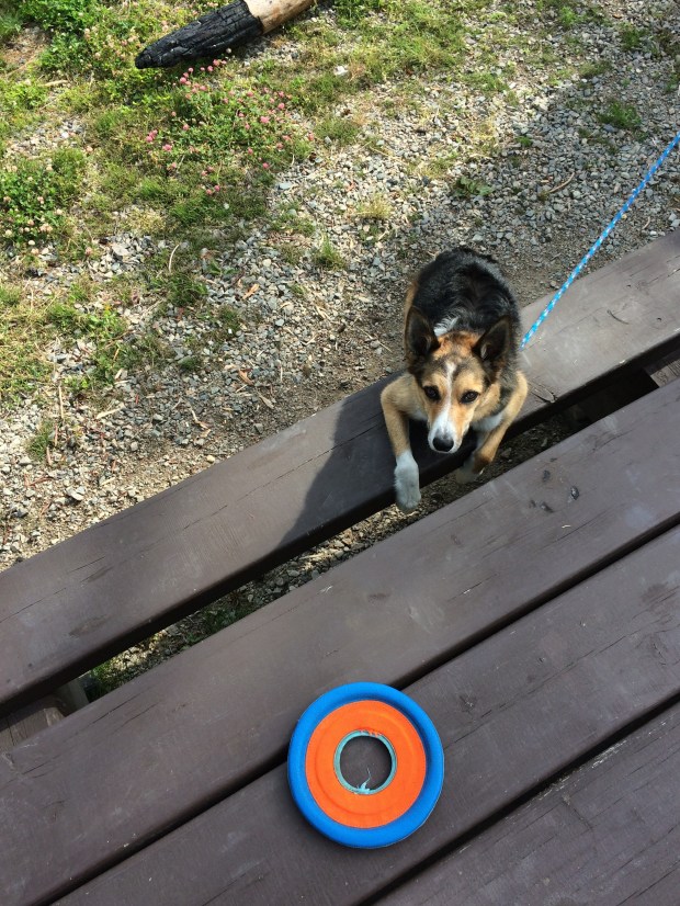
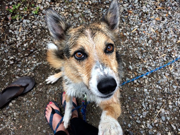
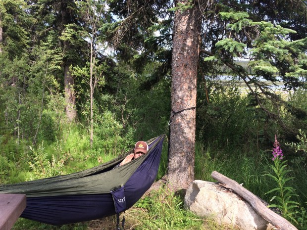
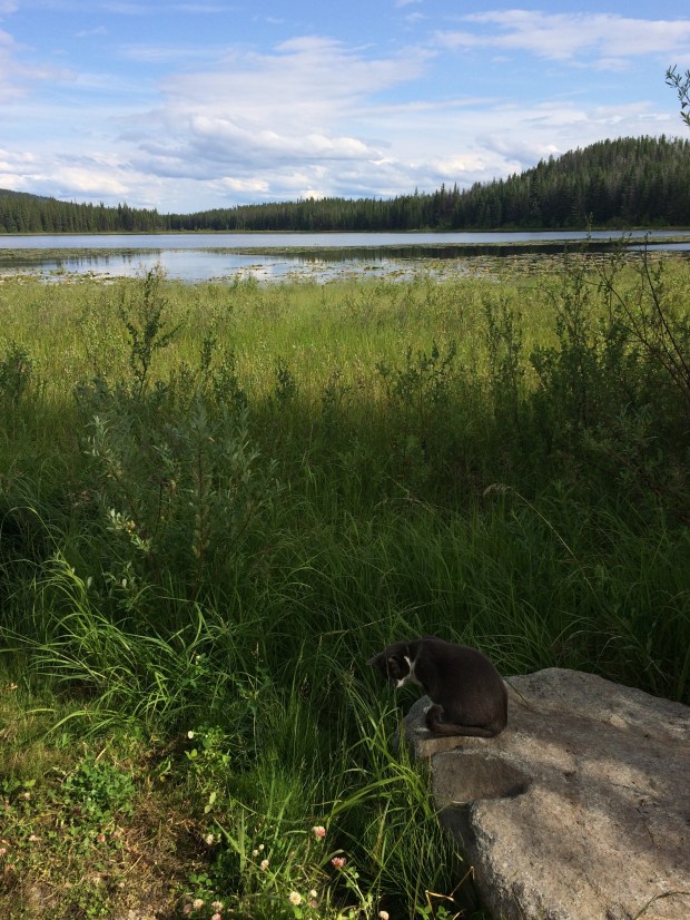
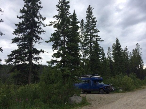
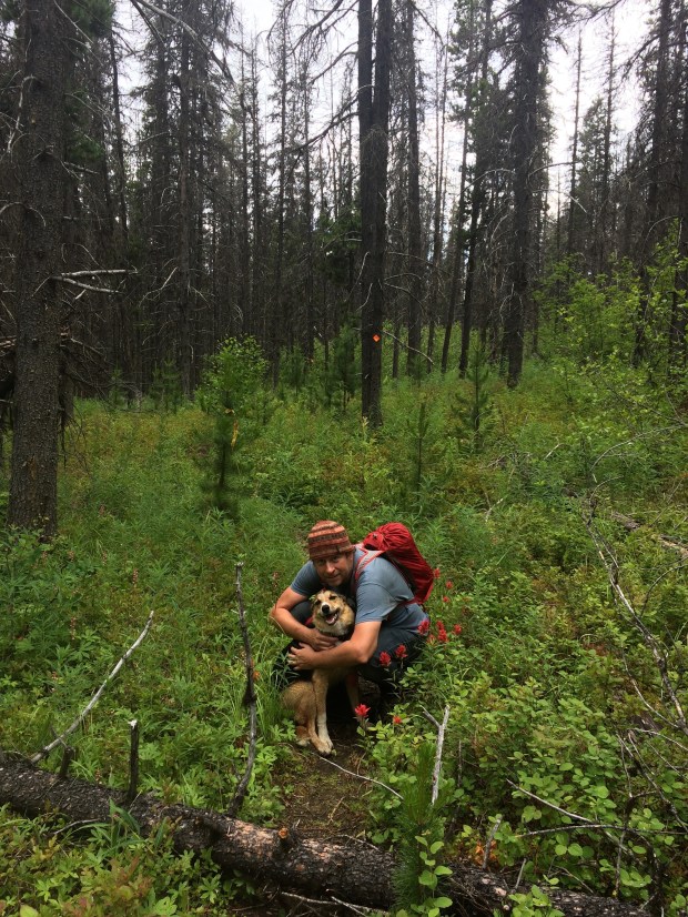
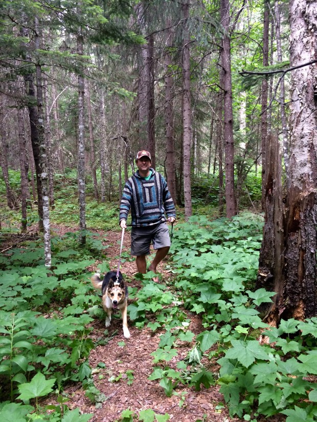
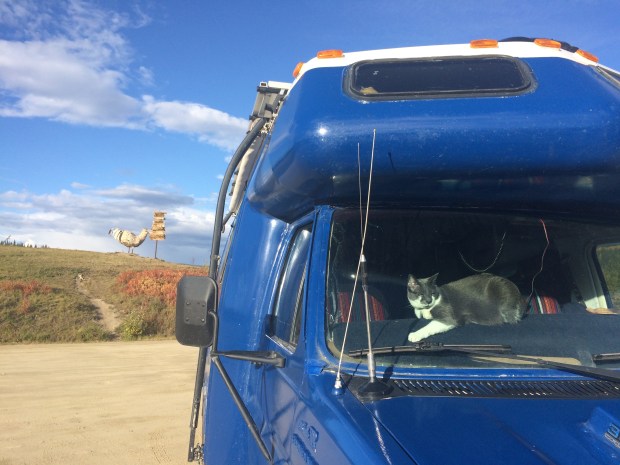
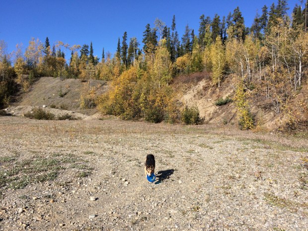
We spent a few days in Dawson City, a historic town full of stories of the Gold Rush and prospecting and super-tough men and women. In the interest of time, and because they haven’t made many appearances in this post, I’ll just show you a few adorable pictures of Scout and Gracie at a nice site we found for an overnight stay as we left Dawson City.

IMG_2383

IMG_2382

IMG_2373

IMG_2371

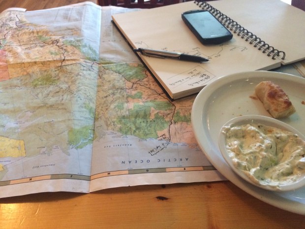
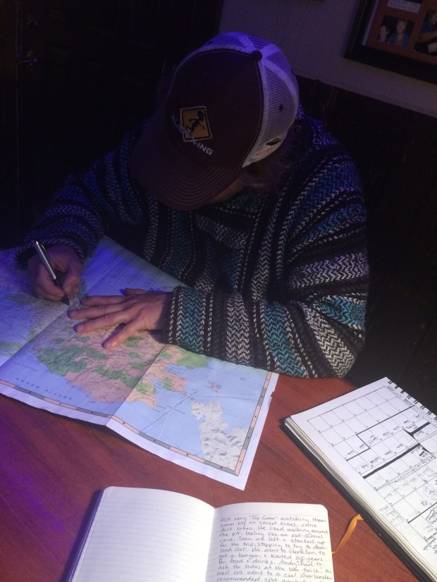
The Alaska chapter of our journey was done, but as we mapped out our progress over Tiropitas, it was clear that there was plenty of adventure ahead!

IMG_1730

On Top of the World: Deadhorse, AK + The Arctic Ocean + An Arctic Fox

Here is what you need to know about Deadhorse, AK. It’s a small town in northernmost Alaska near the Arctic Ocean with a population that is often listed at 25-50 permanent residents. The town’s primary function is to house the workers at the Prudhoe Bay oil field, which when including the temporary workers brings the population to around 3,000. In order to house the workers, “pre-fabricated modules” (cozy!) were shipped up and put on man-made gravel pads on top of the tundra, where the workers live for the duration of their employment.

IMG_0319

Most people work 12-hour shifts daily for two weeks straight, and then have a week off. The town has a very small airport for transporting workers at no charge, so most people fly home and back in that week. Each work camp has its own building, with different amenities from camp to camp. Some have theaters or gyms or basketball courts, but these are all housed right in the work camp building.

IMG_0318

It’s not as if anyone would want to pass the time outside their camp anyway; the mean annual temperature is 12 degrees Fahrenheit, and even the warmest month—July—sees an average temperature of only 47 degrees! Lows in the winter are generally below -40 degrees. It’s freakin’ cold up there. Almost every parking spot in town comes with a power cord.

IMG_0339.jpg

What this means for tourists is that after being shaken around in your vehicle like dice in a Yahtzee cup for somewhere around 18 hours, there’s not a lot going on up there to do! Well, that’s not necessarily true, but the accomodations for tourists are limited to a gas station, general store, Napa store, a handful of buffet-style cafeterias for the workers that are open to the public during limited hours, and a hotel with a little snack shop and coffee counter inside. So we did all those things on our first full day there.

IMG_0322


IMG_0337

The white building up there is the hotel. It didn’t look any different than the housing, General Store, or gas station and the town really doesn’t waste good money on signage.

IMG_0351

We also came across one of my favorite wildlife sightings to date: a little arctic fox! He was just the sweetest little thing and stayed close enough for us to watch him scamper around for about 5 minutes.

There is also a tour bus that you can book 24-hours in advance (to run a security check), which will take you past the security checkpoint and up to the Arctic Ocean! They charge $70 per person, but once you get that far, you really have to go all the way, right?

We thought so. So on our third day in Deadhorse, we took the early tour through the oil fields and saw the sights on our way to the beach. There were five others on our tour: a French couple who had flown in, and a couple from upstate New York and their tour guide who had driven them up in a tricked out Ford Escape set up by the tour company specifically for the Dalton Highway drive. Their guide jokingly asked if we’d remembered our swimsuits, to which I replied, “Actually, yes!” He laughed good-naturedly, as it was the first day of September, and said he’d be amazed if we went through with it. Challenge accepted!

IMG_0353

IMG_0360

The beach access we were able to explore was a nice long stretch that jutted out into the ocean. When we got there, our view was especially lovely under a hazy rainbow.

IMG_0363

The guide volunteered to take pictures for us, and got a nice play-by-play of our walk out, and Andy’s sudden and shocking dive below the water.

IMG_0371

IMG_0375 (1)

IMG_0378

IMG_0382

What a beast! That boy knows how to have an adventure. I take longer than Andy does when it comes to decisions involving plunging my bare skin into frigid arctic water on a 30-degree day. But of course I eventually got the job done.

IMG_0393

Ok . . . half done. But I’m telling you; it was so cold that not even my five layers on top could save me from that icy shock, or the subsequent half hour of numb legs and toes! It was awesome. We are very proud new members of the Polar Bear Club, and have a pure white rock from the beach as our memento of the day we took the plunge.

By the time we got back to the Turtle, we’d warmed up under the blanket Andy had brought along and felt ready to take on the Dalton Highway again. We decided to break the drive up into three days this time, because we wanted to check another National Park off our list by hiking into Gates of the Arctic.

We turned southward and said farewell to Deadhorse. We were so glad we made the trip, but are fairly certain we won’t be returning unless Andy will agree with my brilliant idea to build a summer home there. And so far he’s not budging. Oh well . . . goodbye, Deadhorse!

IMG_0357

On Top of the World: North on The Dalton Highway to Deadhorse, AK

Andy loves maps. So when we got our Milepost to plan our trip up to Alaska and it had a big Alaska map included, he was super excited. He unfolded it and we started pointing at places we would visit, and finding new places we didn’t know existed, like Chicken, Alaska. I noticed the Deadhorse dot way at the top of the state and said, “So are we going to the top of Alaska too, then?” Immediately I could see Andy’s wheels turning. We did a little quick research. And thus began our two-month-long back-and-forth decision/indecision about making the drive up the Dalton High to Deadhorse, Alaska.

Screen Shot 2017-09-17 at 8.55.58 PM.png

The reason the decision wasn’t obvious is that the Dalton Highway has a bit of a reputation. It’s been featured on BBC’s World’s Most Dangerous Roads, America’s Toughest Jobs, and was the focus of four seasons of Ice Road Truckers. It’s a beast.

Here’s the rundown:

  • It’s a 414-mile road between Livengood and Deadhorse.
  • Nearly the whole route is dirt and gravel and in rough condition, with grades up to 12%.
  • It is one of the most isolated roads in the US, with only three towns along the route: Coldfoot (pop. 10), Wiseman (pop. 14), and Deadhorse (permanent pop. 25-50 but there are several thousand workers living there at any given time).
  • As the longest stretch of unserviced road on the North American continent, the Dalton is totally remote and has no cell service along the entire route until Deadhorse.
  • There is one gas station in Coldfoot and one in Deadhorse.
  • It gets cold up there. In 1971 it was the location of the coldest temperature ever recorded in North America at -82 degrees.
  • Atigun Pass through the Brooks Range is at elevation 4,739 feet and is considered quite treacherous, especially in unfavorable conditions.
  • It was built as a service road during the construction of the Alaska pipeline and is still used primarily by supply trucks—about 160 daily in the summer and 250 daily in winter and they’re all driving at top speed and have the right of way.
  • Travel tips on various sites include bringing two spare tires, plenty of extra fuel, survival gear, and your own surgical supplies.
  • The road ends at Deadhorse, which is not a town in the traditional sense but an industrial camp in the Prudhoe Bay oil fields. So there’s not much to do once you get there.
    DaltonHighway.jpg

According to a NY Times article, “In addition to these numerous privations, there is also no good reason for a nonprofessional driver to drive the Dalton Highway.” When we asked around, most Alaskans and fellow travelers we talked to about making the drive told us emphatically that it was a bad idea and just don’t do it.

So there was that.

You’d think that would be enough to make the decision quick and easy. Buuuuuut. . . we were also feeling compelled by the other characteristics of that most remote wilderness. For example:

  • Just south of Coldfoot you pass into the Arctic Circle!
  • We’d get to see arctic tundra and (hopefully) arctic wildlife.
  • The Arctic Ocean is just beyond Deadhorse, and though the area is blocked by security, there is a tour company that will take you right to the ocean, after you pass a security check and pay them $70 a person.
  • Gates of the Arctic National Park sits on the west side of the highway, and though you can’t access the park by car, you can hike in on foot from a few parking areas.
  • The terminus at Deadhorse is the farthest north you can drive in North America. And we have plans to drive to Chile one day, so it would be pretty freakin’ cool to have driven the continents from top to bottom.
  • Apparently it’s really, really beautiful up there.
  • It’s almost completely wild.
  • Adventure calls!

I think by now you have a pretty good idea of where we landed on this one, especially if you read the title of this post. (We decided to go.) A few final pushes in that direction came from our friend Sam, who is a native Alaskan and knows all the information contained in both above lists and said that he wouldn’t recommend it to just anyone, but he knows the Turtle is capable and so are we, and that we should definitely do it. That’s all Andy needed to hear, so he was locked in. I was at 98% until my friend Lexie sent me a video by a pair of overlanders who had made the trip just a week earlier in their truck camper, and the scenery was more beautiful than I’d even imagined, and also they saw a baby grizzly bear. So I was locked in.

We got to Fairbanks, got all our supplies in order and bought a CB radio so we could communicate with the truckers as an added safety measure. We got up early the next morning and began our northward journey to the top of Alaska.

IMG_0029

The first thing we noticed was the Alaska Pipeline, which was to be our one constant over the next few days, as it parallels the Dalton all the way to Deadhorse.

IMG_0038

IMG_9993 (1).jpg

Also notable was how much more it felt like fall! It was much colder and the colors were gorgeous.

IMG_0033

IMG_0041

IMG_9988

IMG_9995

The pavement soon ended and we began the brain-rattling portion of the journey across the pitted, wash-boarded and pot-holed dirt road that would continue all the way to Deadhorse. It was a really beautiful drive, and we still felt pretty fresh when we saw the Arctic Circle sign and pulled over to take a few pictures.

IMG_0061

IMG_0079

The Turtle still looked blue at this point, too! We continued on to Coldfoot, watching the lovely scenery as well as the gas gauge.

IMG_0088

IMG_0095

We weren’t sure what to expect when we finally reached Coldfoot after 8 long hours, and were pleasantly surprised to discover the Arctic Interagency Visitor Center tucked away on the west side of the highway. The facility is a cozy spot to learn about the Northern Lights and the flora and fauna of the area, and they have maps available and flyers with information about Coldfoot, Wiseman, and Deadhorse since there’s no cell service all along the highway.

IMG_0105

They also print out the weather forecast for the towns and the Atigun Pass, which on our visit showed snowflakes in the next day’s box. We’d already made it halfway there, so there was no turning back. We filled up with gas across the road and had a surprisingly top-notch dinner buffet at the restaurant/bar/gift shop/one building in the town that felt kind of like a church basement but really served up a mean meal. Then we drove just a bit north of town to a nice little turnout for the night.

IMG_0110

IMG_0114

IMG_0134

As predicted, the next day was super cold and foggy and the snow loomed on the horizon.

IMG_0148

We could barely see the scenery behind all that fog!

IMG_0154

There were huge mountains on all sides but after a while we couldn’t see them even a little. It was just a blank white backdrop in every direction.

IMG_0155

As we gained elevation approaching the Atigun Pass, the snow set in so suddenly that we were climbing the pass before we realized it and it was too late to chain up. If there were any turnouts we couldn’t see them at all, and there was barely enough room for two cars to pass one another, much less to pull off enough to not get hit by other passing vehicles.

IMG_0156

We climbed and climbed, following the guard rails since that’s all we could see, and hoping against hope that the speedy ice road truckers wouldn’t blast by us.

IMG_0175

IMG_0177

At least we could read the road signs. . . what does that one say? Avalance Area? Oh good.

IMG_0178

Andy handled that Turtle brilliantly, and I alternated between nervous picture taking and looking at the sky so I wouldn’t have to look over the dropoff into the white abyss. We finally made it through, and amazingly encountered no trucks. But even after the pass, the roads were so slippery that we pulled over on the road that leads to Galbraith Campground to chain up as a precaution.

On the return drive, we noted this spot was where we’d pulled over and were shocked to discover that there had been mountains surrounding us the whole time, but we had no idea.

IMG_0205

Scout loved this stop. He’s a real snow hound, and he bounded through the snow and grazed on it and tried to get me to run with him, but it was too slippery. We did get an arctic frisbee session in though.

IMG_0212

IMG_0195.jpg

IMG_0215

Soon the snow lessened, so we asked a driver on the CB if there was any more snow between us and Deadhorse. He said it was nothing but mud, so we removed the chains and bumped lurched down the road the rest of the way through the arctic tundra. It felt like being on another planet. It’s completely flat as far as the eye can see!

IMG_0248

From the literature we took from the Visitor Center, I learned that because the ground is all permafrost beneath the top layer, there is a lot of standing water in the tundra because it has nowhere to go. Seeing little puddles and lakes everywhere wasn’t at all what I expected, but it was really interesting and beautiful.

IMG_0262

After 10 exhausting, jarring hours, we made it to Deadhorse!

IMG_0263

We really felt like we were on top of the world. I put on 10 layers and Andy put on his one extra layer so we could examine the Turtle and let the animals out. Gracie hopped out, felt the cold, and jumped right back in. Scout was unfazed and just wanted to play frisbee again.

IMG_0278

We were thrilled and amazed that the only part that had come off the Turtle had been removed intentionally—as we drove with the chains on, they were slapping into the corner of the running board on Andy’s side, so he just took it off. Otherwise, we’d made it in one piece!

IMG_0271

IMG_0273

We were worn out by the drive, so we hopped back in to cozy up for the evening and admire the view out our living room windows.

IMG_0266

We’re all good at getting cozy, but Gracie is the professional. She zonked out so hard that when I jokingly put my hat on her head, she just slept right through it. We all could relate, and the whole gang slept like logs that night, excited to explore the northiest north the next day!

IMG_0313

The Road to Alaska – Part 8: Feelin’ Fall-y in Denali

Our adventure of a lifetime was in full swing by the time we left Anchorage for Denali National Park, which was our second park in Alaska so far.

IMG_9498

IMG_9556.jpg

IMG_9561

IMG_9548

IMG_9512

IMG_9754

Alaska has 8 National Parks:

  • Denali
  • Wrangell St. Elias
  • Gates of the Arctic
  • Kenai Fjords
  • Glacier Bay
  • Katmai
  • Kobuk Valley
  • Lake Clark

Due to the terrain and undeveloped nature of the state, however, only two are accessible by car: Denali and Wrangell St. Elias. We’d stopped at Wrangell St. Elias on our way to Valdez, but didn’t spend much time there since we were working with a bit of a deadline and the park is so huge that it could take hours just to see a small portion anyway. We did take a little walk through the park and saw both the namesake Wrangell and St. Elias ranges, and had even camped out with a beautiful view of the mountains the previous night.

IMG_8368

Denali was the next on our list, and we couldn’t wait to get in there and see some wildlife and hopefully Denali (a.k.a. Mount McKinley) itself. They say on average only 1 in 3 visitors gets to see the mountain, as it’s often socked in by clouds or fog, and we had a cloudy forecast. So we arrived with fingers crossed and bought our tickets for a bus tour the following day. I didn’t know this before we went, but Denali National Park is only accessible to the public for 15 miles of the 92-mile road into the park. You can drive in as far as Savage River, but after that all tourists—other than those staying at Teklanika Campground—must pay for a bus tour in order to access the remainder. Some of the tours can last as long as 12 hours, but we went for an 8-hour ride since we had a doggy at home who would need to go out. It was a chilly morning, and the windows were steamed up for the beginning of the trip, but soon they cleared and we could all sit back and watch the fall colors roll by.

IMG_9632

IMG_9629

IMG_9617

IMG_9626

It’s been startling how quickly the season has advanced as we travel north! It has accelerated the timeline, but luckily I love fall and I’m exactly in the mood for it.

On the way to the Visitors Center that would be our turnaround point, we stopped a few times and got to hike around, use bathrooms, and take pictures.

IMG_9644

IMG_9649

IMG_9651

IMG_9721 (1).jpg

Along the drive we saw ptarmigan, Dall sheep, moose, Arctic ground squirrel, and a mama grizzly bear and two little cubs in the distance running along fast! There was much speculation as to why they were running, since they’re so close to hibernation that they should be conserving calories. Our guide guessed that the mama could smell a male grizzly nearby and she was trying to protect her cubs. We stayed and watched for a long time, and still they ran and ran until we lost sight of them.

We continued on to the Visitors Center, and had a little time to walk to the lookout and admire the view.

IMG_9673

IMG_9662

Then back onto the bus, where we had fewer people since many had started hikes and would take another bus down later. So for the whole trip back we had great views on both sides of the bus, which really came in handy when a big male grizzly was sighted on the opposite side of the bus. We hopped over and I took some pictures that are grainy, but still fun to see.

IMG_9716

We’d found a nice spot to park for the few nights we’d be in town, so we went back and settled in for the evening, taking the animals on a nice walk and even snapped our first 4-person selfie with the pets.

IMG_9596

The next day we went back to the park and took a walk around Savage River, which was moody and cozy in the drizzle and fog.

IMG_9889

IMG_9776

IMG_9859

IMG_9866

IMG_9867

IMG_9873

IMG_9879

IMG_9857

IMG_9905.jpg

During the summer the park has three daily demonstrations with their sled dog team, which we had timed our hike’s end to attend. I was so excited to see the dogs. They are actual working dogs who spend the winter helping the rangers get around and haul supplies to the cabins and outposts around the grounds. Since the park is a designated wilderness area motorized vehicles aren’t allowed anyway, but additionally the dogs are part of the history of the park and actually much more reliable than vehicles.

IMG_9911.jpg

They are bred not for appearance in any way, but for their athleticism, double coat, closeness of paw pads (so ice doesn’t pack between them), bushy tail (to keep them warm when they sleep outside with tail over face, creating a warm pocket of air), and a trait where their arteries and veins are very close together which helps keep their blood warm as it travels around their bodies. But their appearance is still pretty darn cute too.

IMG_9918.jpg

They were so sweet and eager to run. The trainer told us that they harness two fewer dogs to the summer “sled” for the demonstration than they do for the winter sleds, because if they didn’t she’d end up in the ditch!

Andy of course loved the sled.

IMG_9916.jpg

We would have loved to stay extra days to climb all the mountains and watch fall continue to move in, but we’d planned a trip up to the Arctic Ocean and every degree counts when you get close to freezing. So we pressed on Northward for what was to become one of the greatest adventures yet!

IMG_9479

The Road to Alaska – Part 2: British Columbia, Eh?

Greetings from Beautiful British Columbia!

IMG_6107

It’s been an exciting first few weeks in Canada as we make our way north to Alaska. We’ve covered some ground and have been really enjoying watching the landscape change and become less and less familiar. The road signs are more frequently featuring moose, and though we haven’t yet spotted one yet, we did see a sleek little silver fox slinking around a park as we pulled in for the evening in Prince George! So that will tide me over for quite some time.

Our first adventure over the border began in Vancouver, BC. I briefly mentioned our stay in Vancouver in my last post, but now that I have all the photos uploaded I thought I’d fill you in further on the fun we had while we were there. Especially since, despite the fact that both of us have lived in Seattle, neither had ever been to nearby Vancouver so we were really looking forward to seeing the city.

IMG_5964

One of my favorite resources as we visit new cities has been the online Atlas Obscura site, which suggests interesting attractions that aren’t found on most other “Things To Do In _______” sites. This time I told Andy that I was going to take him on a surprise tour of Vancouver and lead him to all the spots I thought sounded fun without telling him what they would be. He’s a good sport and agreed!

Our first stop was the VanDusen Botanical Gardens, which was one of the loveliest botanical gardens I’ve ever visited. The grounds are enormous, and the circuitous layout lends itself to a full day of wandering through paths and gardens reminiscent of Alice’s Wonderland.

IMG_5885 (1).jpg

Check out this delphinium garden:

IMG_5917

IMG_5919.jpg

Ok so if I’m being honest, the gardens were lovely, but the real reason for going here was something that’s been on my to-do list for as long as I can remember:

IMG_5953

A hedge maze!

It’s one of only six Elizabethan hedge mazes in North America, and it was so much fun and more challenging than we gave it credit for going in.

Afterwards we went to the Granville Island Market, which my uncles in Seattle had highly recommended to us. It took us some time to find a spot to park, and it came in handy that Andy is a wizard. Look at this park job!

IMG_5960

We wandered around the market and were totally in love. It was a bustling throng of people and the wonderful smells of hot espresso, cooking meats, fresh flowers and herby soaps. After picking up some darling wood map pins, we had lunch at a tiny Chinese restaurant downtown and then hit the road for the next stop on the secret tour . . .

IMG_5983

The Steam Clock in Gastown. It’s a working steam clock built in 1977, which you can look inside and see the gears and levers moving. We were even there to hear the hourly musical whistles blow. In honor of the clock, we popped into nearby Steamworks Brewing Company for a beer.

Next we walked a number of blocks to the Marine Building, a remarkable Art Deco building that was conceived to look like it had risen from the sea, and it truly does. I mean it looks like something from a movie . . . oh wait, it is! To my fellow nerds out there, it’s also been featured in a number of movies, as the Baxter Building in Fantastic Four and for The Daily Planet in Smallville. Fun!

KIMG0583.jpg

KIMG0584.jpg

Afterwards we walked to see the Digital Orca sculpture, which we weren’t able to see up close due to an event that had the terrace roped off. (If you look closely, you can see empty glassware at the tail.)

KIMG0587.jpg

It was a full day in Vancouver, and we left very satisfied. But after over a month staying in cities, I’d been so looking forward to getting back outside, and was happy to arrive at our next campsite at Gillis Lake. We stayed two nights, and got plenty of reading and swimming done.

IMG_6067

IMG_6039

IMG_6059

IMG_6014

IMG_6053

IMG_6004

When we woke up the morning of third day, the entire forest was flooded with smoke, which we later found out was due to dozens of forest fires throughout BC. A handful of towns had been evacuated, and the road we’d planned to take was closed. So we rerouted and drove through Kamloops to Prince George, windows rolled up to minimize our smoke inhalation. It was so thick my eyes watered, and you couldn’t even see the mountains beyond the freeway through the grey. And in the areas that we could see a fair distance, we saw fires licking the mountainsides. It was unreal.

IMG_6091

IMG_6076

We spent a two days in Prince George, or “PG” as the locals call it. (Which is pretty cute for a city in Canada, where everything is sweet and friendly and very “rated PG”.) When we got to town, we went to one of the best Railway Museums we’ve been to so far, and that’s saying something! We go to a lot of railroad museums, apparently.

IMG_6181

IMG_6196

IMG_6205

IMG_6214

IMG_6230

We rode the little train around the grounds, and got to go inside most of the cars and engines. Andy had more fun than all the other museum-goers combined.

IMG_6234

IMG_6251

IMG_6256

We stayed until they closed, then walked right next door to Cottonwood Island Park. I’d read that a local artist sculpted little pieces right into the trees, and as you walk through you can treasure hunt for them.

IMG_6320

IMG_6267

IMG_6274

IMG_6280

IMG_6282

IMG_6296

It likely comes as a huge surprise to nobody that my favorite was the gnome houses.

IMG_6308

We stayed the night at the park’s lot and that’s where we saw the silver fox!

IMG_6346

It’s a poor picture, but it was the best I could do at twilight while squealing with joy.

Over the next few days, we found ourselves in more picture-perfect campsites, all of which are free! We stayed a few nights at Co-op Lake, where we noticed a strange bubbling at the shoreline. As we got nearer to investigate, we saw that it was a massive mob of tadpoles!

IMG_6457

We all had a wonderful time there, reading, hammock-ing, swimming, fetching frisbees in the lake, pouncing on bugs, paddling out to the middle of the lake in our floaties and watching the clouds roll by.

IMG_6452

IMG_6449

IMG_6401

IMG_6424

IMG_6421

IMG_6461

IMG_6418

IMG_6417

IMG_6379

We then moved to another great campsite at the Eagle Creek Opal Beds, where we went on a gorgeous hike, hunted for—and found!—raw opals, discovered and ate the huckleberries along the path, and then hiked up a hill at midnight where we saw the Northern Lights flickering on the horizon. It was a pretty magical spot.

IMG_6492

IMG_6501

IMG_6530

Scout even remembered how to pick huckleberries!


I could have stayed in any one of those campsites for weeks, but there is much to see in these parts, so we pressed on. We wanted to see Prince Rupert, a darling coastal town in northwestern BC, even though it was a few hours out of the way. On our way there, other things happened and they looked like this:

IMG_5971

IMG_6158

IMG_6149

IMG_5994

IMG_6326

IMG_6358

IMG_6467

IMG_6536

IMG_6583

IMG_6608

IMG_6616

IMG_6666

When we got to Prince Rupert it was a brilliant sunny day, which—we were informed by the locals—is not usually the case. We walked all around town, in and out of cute little shops, through the Museum of Northern British Columbia, and ended up on a bright patio overlooking the ocean.

IMG_6695

IMG_6688

We looked down and noticed crabs walking along the ocean floor, and the next day’s plan was born. After all, we’ve been carrying our crab traps around for over a year!

IMG_6705

The next day we got our licenses and some bait, and headed down to the docks, where we discovered the depth off the edge was around 80 feet! We spent the entire afternoon into the evening sitting on the dock, chatting with locals, fishing, and reading books. We caught three crabs, one was a keeper, and Andy caught a small flounder.

IMG_6709

IMG_6764

IMG_6805

So all in all the day was a success, and as we packed up we were treated to a perfectly picturesque coastal sunset.

IMG_6822

Today was our last day in Prince Rupert, and we visited the North Pacific Cannery Museum on our way out of town. We accidentally stayed three hours, and enjoyed every last minute.

IMG_6830

IMG_6833

IMG_6841

IMG_6843

We’re now back in Terrace, BC, heading north for some serious camping way-off-grid, so the next post will be on the other side of the wilderness when we have service again. And though the silver fox was a superior thrill, here’s hoping that next post will include some photos of a moose. 🙂