travels

On Top of the World: Deadhorse, AK + The Arctic Ocean + An Arctic Fox

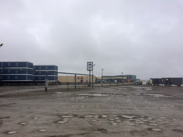
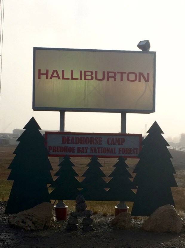
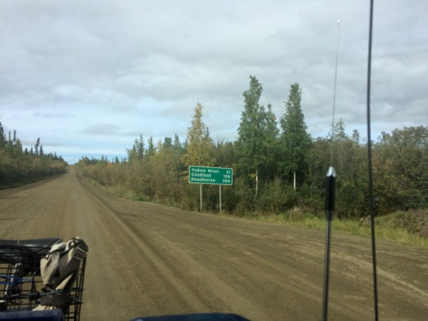
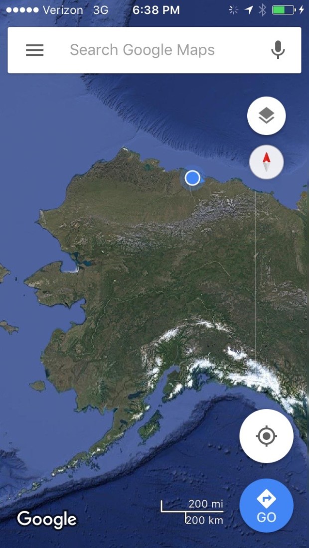
Here is what you need to know about Deadhorse, AK. It’s a small town in northernmost Alaska near the Arctic Ocean with a population that is often listed at 25-50 permanent residents. The town’s primary function is to house the workers at the Prudhoe Bay oil field, which when including the temporary workers brings the population to around 3,000. In order to house the workers, “pre-fabricated modules” (cozy!) were shipped up and put on man-made gravel pads on top of the tundra, where the workers live for the duration of their employment.

IMG_0319

Most people work 12-hour shifts daily for two weeks straight, and then have a week off. The town has a very small airport for transporting workers at no charge, so most people fly home and back in that week. Each work camp has its own building, with different amenities from camp to camp. Some have theaters or gyms or basketball courts, but these are all housed right in the work camp building.

IMG_0318

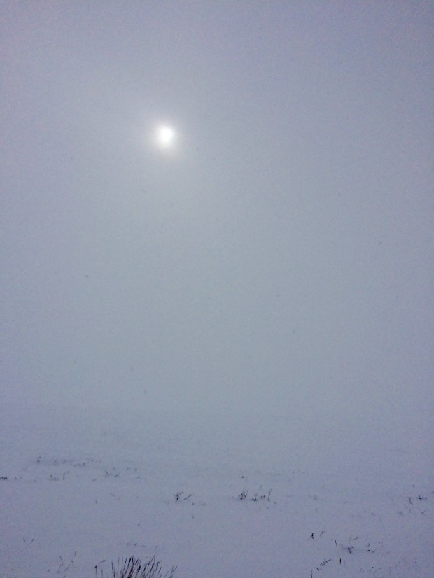
It’s not as if anyone would want to pass the time outside their camp anyway; the mean annual temperature is 12 degrees Fahrenheit, and even the warmest month—July—sees an average temperature of only 47 degrees! Lows in the winter are generally below -40 degrees. It’s freakin’ cold up there. Almost every parking spot in town comes with a power cord.

IMG_0339.jpg

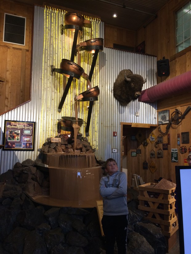
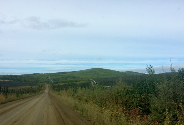
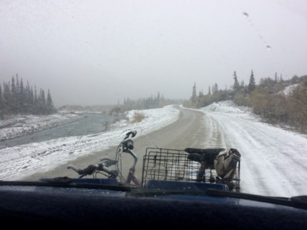
What this means for tourists is that after being shaken around in your vehicle like dice in a Yahtzee cup for somewhere around 18 hours, there’s not a lot going on up there to do! Well, that’s not necessarily true, but the accomodations for tourists are limited to a gas station, general store, Napa store, a handful of buffet-style cafeterias for the workers that are open to the public during limited hours, and a hotel with a little snack shop and coffee counter inside. So we did all those things on our first full day there.

IMG_0322


IMG_0337

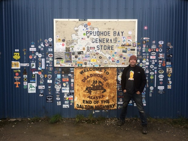
The white building up there is the hotel. It didn’t look any different than the housing, General Store, or gas station and the town really doesn’t waste good money on signage.

IMG_0351

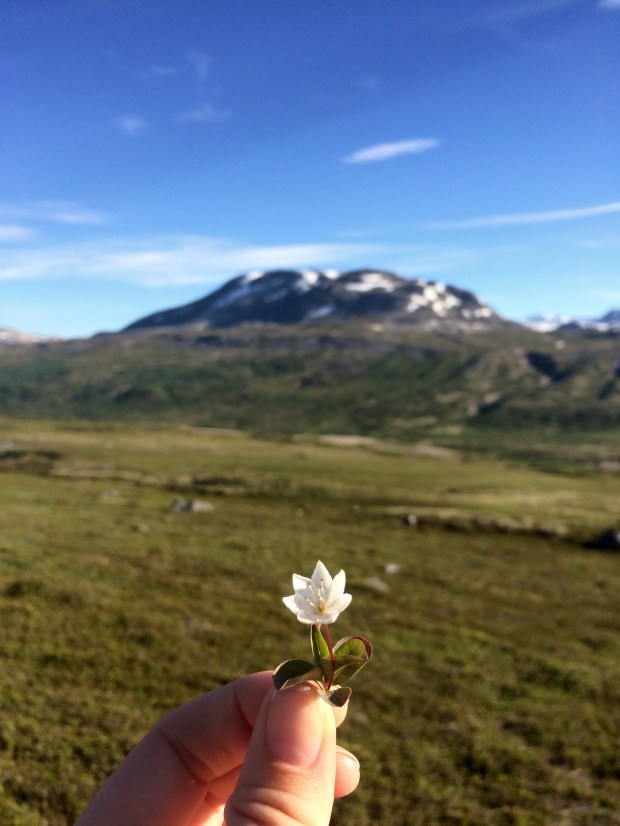
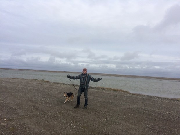
We also came across one of my favorite wildlife sightings to date: a little arctic fox! He was just the sweetest little thing and stayed close enough for us to watch him scamper around for about 5 minutes.

There is also a tour bus that you can book 24-hours in advance (to run a security check), which will take you past the security checkpoint and up to the Arctic Ocean! They charge $70 per person, but once you get that far, you really have to go all the way, right?

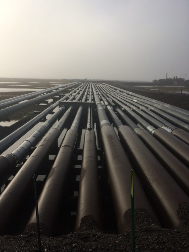
We thought so. So on our third day in Deadhorse, we took the early tour through the oil fields and saw the sights on our way to the beach. There were five others on our tour: a French couple who had flown in, and a couple from upstate New York and their tour guide who had driven them up in a tricked out Ford Escape set up by the tour company specifically for the Dalton Highway drive. Their guide jokingly asked if we’d remembered our swimsuits, to which I replied, “Actually, yes!” He laughed good-naturedly, as it was the first day of September, and said he’d be amazed if we went through with it. Challenge accepted!

IMG_0353

IMG_0360

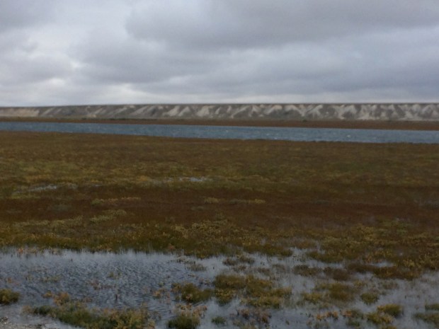
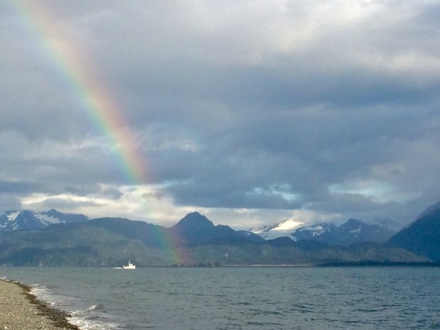
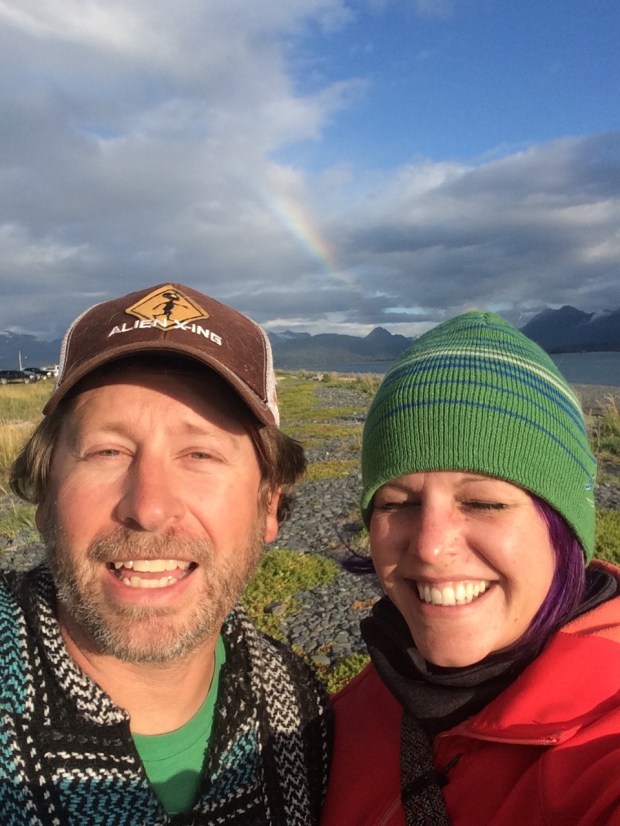
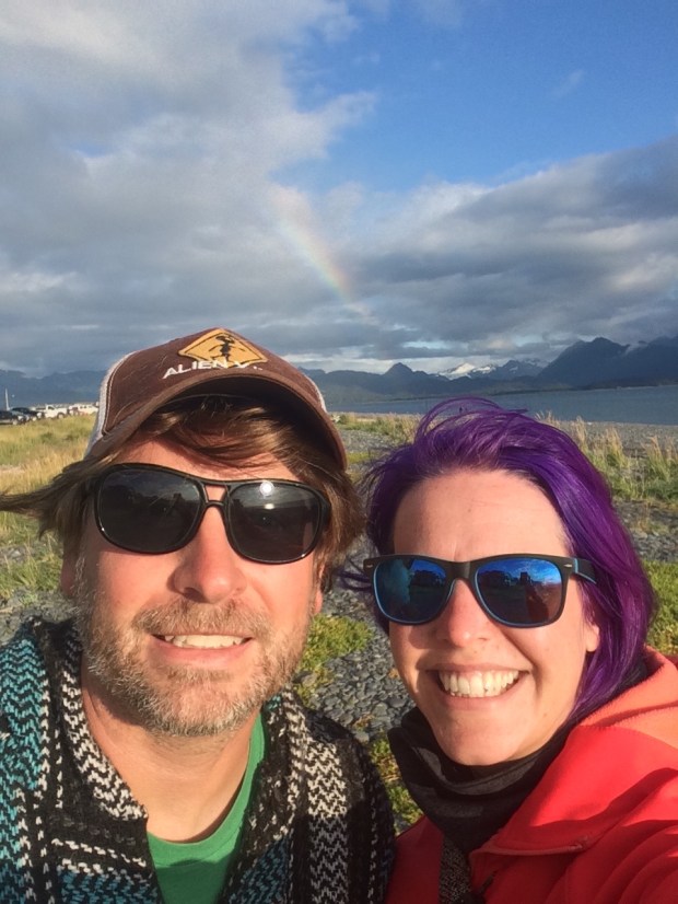
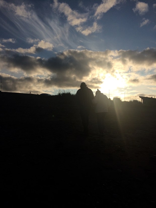
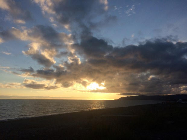
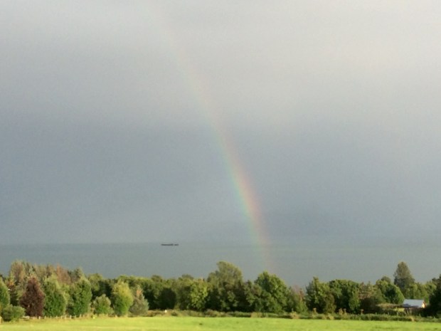
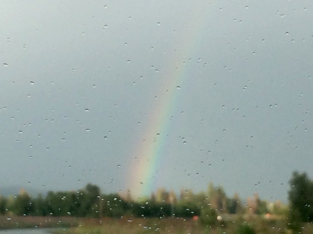
The beach access we were able to explore was a nice long stretch that jutted out into the ocean. When we got there, our view was especially lovely under a hazy rainbow.

IMG_0363

The guide volunteered to take pictures for us, and got a nice play-by-play of our walk out, and Andy’s sudden and shocking dive below the water.

IMG_0371

IMG_0375 (1)

IMG_0378

IMG_0382

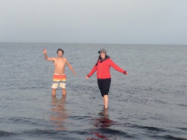
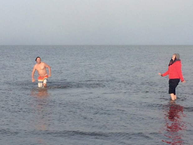
What a beast! That boy knows how to have an adventure. I take longer than Andy does when it comes to decisions involving plunging my bare skin into frigid arctic water on a 30-degree day. But of course I eventually got the job done.

IMG_0393

Ok . . . half done. But I’m telling you; it was so cold that not even my five layers on top could save me from that icy shock, or the subsequent half hour of numb legs and toes! It was awesome. We are very proud new members of the Polar Bear Club, and have a pure white rock from the beach as our memento of the day we took the plunge.

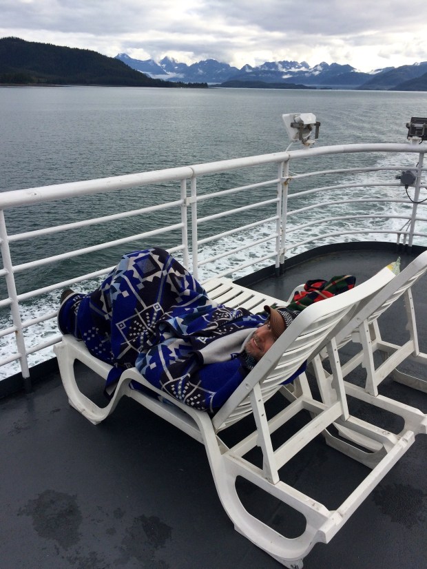
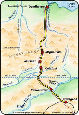
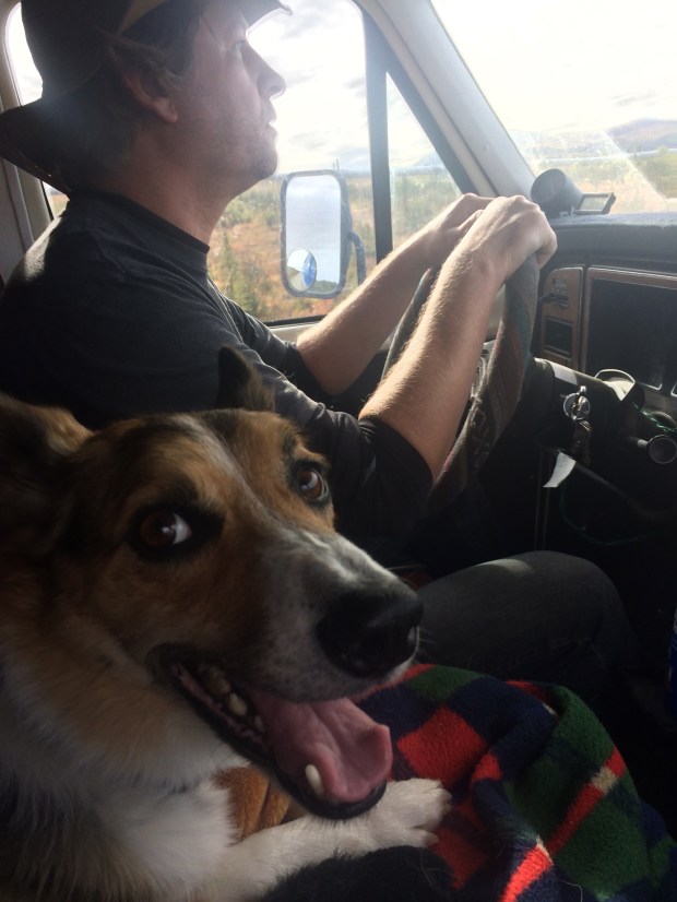
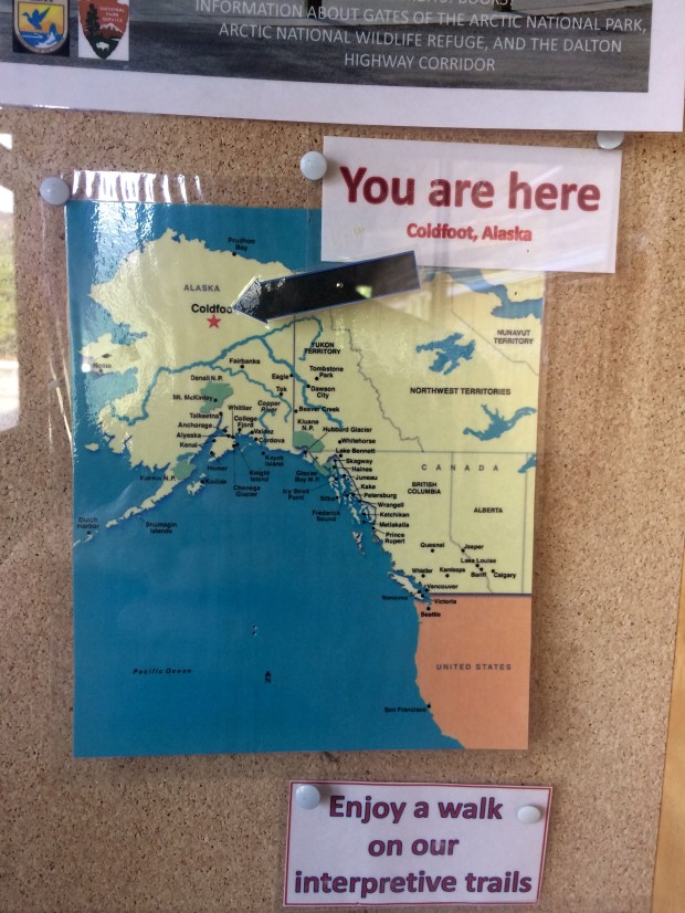
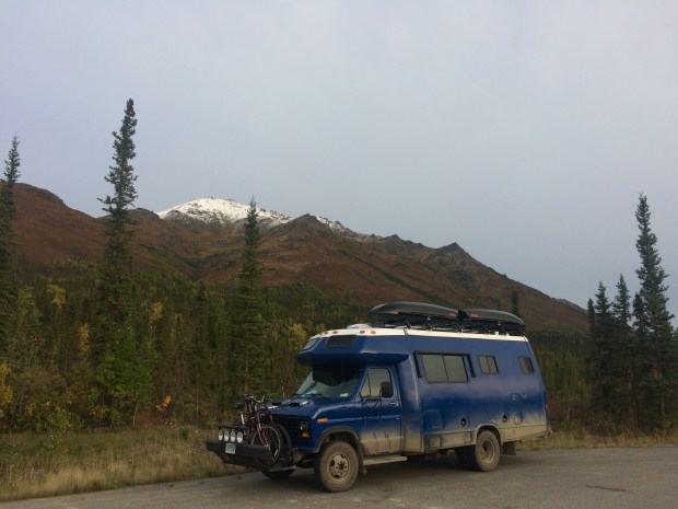
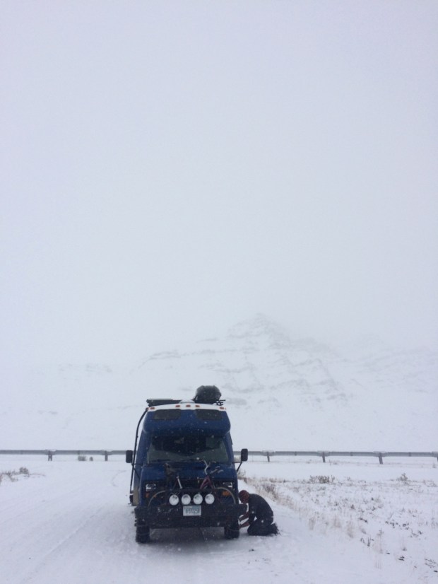
By the time we got back to the Turtle, we’d warmed up under the blanket Andy had brought along and felt ready to take on the Dalton Highway again. We decided to break the drive up into three days this time, because we wanted to check another National Park off our list by hiking into Gates of the Arctic.

We turned southward and said farewell to Deadhorse. We were so glad we made the trip, but are fairly certain we won’t be returning unless Andy will agree with my brilliant idea to build a summer home there. And so far he’s not budging. Oh well . . . goodbye, Deadhorse!

IMG_0357

On Top of the World: North on The Dalton Highway to Deadhorse, AK

Andy loves maps. So when we got our Milepost to plan our trip up to Alaska and it had a big Alaska map included, he was super excited. He unfolded it and we started pointing at places we would visit, and finding new places we didn’t know existed, like Chicken, Alaska. I noticed the Deadhorse dot way at the top of the state and said, “So are we going to the top of Alaska too, then?” Immediately I could see Andy’s wheels turning. We did a little quick research. And thus began our two-month-long back-and-forth decision/indecision about making the drive up the Dalton High to Deadhorse, Alaska.

Screen Shot 2017-09-17 at 8.55.58 PM.png

The reason the decision wasn’t obvious is that the Dalton Highway has a bit of a reputation. It’s been featured on BBC’s World’s Most Dangerous Roads, America’s Toughest Jobs, and was the focus of four seasons of Ice Road Truckers. It’s a beast.

Here’s the rundown:

  • It’s a 414-mile road between Livengood and Deadhorse.
  • Nearly the whole route is dirt and gravel and in rough condition, with grades up to 12%.
  • It is one of the most isolated roads in the US, with only three towns along the route: Coldfoot (pop. 10), Wiseman (pop. 14), and Deadhorse (permanent pop. 25-50 but there are several thousand workers living there at any given time).
  • As the longest stretch of unserviced road on the North American continent, the Dalton is totally remote and has no cell service along the entire route until Deadhorse.
  • There is one gas station in Coldfoot and one in Deadhorse.
  • It gets cold up there. In 1971 it was the location of the coldest temperature ever recorded in North America at -82 degrees.
  • Atigun Pass through the Brooks Range is at elevation 4,739 feet and is considered quite treacherous, especially in unfavorable conditions.
  • It was built as a service road during the construction of the Alaska pipeline and is still used primarily by supply trucks—about 160 daily in the summer and 250 daily in winter and they’re all driving at top speed and have the right of way.
  • Travel tips on various sites include bringing two spare tires, plenty of extra fuel, survival gear, and your own surgical supplies.
  • The road ends at Deadhorse, which is not a town in the traditional sense but an industrial camp in the Prudhoe Bay oil fields. So there’s not much to do once you get there.
    DaltonHighway.jpg

According to a NY Times article, “In addition to these numerous privations, there is also no good reason for a nonprofessional driver to drive the Dalton Highway.” When we asked around, most Alaskans and fellow travelers we talked to about making the drive told us emphatically that it was a bad idea and just don’t do it.

So there was that.

You’d think that would be enough to make the decision quick and easy. Buuuuuut. . . we were also feeling compelled by the other characteristics of that most remote wilderness. For example:

  • Just south of Coldfoot you pass into the Arctic Circle!
  • We’d get to see arctic tundra and (hopefully) arctic wildlife.
  • The Arctic Ocean is just beyond Deadhorse, and though the area is blocked by security, there is a tour company that will take you right to the ocean, after you pass a security check and pay them $70 a person.
  • Gates of the Arctic National Park sits on the west side of the highway, and though you can’t access the park by car, you can hike in on foot from a few parking areas.
  • The terminus at Deadhorse is the farthest north you can drive in North America. And we have plans to drive to Chile one day, so it would be pretty freakin’ cool to have driven the continents from top to bottom.
  • Apparently it’s really, really beautiful up there.
  • It’s almost completely wild.
  • Adventure calls!

I think by now you have a pretty good idea of where we landed on this one, especially if you read the title of this post. (We decided to go.) A few final pushes in that direction came from our friend Sam, who is a native Alaskan and knows all the information contained in both above lists and said that he wouldn’t recommend it to just anyone, but he knows the Turtle is capable and so are we, and that we should definitely do it. That’s all Andy needed to hear, so he was locked in. I was at 98% until my friend Lexie sent me a video by a pair of overlanders who had made the trip just a week earlier in their truck camper, and the scenery was more beautiful than I’d even imagined, and also they saw a baby grizzly bear. So I was locked in.

We got to Fairbanks, got all our supplies in order and bought a CB radio so we could communicate with the truckers as an added safety measure. We got up early the next morning and began our northward journey to the top of Alaska.

IMG_0029

The first thing we noticed was the Alaska Pipeline, which was to be our one constant over the next few days, as it parallels the Dalton all the way to Deadhorse.

IMG_0038

IMG_9993 (1).jpg

Also notable was how much more it felt like fall! It was much colder and the colors were gorgeous.

IMG_0033

IMG_0041

IMG_9988

IMG_9995

The pavement soon ended and we began the brain-rattling portion of the journey across the pitted, wash-boarded and pot-holed dirt road that would continue all the way to Deadhorse. It was a really beautiful drive, and we still felt pretty fresh when we saw the Arctic Circle sign and pulled over to take a few pictures.

IMG_0061

IMG_0079

The Turtle still looked blue at this point, too! We continued on to Coldfoot, watching the lovely scenery as well as the gas gauge.

IMG_0088

IMG_0095

We weren’t sure what to expect when we finally reached Coldfoot after 8 long hours, and were pleasantly surprised to discover the Arctic Interagency Visitor Center tucked away on the west side of the highway. The facility is a cozy spot to learn about the Northern Lights and the flora and fauna of the area, and they have maps available and flyers with information about Coldfoot, Wiseman, and Deadhorse since there’s no cell service all along the highway.

IMG_0105

They also print out the weather forecast for the towns and the Atigun Pass, which on our visit showed snowflakes in the next day’s box. We’d already made it halfway there, so there was no turning back. We filled up with gas across the road and had a surprisingly top-notch dinner buffet at the restaurant/bar/gift shop/one building in the town that felt kind of like a church basement but really served up a mean meal. Then we drove just a bit north of town to a nice little turnout for the night.

IMG_0110

IMG_0114

IMG_0134

As predicted, the next day was super cold and foggy and the snow loomed on the horizon.

IMG_0148

We could barely see the scenery behind all that fog!

IMG_0154

There were huge mountains on all sides but after a while we couldn’t see them even a little. It was just a blank white backdrop in every direction.

IMG_0155

As we gained elevation approaching the Atigun Pass, the snow set in so suddenly that we were climbing the pass before we realized it and it was too late to chain up. If there were any turnouts we couldn’t see them at all, and there was barely enough room for two cars to pass one another, much less to pull off enough to not get hit by other passing vehicles.

IMG_0156

We climbed and climbed, following the guard rails since that’s all we could see, and hoping against hope that the speedy ice road truckers wouldn’t blast by us.

IMG_0175

IMG_0177

At least we could read the road signs. . . what does that one say? Avalance Area? Oh good.

IMG_0178

Andy handled that Turtle brilliantly, and I alternated between nervous picture taking and looking at the sky so I wouldn’t have to look over the dropoff into the white abyss. We finally made it through, and amazingly encountered no trucks. But even after the pass, the roads were so slippery that we pulled over on the road that leads to Galbraith Campground to chain up as a precaution.

On the return drive, we noted this spot was where we’d pulled over and were shocked to discover that there had been mountains surrounding us the whole time, but we had no idea.

IMG_0205

Scout loved this stop. He’s a real snow hound, and he bounded through the snow and grazed on it and tried to get me to run with him, but it was too slippery. We did get an arctic frisbee session in though.

IMG_0212

IMG_0195.jpg

IMG_0215

Soon the snow lessened, so we asked a driver on the CB if there was any more snow between us and Deadhorse. He said it was nothing but mud, so we removed the chains and bumped lurched down the road the rest of the way through the arctic tundra. It felt like being on another planet. It’s completely flat as far as the eye can see!

IMG_0248

From the literature we took from the Visitor Center, I learned that because the ground is all permafrost beneath the top layer, there is a lot of standing water in the tundra because it has nowhere to go. Seeing little puddles and lakes everywhere wasn’t at all what I expected, but it was really interesting and beautiful.

IMG_0262

After 10 exhausting, jarring hours, we made it to Deadhorse!

IMG_0263

We really felt like we were on top of the world. I put on 10 layers and Andy put on his one extra layer so we could examine the Turtle and let the animals out. Gracie hopped out, felt the cold, and jumped right back in. Scout was unfazed and just wanted to play frisbee again.

IMG_0278

We were thrilled and amazed that the only part that had come off the Turtle had been removed intentionally—as we drove with the chains on, they were slapping into the corner of the running board on Andy’s side, so he just took it off. Otherwise, we’d made it in one piece!

IMG_0271

IMG_0273

We were worn out by the drive, so we hopped back in to cozy up for the evening and admire the view out our living room windows.

IMG_0266

We’re all good at getting cozy, but Gracie is the professional. She zonked out so hard that when I jokingly put my hat on her head, she just slept right through it. We all could relate, and the whole gang slept like logs that night, excited to explore the northiest north the next day!

IMG_0313

The Road to Alaska – Part 7: Anchorage, AK with Family + The Kenai Peninsula

When we planned our road trip to Alaska, we wouldn’t have anticipated that we’d be spending so much time with familiar faces, but after our super enjoyable visit with friends in Anchorage, we still had more fun coming our way!

IMG_2224

Knowing we were spending some time up north, Andy’s mom Genie had planned a trip with Andy’s nephew Will to visit Alaska while we were in the area. Will loves to fish, and the Kenai Peninsula has been on his list for some time now. So they flew in to Anchorage, where we kicked off the trip by catching up, having dinner, and witnessing the beginning to Will and Andy’s very promising career as meat smoker models.

IMG_8997

We drove down the Kenai Peninsula and stopped at Deep Creek, a fishing spot that had been recommended to Will by a fellow fisherman back home. We stayed a few hours, enjoying the sun and scenery as we watched other people catch our fish.

IMG_9037

IMG_9028

IMG_9046

IMG_9047

After a few hours with no luck, we decided to head into Homer to check into the house Andy’s sister had rented for the travelers. We parked the Turtle in the driveway, and were instant neighbors! I’ll under-exaggerate here and say it was a beautiful spot.

IMG_9055

The next day we tried another fishing spot, this one just as scenic as the last. We’re beginning to see a trend in our Alaskan fishing spots: so picturesque you’d go there even if there weren’t any fish.

IMG_9078

Except this time, there were!

IMG_9087

IMG_9091

A number of locals mentioned how sparse the fishing was this season, and it seemed like a pretty big deal when even the seasoned fishermen caught anything. So we felt very pleased that by the end of the day, all four of us had a caught a fish! Andy, Will and I all got humpys, and Genie got a nice big silver (gifted to her by some boys fishing next to us, but we all agreed it totally counted).

Afterwards we went down to the spit, which quickly became one of my favorite spots on our Alaskan journey. The whole spit is lined with funky shops and restaurants built on piers or decks or just smashed up against one another, people are filleting huge halibut and salmon right on the walkway, and the whole place is set against a backdrop you just can’t believe.

IMG_9127

IMG_9152

As we walked down the beach to get pictures of the rainbow, we took what will go down in history as The Greatest Photo of Us Ever Taken.

IMG_9156

Sunglasses for the win!

The others did a much better job modeling and nailed it on the first try.

IMG_9162

IMG_9167

IMG_9168

IMG_9170

When we got home, Andy began preparing the fish for our big dinner.

IMG_9177

IMG_9178

We got so involved with preparations for a banquet, that by the time the meal was finished, it was midnight. (We didn’t know yet, but that would become kind of our thing during this trip.)

IMG_9186

Even Scout had given up on us and went to sleep on the futon before we finished. Of course he woke up ready to play as soon as I tried to take the picture, but that’s to be expected with this one.

IMG_9264 (1)

We still had three pink salmon on deck for us to enjoy, so before leaving for our third day of fishing Andy began experimenting with some new recipes and preparation methods. The night before he’d brined some for smoking, using the recipe given to us by Sam’s mom, and here he is removing it and readying it for smoking later in the day.

IMG_9189

Here he is with his partner in mischief, who did not find Andy’s obsession with the new vacuum sealer strange in the least, and in fact suggested they try vacuum sealing the vacuum sealer bags.

IMG_9194

I continued to find other goody bags stashed around the house, including this battery and handful of dried garlic chips. Also, all the dinner knives in a pouch, not pictured, but one of my favorites.

IMG_9188

We packed up with discussions about how one might vacuum seal the vacuum sealer, and went back to Deep Creek to try a new spot this time. Unfortunately the weather had lived up to the rainy forecast, and as we fished it got colder and colder, until we finally had to admit defeat. Luckily, we had smoked salmon linguini on the evening’s menu, so we were excited to return to Homer and prepare it.

IMG_2332

IMG_9205

On the way, we saw more rainbows! Alaska makes really nice rainbows.

IMG_9221

IMG_9224

IMG_9246

That last one is the view from the house, so we had that rainbow to admire out the big square windows as we made dinner. It really was an amazing spot. Will created a few antipasto platters that were as delicious as they were beautiful.

IMG_9254

It was a good thing he did, too, because once again dinner wasn’t on the table until midnight! I think it must have something to do with the long daylight hours up here, but either way we partied into the A.M. every day. Andy’s smoked salmon linguini was better than any I’ve ever had in a restaurant, and fully worth the wait. Another fine fresh Alaskan fish meal!


The view from the rental house changed daily, each time a surprise and delight. The morning we left was another hit.

IMG_9269

We took advantage of the scenery by taking a few group shots on our way out.

IMG_2322IMG_2324

I had to get a photo of Scout and Will, the two best buddies you’d ever hope to meet. Scout is crazy about Will, who very generously spent much of his time playing outside with him and throwing the frisbee in the back yard. Nothing beats a boy and his dog!

IMG_2318

IMG_9274

We left Homer mid-day, and had planned on stopping to fish one last time on the way back to Anchorage, but the Turtle had other plans. We broke down (Andy easily agreed this one was official) and immediately got towed by a good Samaritan to a spot just up the road, which turned out to be a great place to be broken down.

IMG_2329

IMG_9326

Andy had no idea what the problem was. I said maybe we’d run over a lawn mower, because that’s what it sounded like, but he thought he’d investigate further despite my diagnosis. After a bit, this wizard not only figured out what the problem was, but also happened to have the spare part that we needed on hand!

IMG_9295

Remember that time we broke down at Mike and Becky’s house in Bend, OR? While that problem was being investigated, Andy had bought a distributer to see if that was the problem, which we all know now it wasn’t. (It was Becky pulling fuses out.) So we had an extra!

IMG_9298

IMG_9296
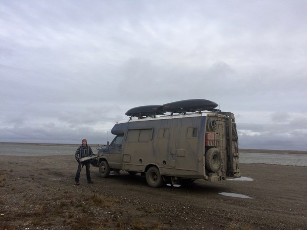
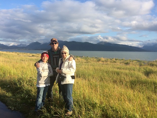
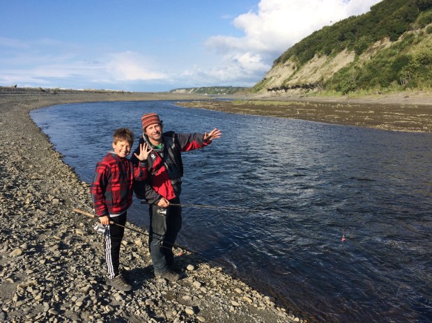
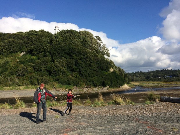
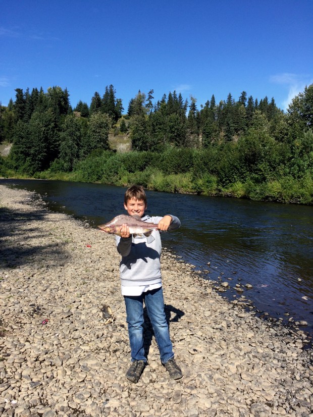
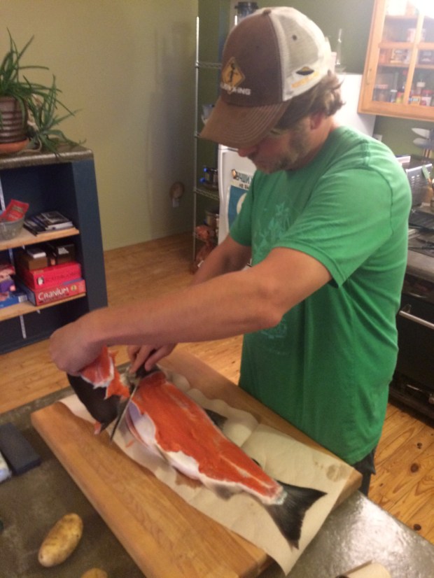
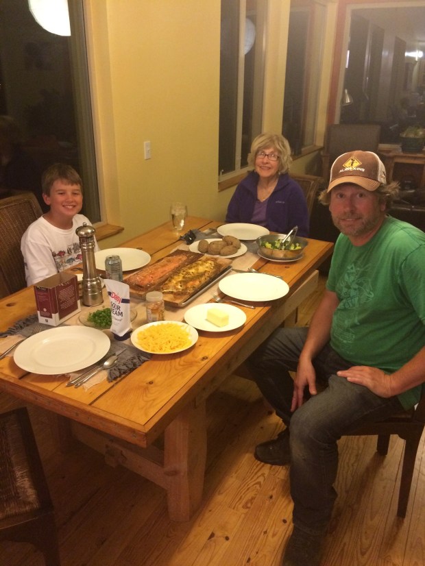
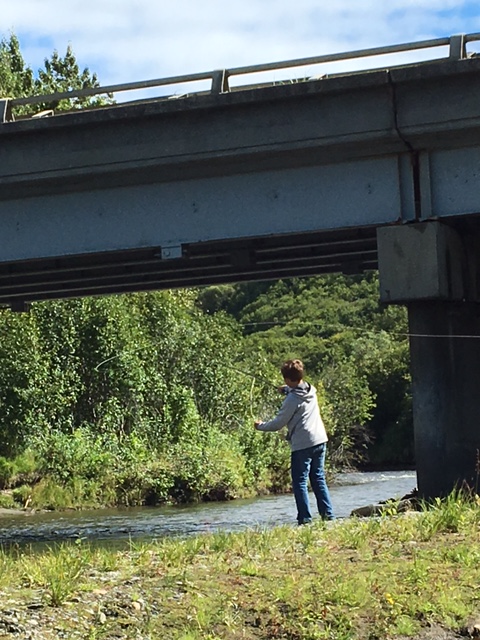
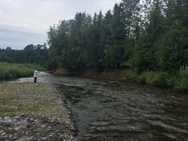
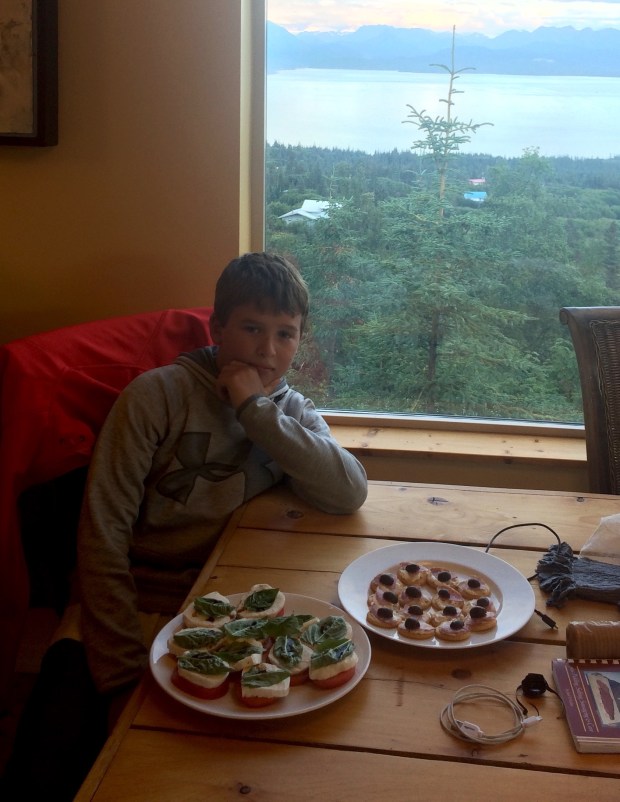
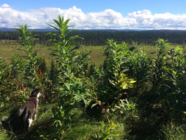
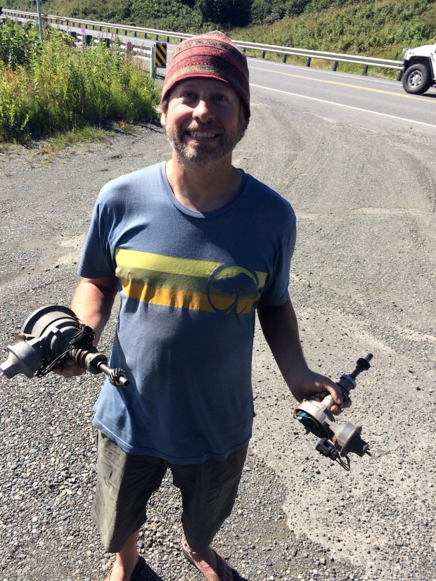
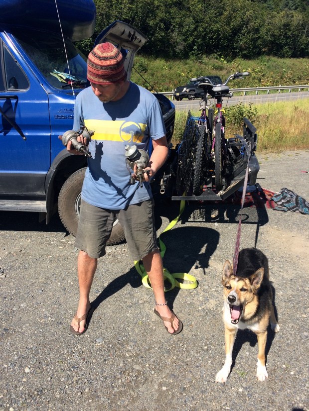
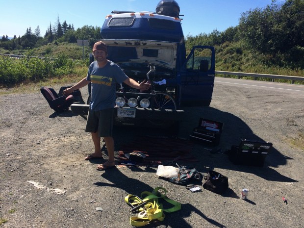
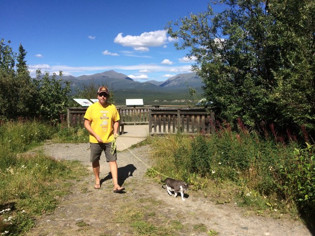
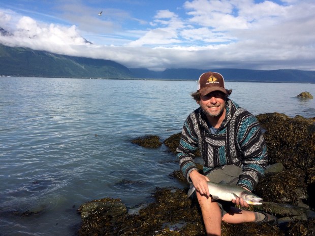
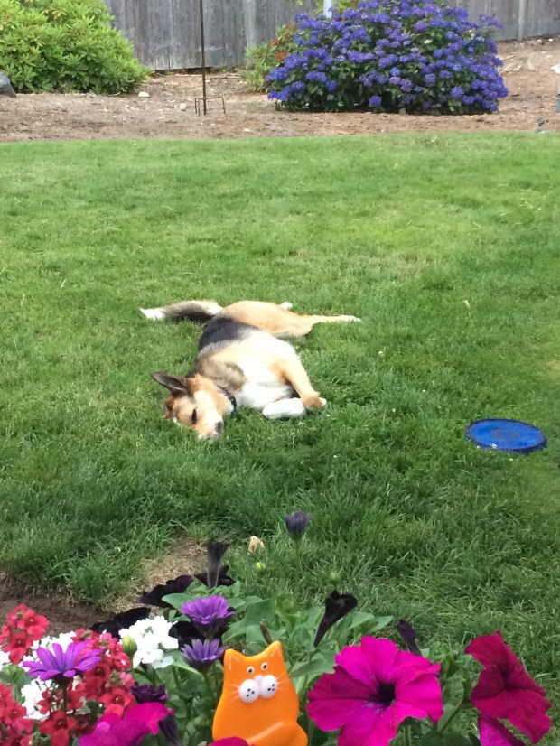
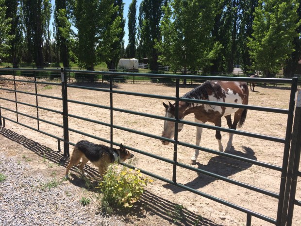
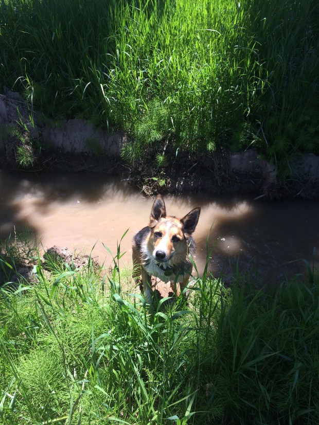
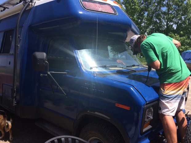
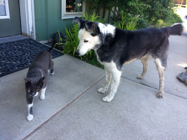
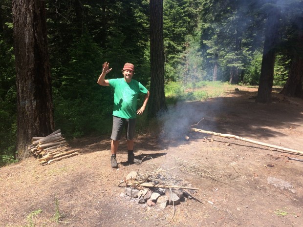
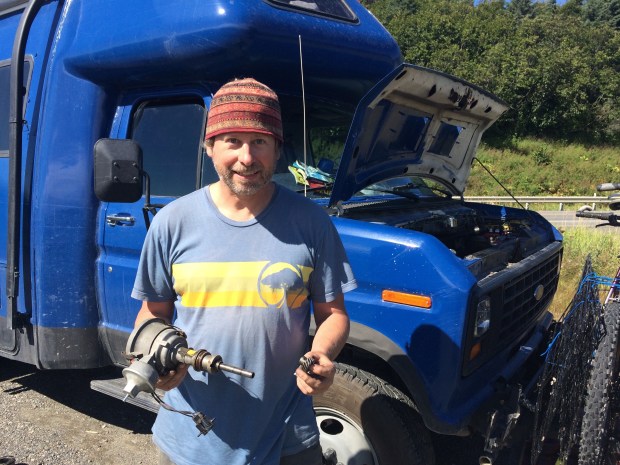
While Andy pulled the Turtle apart and worked his magic, Will and Genie went fishing, and I used the time to run Scout and let Gracie play outside for a while, cleaned up the Turtle, and read my book in the sun with the animals. It was actually a very nice afternoon for all involved!

IMG_2327

IMG_9309

When we got back to Anchorage we decided to have an early dinner, so at 10 p.m. we stopped by 49th State Brewery to have huge delicious reubens and play with WikiSticks.

IMG_2334

IMG_9353

We still had a full day left in Anchorage before Genie and Will had to fly back, so we visited the zoo. . .

IMG_9387

IMG_9383

IMG_9369

IMG_9378

And saw the world’s largest chocolate waterfall at Alaska Wild Berry Products.

IMG_9396

The candy store also had huge chocolate bars that Andy really, really wanted to touch but he obeyed the sign anyway, and a polar bear.

IMG_9401

IMG_9409

IMG_2356

After a delicious Italian dinner, this time at a much more reasonable hour due to Will and Genie’s 3 a.m. wakeup call, we said our goodbyes.

The trip was unforgettable, and we’re so glad you guys came up north to meet us. Alaska isn’t the same without you!

IMG_9441

The Road to Alaska – Part 5: Yukon! Valdez! Gracie Cleans Her Tail!

Everything you’ve heard about the drive to Alaska is true.

Ok, wait.

I guess I don’t know what you’ve heard about the drive to Alaska. Let’s go with this instead: if you’ve heard that the drive to Alaska is mile after mile of astonishingly beautiful scenery that seems too enormous and perfect to exist in real life, then what you’ve heard is true.

Especially once you hit Yukon. I have so many photos of this drive that I promise you’re hoping I never show up at your house for a slide show. Because it would take longer to show you all the gorgeous scenery and tell the stories than it took to drive through it. But here are a few of my favorites.

IMG_8179

IMG_8221

IMG_8232

IMG_8212.jpg

IMG_8368 (1).jpg

IMG_8376.jpg

IMG_8434

IMG_8440

IMG_8442

IMG_8522

Right??

If you make the drive, be sure to multiply your estimated drive time by 2 to account for all the stoping and staring you’ll be doing.

IMG_8302

The beauty didn’t stop once we hit Alaska, of course. We went to Valdez, where we’d been told the best fishing awaited us. You’ll just have to believe me when I tell you that I caught a fish on my very first cast, and then caught two more before Andy had even finished attaching his lure! (In all fairness, he’d gallantly put mine on first, which is why I was fishing already. But it just goes to show you how good the fishing is in Valdez!) We estimate that we caught 25 fish—dollys and humpys. We kept two to bring with us and released the rest, not because we didn’t want them, but we just didn’t have any room left in the fridge after all the fish we caught in Haines. A fine problem to have, it’s true.

IMG_8563

IMG_8566

IMG_8651

From Valdez, we took a very early ferry over to Whittier. As we drank our coffee and admired the ocean, the fog made the horizon completely disappear, which was lovely.

IMG_8746

As the sun rose, a chubby little porcupine came out of the bushes and delighted everyone in the ferry line.

IMG_8721

The Valdez-Whittier trip is about 4.5 hours, and so beautiful that even though it got chilly we stayed posted up on the deck under our blankets for most of the ride.

IMG_8740

Once we arrived in Whittier, we drove straight on to Anchorage. We had so much fun visiting friends while we were there that I’ll make a separate post to cover all those adventures.

For now, I’ll make the title of the post accurate with the following pictures of Gracie cleaning her tail.

IMG_8794

IMG_8799

IMG_8802


The Alaska Road Trip Begins!

Well hello there!

A lot has happened since the last time I updated the blog on our roving whereabouts, wild shenanigans and general goings-on, and if I could, I’d catch you up completely on what we’ve been up to since I last reported. But as I sit here writing this post, I realize how long that could take, as we’ve been moving at breakneck Turtle speed for the last few months! (Of course I’m not referring to miles-per-hour speed, as that remains as slow as ever. I’m talking about how much ground we’ve covered, which for us has been a lot in an uncharacteristically short amount of time.)

Instead, I’ve decided to pick up where we are at this moment, which is the beginning of such a fun adventure that I think you’ll agree this is the best place to begin. Because we just crossed the border into Canada, which (in our minds at least) is the official beginning of the Overland Trek to Alaska!

IMG_5838

The general plan is as follows:

The Timeframe: A month driving up to Alaska (July), a month exploring Alaska (August), and a month returning home (September). We’d stay longer, but we’d like to stay ahead of snowy road conditions and by October the roads can start to ice over.

The Route: We are going to loosely follow what some travel guides call the “Gold Rush Route” on the way up, and then follow the Alcan Highway which ends just north of Montana, so we can drop in to see family at the end of the journey.

Must See: Denali National Park, Wrangell-St. Elias National Park, The Cook Family in Anchorage, Harding Ice Fields, Kenai Peninsula, and a moose. (It doesn’t matter which one.) Other than that we’ll play it by ear, as is our general travel style. There’s a lot of Alaska up there and we want to see as much as we can without moving so quickly that we forget to relax and enjoy the quiet moments that we’ve come to love most during our travels. I’ve been surprised to find my sweetest memories are the little surprise spots we stumble across between official destinations, and we try to make sure we leave room for improvisation for that reason.

Aaaaand, honestly, that’s as far as we’ve gotten. It’s tricky to make new travel plans while you’re in the midst of traveling and enjoying your current location! So we’ve become accustomed to making detailed itineraries a day or two in advance and then making more general plans where the upcoming weeks and months are concerned. It’s just no use trying to nail things down when we could see an interesting road and end up somewhere completely different than we’d anticipated!

We just arrived in Canada yesterday, and already we’re just charmed to pieces. It’s very familiar of course, but different enough that we’re excited to see what unexpected twists we’ll encounter as we go.

Unanswered questions include:

  • How different are the regulations regarding boondocking? Can you stay overnight at any turnout or viewpoint along the highway like you can in the states we’ve visited in the US?
  • What are “good” prices for fuel and propane? Our brains are already so tangled by conversions, and then by the time we work out what the prices are in US Dollars we realize that we don’t even know if the price is good or bad for the region we’re in!
  • We were surprised by the questions they asked us at the border, but they let us in so who are we to complain? They had a lot of questions regarding our lack of jobs, even though we explained we were living off of savings, and wanted to know what jobs we had before we left them for life on the road. The agent asked to see bank account balances to ensure we had enough money to cover our trip, which makes sense. He didn’t ask about pets, even though we did have all the documentation for Scout and Gracie including immunization records, etc. The one we’re still puzzled about though is that he asked how many guns we own. Not how many we were carrying with us, but how many do we own anywhere in the world. Interesting, right? The answer is none, so I’m not sure what the outcome would have been had we said we had an arsenal somewhere in the states. But again, we’re not here to tell the man how to do his job, especially since we crossed over in very little time.

IMG_5834

Today we went to Vancouver, BC and had a great time at the Granville Island Market and VanDusen Botanical Gardens before hitting up a few points of interest including the steam clock, a “metaphysical supply store,” the Digital Orca, and the Marine Building. All awesome.

IMG_5882IMG_5917IMG_5927IMG_5953IMG_5964IMG_5971IMG_5983

We love Vancouver!

And now that we’re all up-to-date on the current adventure, here is a sampler platter of the aforementioned shenanigans we’ve been into the last month or two, for those who like pictures of cute animals, lovely scenery, fun friends, and other general niceness.

IMG_3824
IMG_4198IMG_3914IMG_5793IMG_5784IMG_3818IMG_4307IMG_0800IMG_3976IMG_4797 (1)IMG_4843IMG_5413IMG_5342IMG_0667IMG_4364IMG_0680tIMG_4191IMG_5068IMG_0762IMG_0809wIMG_3997IMG_4056IMG_5489IMG_5684IMG_5414IMG_5706IMG_5090IMG_5228IMG_4060IMG_4006IMG_0819dogIMG_5403IMG_4730IMG_4376IMG_4477IMG_3971